
Shoghakat, Armenia
Shogahakat
Շողակաթ | |
|---|---|
 A view of Shoghakat and Lake Sevan | |
 Coat of arms | |
 Shogahakat  Shogahakat | |
| Coordinates: 40°30′04″N 45°16′28″E / 40.50111°N 45.27444°E | |
| Country | Armenia |
| Province | Gegharkunik |
| Municipality | Shoghakat |
| Elevation | 1,915 m (6,283 ft) |
| Population | |
| • Total | 509 |
| Time zone | UTC+4 (AMT) |
| Postal code | 1316 |
| Shoghakat, Armenia at GEOnet Names Server | |
Shoghakat (Armenian: Շողակաթ) is a village in the Shoghakat Municipality of the Gegharkunik Province of Armenia, located near Lake Sevan, northwest of the Artanish Peninsula. The village was founded in the 1810s by Mordvins exiled from Russia. At the beginning of the 20th century Turks settled in the village. In 1988-1989 Armenian refugees from Azerbaijan settled in the village.[2]
Toponymy[edit]
The village was formerly known as Nadezhdino, Shordzhalu and later Shorzha (Armenian: Շորժա) until November 2017.
Historical sites[edit]

A 17th-century chapel and cemetery are located along the southern outskirts of the village. On the hill overlooking Shoghakat, there are the ruins of another chapel. Remains of an Iron Age fort can be seen in same area.[3]
Nature[edit]

The Artanish peninsula of Lake Sevan with a hill of the same name, is located close to the village. Sea-buckthorn (Hippophae) with wild-growing edible sour berries grow at the shores of Lake Sevan. Planted after the lowering of the level of Lake Sevan in the Soviet period. The vicinity of the village hosts 111 species of butterflies and is recognized as the Prime Butterfly Area "Artanish-Shoghakat".[4] Also the area is known as one of the key birding sites of Armenia.[5]
Climate[edit]
The climate of the village is cold and continental, designated as Dfb in Köppen climate classification.
| Climate data for Shorzha(1991-2020) | |||||||||||||
|---|---|---|---|---|---|---|---|---|---|---|---|---|---|
| Month | Jan | Feb | Mar | Apr | May | Jun | Jul | Aug | Sep | Oct | Nov | Dec | Year |
| Daily mean °C (°F) | −4.6 (23.7) |
−3.8 (25.2) |
0.0 (32.0) |
5.2 (41.4) |
9.7 (49.5) |
14.3 (57.7) |
17.0 (62.6) |
17.6 (63.7) |
14.0 (57.2) |
8.7 (47.7) |
2.7 (36.9) |
−2.0 (28.4) |
6.6 (43.8) |
| Average precipitation mm (inches) | 17.8 (0.70) |
17.7 (0.70) |
26.1 (1.03) |
39.2 (1.54) |
54.8 (2.16) |
57.6 (2.27) |
45.4 (1.79) |
33.8 (1.33) |
28.0 (1.10) |
29.2 (1.15) |
18.6 (0.73) |
15.1 (0.59) |
383.3 (15.09) |
| Average precipitation days | 3.7 | 4.2 | 5.6 | 8.1 | 9.6 | 8.2 | 6 | 4.7 | 4.3 | 5.7 | 4 | 4.2 | 68.3 |
| Average relative humidity (%) | 76.4 | 76.8 | 78.5 | 77.3 | 74.7 | 73.3 | 73.1 | 72.2 | 73.6 | 74.9 | 78.2 | 77.9 | 75.6 |
| Mean monthly sunshine hours | 115.5 | 125.8 | 156.3 | 157.6 | 196.1 | 251.6 | 297.2 | 290.1 | 243.8 | 187 | 148.8 | 116.4 | 2,286.2 |
| Source: NOAA[6] | |||||||||||||
Infrastructure[edit]
The village can be accessed via Armenian road M14 (repaired in 2020-21) running along the north-east shore of Lake Sevan either from Tsovagyugh village (in the northwest of Shoghakat) or from Vardenis (in the south-east). Another road connects it to the town of Chambarak in the north-west. In summer, passenger trains of South Caucasus Railways commute from Yerevan, via the towns of Hrazdan and Sevan.
Recreation[edit]

The shores of Lake Sevan near the village hosts several popular camping sites. Most popular is perhaps the camping site called "Whishup" (a wordplay with Vishap, "dragon" in Armenian) located between the road and lakeshore at about 1.5 km from the village towards Tsovagyugh. Various water sports, like wakeboarding, kiteboarding, are practiced there and some equipment is available for rent along a sandy beach with a cafe. In summer evenings concerts are held at the stage on the beach. On the opposite side of the Artanish peninsula, the yachting clubs "Ayas" and "Armenian camp" can be found. Sailing and paddling equipment can be rented there and guided tours on a sailing ship can be booked.
A copy of a medieval Armenian sea vessel is placed there. Built in the 90's and named Cilicia (referring to Armenian Kingdom of Cilicia, where such vessels were built and used) it sailed round Europe,[7] and was brought back to Lake Sevan.[8] There is also a diver's club located nearby.
Municipal administration[edit]
After administrative reforms in November 2017, the name of the village was changed from Shorzha to Shoghakat and it was assigned as the administrative centre of the same-name rural municipality including the villages of Aghberk, Artanish, Drakhtik, Jil and Tsapatagh.
Gallery[edit]
-
 17th-century chapel on the outskirts of the village
 -
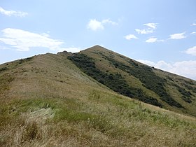 Hilltop of Artanish peninsula
 -
 Shoghakat as viewed from atop the adjacent hill with chapel ruins
 -
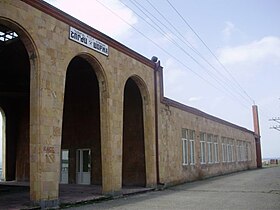 Railroad station
 -
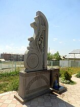 Monument to the fallen in the First Nagorno-Karabakh War
 -
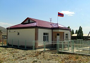 Municipality building


.jpg)


References[edit]
- ^ Statistical Committee of Armenia. "The results of the 2011 Population Census of Armenia" (PDF).
- ^ "ՇՈՐԺԱ". gegharkunik.am. Retrieved 14 February 2021.
- ^ Kiesling, Brady; Kojian, Raffi (2005). Rediscovering Armenia: Guide (2nd ed.). Yerevan: Matit Graphic Design Studio. pp. 83–84. ISBN 99941-0-121-8.
- ^ Prime Butterfly Area "Artanish-Shoghakat". Butterfly Conservation Armenia, 2016. http://www.butterfly-conservation-armenia.org/artanish-shorzha.html
- ^ Birdwatching. Armenian Bird Census Council. 2016. http://www.abcc-am.org/birdwatching.html
- ^ "WMO Climate Normals for 1991-2020: Shorja-37802" (CSV). ncei.noaa.gov (Excel). NOAA. Retrieved 2024-03-10.
{{cite web}}: CS1 maint: postscript (link) - ^ "Cilicia: the first-ever Armenian sailing ship to circumnavigate the world". Wandelion Blog: Travel News, Stories, Tips & How-To Guides. 2015-05-06. Retrieved 2020-01-24.
- ^ Daghdigian, Hovsep (2019-10-09). "Unseen Armenia: A New Home for the Ship Cilicia". The Armenian Weekly. Retrieved 2020-01-24.
External links[edit]
- Report of the results of the 2001 Armenian Census, Statistical Committee of Armenia
- Kiesling, Brady (June 2000). Rediscovering Armenia: An Archaeological/Touristic Gazetteer and Map Set for the Historical Monuments of Armenia (PDF). Archived (PDF) from the original on 6 November 2021.
