
Makenis
40°07′26″N 45°36′39″E / 40.12389°N 45.61083°E
Makenis
Մաքենիս | |
|---|---|
 The village of Makenis overlooking the gorge, as seen from Makenyats Vank. | |
 Makenis  Makenis | |
| Coordinates: 40°07′26″N 45°36′39″E / 40.12389°N 45.61083°E | |
| Country | Armenia |
| Province | Gegharkunik |
| Municipality | Vardenis |
| Population | |
| • Total | 405 |
| Time zone | UTC+4 (AMT) |
| Makenis at GEOnet Names Server | |
Makenis (Armenian: Մաքենիս) is a village in the Vardenis Municipality of the Gegharkunik Province of Armenia.
History[edit]
The Makenyats Vank monastery in the village was a major cultural and educational center of medieval Gegharkunik, with structures dating from the 9th to 13th centuries.[2]
Gallery[edit]
-
 Makenyats Vank
 -
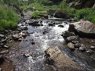 River near Makenyats Vank
 -
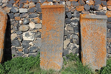 Khachkars around Makenyats Vank
 -
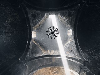 The dome of Makenyats Vank


References[edit]
- ^ Statistical Committee of Armenia. "The results of the 2011 Population Census of Armenia" (PDF).
- ^ Kiesling, Brady; Kojian, Raffi (2005). Rediscovering Armenia: Guide (2nd ed.). Yerevan: Matit Graphic Design Studio. p. 81. ISBN 99941-0-121-8.
External links[edit]
Wikimedia Commons has media related to Makenis.
- Report of the results of the 2001 Armenian Census, Statistical Committee of Armenia
- Kiesling, Brady (June 2000). Rediscovering Armenia: An Archaeological/Touristic Gazetteer and Map Set for the Historical Monuments of Armenia (PDF). Archived (PDF) from the original on 6 November 2021.

This article about a location in Gegharkunik Province, Armenia is a stub. You can help Wikipedia by expanding it. |