
Frévillers
Frévillers | |
|---|---|
 Entrance to St. Anne’s church | |
 Coat of arms | |
Location of Frévillers  | |
 Frévillers  Frévillers | |
| Coordinates: 50°23′50″N 2°31′25″E / 50.3972°N 2.5236°E | |
| Country | France |
| Region | Hauts-de-France |
| Department | Pas-de-Calais |
| Arrondissement | Arras |
| Canton | Avesnes-le-Comte |
| Intercommunality | CC Campagnes de l'Artois |
| Government | |
| • Mayor (2020–2026) | Guy Vasseur[1] |
| Area 1 | 5.07 km2 (1.96 sq mi) |
| Population (2021)[2] | 240 |
| • Density | 47/km2 (120/sq mi) |
| Time zone | UTC+01:00 (CET) |
| • Summer (DST) | UTC+02:00 (CEST) |
| INSEE/Postal code | 62362 /62127 |
| Elevation | 141–187 m (463–614 ft) (avg. 172 m or 564 ft) |
| 1 French Land Register data, which excludes lakes, ponds, glaciers > 1 km2 (0.386 sq mi or 247 acres) and river estuaries. | |
Frévillers is a commune in the Pas-de-Calais department in the Hauts-de-France region of France.[3]
Geography[edit]
A farming village situated at the highest point in the département, 16 miles (26 km) northwest of Arras, at the junction of the D72 and the D74 roads.
Population[edit]
| Year | Pop. | ±% p.a. |
|---|---|---|
| 1968 | 235 | — |
| 1975 | 231 | −0.24% |
| 1982 | 226 | −0.31% |
| 1990 | 232 | +0.33% |
| 1999 | 253 | +0.97% |
| 2007 | 242 | −0.55% |
| 2012 | 250 | +0.65% |
| 2017 | 239 | −0.90% |
| Source: INSEE[4] | ||
Places of interest[edit]
- The church of St. Anne, dating from the eighteenth century.
- Vestiges of an old castle.
See also[edit]
References[edit]
- ^ "Répertoire national des élus: les maires". data.gouv.fr, Plateforme ouverte des données publiques françaises (in French). 2 December 2020.
- ^ "Populations légales 2021". The National Institute of Statistics and Economic Studies. 28 December 2023.
- ^ INSEE commune file
- ^ Population en historique depuis 1968, INSEE
Wikimedia Commons has media related to Frévillers.
-
 The old gatehouse
 -
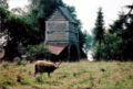 Sheep and the gatehouse


| Authority control databases: National |
|---|
This Arras arrondissement, Pas-de-Calais geographical article is a stub. You can help Wikipedia by expanding it. |