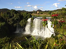
Sakay River
| Sakay River | |
|---|---|
 Sakay River in the Tsiribihina River basin | |
| Location | |
| Country | Madagascar |
| Region | Bongolava |
| Physical characteristics | |
| Mouth | Mahajilo River |
• coordinates | 19°24′06″S 46°09′50″E / 19.40167°S 46.16389°E |
• elevation | 680 m (2,230 ft) |
| Basin features | |
| River system | Tsiribihina River |
| Tributaries | |
| • left | Lily River |
The Sakay River is a waterway in Bongolava, Madagascar, and passes through the towns of Ankadinondry Sakay and Mahasolo.
It has its sources East of Tsiroanomandidy in a plaine at 1400m altitude and its mouth is in the Mahajilo River.
An affluent is the Lily River that has its sources in the Kavitaha Lake in Ampefy (Itasy).

References[edit]
