Maryanaj
Maryanaj
Persian: مريانج | |
|---|---|
City | |
 Alvand Mountain overlooking Maryanaj | |
| Coordinates: 34°49′47″N 48°27′28″E / 34.82972°N 48.45778°E[1] | |
| Country | Iran |
| Province | Hamadan |
| County | Hamadan |
| District | Central |
| Population (2016)[2] | |
| • Total | 10,848 |
| Time zone | UTC+3:30 (IRST) |
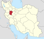
Maryanaj (Persian: مريانج), also Romanized as Maryānaj; also known as Marjān and Marjāna,[3] is a city in the Central District of Hamadan County, Hamadan province, Iran.[4]
At the 2006 census, its population was 9,442 in 2,518 households.[5] The following census in 2011 counted 10,207 people in 3,146 households.[6] The latest census in 2016 showed a population of 10,848 people in 3,619 households.[2]
Etymology[edit]
The name Maryānaj is derived from Middle Persian *margānag, from Old Persian *margā- plus the suffix -ānag; it is related to the Middle Persian mlw' (vocalized /marw/) and Parthian mrg (vocalized /marγ/), both meaning "prairie", and to the Avestan marəγa and Modern Persian مرغ (marğ), both meaning "plant".[7]
In the dialect of Hamadan, the name is pronounced Maryāneh (مریانه), a form influenced by Middle Persian; in the local dialect of Maryanaj itself, the name is pronounced Margāneh (مرگانه), an older form influenced by Northwestern Middle Iranian languages.[7]
References[edit]
- ^ OpenStreetMap contributors (17 October 2023). "Maryanaj, Hamadan County" (Map). OpenStreetMap. Retrieved 17 October 2023.
- ^ a b "Census of the Islamic Republic of Iran, 1395 (2016)". AMAR (in Persian). The Statistical Center of Iran. p. 13. Archived from the original (Excel) on 21 April 2021. Retrieved 19 December 2022.
- ^ Maryanaj can be found at GEOnet Names Server, at this link, by opening the Advanced Search box, entering "-3074206" in the "Unique Feature Id" form, and clicking on "Search Database".
- ^ Habibi, Hassan (21 June 1369). "Approval of the organization and chain of citizenship of the elements and units of the country's divisions of Hamadan province, centered in Hamadan city". Lamtakam (in Persian). Ministry of Interior, Political Defense Commission of the Government Board. Archived from the original on 11 February 2024. Retrieved 11 February 2024.
- ^ "Census of the Islamic Republic of Iran, 1385 (2006)". AMAR (in Persian). The Statistical Center of Iran. p. 13. Archived from the original (Excel) on 20 September 2011. Retrieved 25 September 2022.
- ^ "Census of the Islamic Republic of Iran, 1390 (2011)". Syracuse University (in Persian). The Statistical Center of Iran. p. 13. Archived from the original (Excel) on 17 January 2023. Retrieved 19 December 2022.
- ^ a b Ahadian, M. Mahdi (2010). "Morphological Survey of Hamedan's Toponyms". Linguistics Society of Iran. 6 (12): 129–148. Retrieved 5 May 2020.


