
Heikant, Zeeland
Heikant | |
|---|---|
Village | |
 Heikant, church: kerk van de Heilige Theresia van het kindje Jezus | |
 Heikant Location in the province of Zeeland in the Netherlands  Heikant Heikant (Netherlands) | |
| Coordinates: 51°15′3″N 4°1′29″E / 51.25083°N 4.02472°E | |
| Country | Netherlands |
| Province | Zeeland |
| Municipality | Hulst |
| Area | |
| • Total | 13.92 km2 (5.37 sq mi) |
| Elevation | 1.0 m (3.3 ft) |
| Population (2021)[1] | |
| • Total | 2,350 |
| • Density | 170/km2 (440/sq mi) |
| Time zone | UTC+1 (CET) |
| • Summer (DST) | UTC+2 (CEST) |
| Postal code | 4567[1] |
| Dialing code | 0114 |
Heikant is a village in the Dutch province of Zeeland. It is a part of the municipality of Hulst, and lies about 33 km southwest of Bergen op Zoom.
There are many settlements called Heikant ("heath edge") in the Netherlands; the one near Hulst is the largest and the only one with village status.[3]
History[edit]
The village was first mentioned in 1867 as Heikant, and means "edge of the heath".[4]
Heikant was home to 422 people in 1840. The Catholic Holy Theresia of the Child Jesus church was built in 1930 by the unemployed as a condition of the municipality for a subsidy. The village used to be part of the municipality of Sint Jansteen. In 1970, it became part of the municipality of Hulst.[3]
Gallery[edit]
-
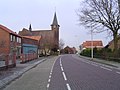 Street view
 -
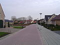 Street view
 -
 House in Heikant


_-_rijksmonument_509688_-_Julianastraat_18_20120714.jpg)
References[edit]
- ^ a b c "Kerncijfers wijken en buurten 2021". Central Bureau of Statistics. Retrieved 20 April 2022.
- ^ "Postcodetool for 4567AA". Actueel Hoogtebestand Nederland (in Dutch). Het Waterschapshuis. Retrieved 20 April 2022.
- ^ a b "Heikant". Plaatsengids (in Dutch). Retrieved 20 April 2022.
- ^ "Heikant - (geografische naam)". Etymologiebank (in Dutch). Retrieved 20 April 2022.
This article about a location in Zeeland is a stub. You can help Wikipedia by expanding it. |