
Labessière-Candeil
Labessière-Candeil | |
|---|---|
.svg) Coat of arms | |
Location of Labessière-Candeil  | |
 Labessière-Candeil  Labessière-Candeil | |
| Coordinates: 43°48′08″N 2°00′21″E / 43.8022°N 2.0058°E | |
| Country | France |
| Region | Occitania |
| Department | Tarn |
| Arrondissement | Albi |
| Canton | Les Deux Rives |
| Intercommunality | CA Gaillac-Graulhet |
| Government | |
| • Mayor (2020–2026) | Francis Monsarrat[1] |
| Area 1 | 21.98 km2 (8.49 sq mi) |
| Population (2021)[2] | 742 |
| • Density | 34/km2 (87/sq mi) |
| Time zone | UTC+01:00 (CET) |
| • Summer (DST) | UTC+02:00 (CEST) |
| INSEE/Postal code | 81117 /81300 |
| Elevation | 167–290 m (548–951 ft) (avg. 265 m or 869 ft) |
| 1 French Land Register data, which excludes lakes, ponds, glaciers > 1 km2 (0.386 sq mi or 247 acres) and river estuaries. | |
Labessière-Candeil (French pronunciation: [labesjɛʁ kɑ̃dɛj]; Occitan: La Becièira de Candelh) is a commune in the Tarn department in southern France.
See also[edit]
-
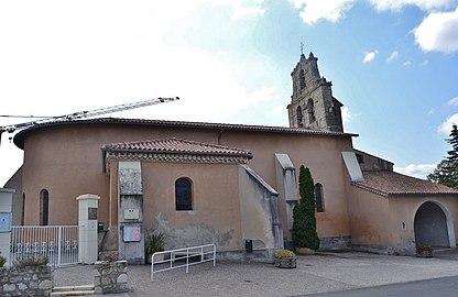 Church Sainte-Anne.
 -
 Shrine as of Labessière-Candeil
 -
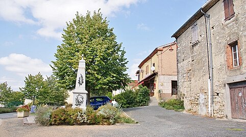 War memorial
_Labessiere_Candeil_(81300).jpg)
_Cath%C3%A9drale_Sainte-C%C3%A9cile_-_Tr%C3%A8sor_-_Ch%C3%A2sse_reliquaire_XIIIe_Labessi%C3%A8re-Candeil_PalissyPM81000176.jpg)
.jpg)
References[edit]
- ^ "Répertoire national des élus: les maires". data.gouv.fr, Plateforme ouverte des données publiques françaises (in French). 2 December 2020.
- ^ "Populations légales 2021". The National Institute of Statistics and Economic Studies. 28 December 2023.
Wikimedia Commons has media related to Labessière-Candeil.
| Authority control databases: National |
|---|
This Tarn geographical article is a stub. You can help Wikipedia by expanding it. |