
Zaslawskaye reservoir
| Zaslawskaye reservoir | |
|---|---|
 Satellite photo of the Minsk sea, 2019 | |
 Zaslawskaye reservoir | |
| Location | Minsk Region |
| Coordinates | 53°58′34″N 27°22′46″E / 53.97611°N 27.37944°E |
| Lake type | Artificial |
| Basin countries | Belarus |
| Max. length | 10 km (6.2 mi) |
| Max. width | 4.5 km (2.8 mi) |
| Surface area | 31.1 km2 (12.0 sq mi) |
| Average depth | 3.5 m (11 ft) |
| Max. depth | 8 m (26 ft) |
| Water volume | 108.5 million cubic metres (3.83×10⁹ cu ft) |
| Shore length1 | 55 km (34 mi) |
| Settlements | Zaslawye |
| 1 Shore length is not a well-defined measure. | |
Zaslawskaye reservoir (Belarusian: Заслаўскае вадасховішча, Russian: Заславское водохранилище) is a water reservoir in the Vileyka-Minsk water system. It is the second largest artificial lake in Belarus. It is located only 5 km from the northwestern edge of Minsk, and is often called the Minsk sea.
Description[edit]
Zaslawskaye reservoir is the second largest artificial reservoir of Belarus, second in size to the largest Vileyka reservoir. It was created in 1956 by a dam on a Svislach river in order to control floods in Minsk and to regulate the flow of the river. It is part of the Vileyka-Minsk water system.[1] The bowl of the reservoir was a swampy floodplain of the Svisloch, Vyacha, Ratomka and Chernyavka rivers before flooding. It is located just 5 km from Minsk, and is often called the Minsk sea.[2][3][4]
Gallery[edit]
-
 Isles in the reservoir
 -
 Isle
Isle -
 Photo from a drone
 -
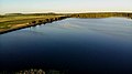 Photo from a drone
 -
 Photo from a drone


References[edit]
- ^ "Водохранилища Беларуси - Белгидромет: Радиационно-экологический мониторинг - Минск". rad.org.by. Retrieved 7 June 2022.
- ^ "Минское море (Заславское водохранилище)". planetabelarus.by (in Russian). Retrieved 7 June 2022.
- ^ "Гид по Беларуси". belarus.by. Retrieved 7 June 2022.
- ^ "Минское море, Беларусь: история, описание, фото". vetliva.ru (in Russian). Retrieved 7 June 2022.
External links[edit]
 Media related to Zaslaŭskaje Reservoir at Wikimedia Commons