Yokkaichi-juku
Yokkaichi-juku 四日市宿 | |
|---|---|
| post station | |
 Hiroshige's print of Yokkaichi-juku, part of the Hōeidō edition The Fifty-three Stations of the Tōkaidō series | |
| General information | |
| Location | Yokkaichi, Mie (former Ise Province) Japan |
| Coordinates | 34°58′11.81″N 136°37′33.1″E / 34.9699472°N 136.625861°E |
| Elevation | 7 meters |
| Line(s) | Tōkaidō |
| Distance | 389.6 km from Edo |
| Location | |
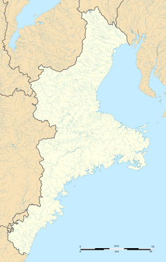
Yokkaichi-juku (四日市宿, Yokkaichi-juku) was the forty-third of the fifty-three stations (shukuba) of the Tōkaidō connecting Edo with Kyoto in Edo period Japan. It was located in former Ise Province in what is now part of the city of Yokkaichi, Mie Prefecture, Japan.
History[edit]
Yokkaichi-juku was a post town located on the intersection between the Tōkaidō and the Ise Sangū Kaidō, one of the main highways for pilgrims to the Ise Grand Shrines, and developed as a market town from the Muromachi period, noted for holding a market on the days ending in "four" of each month. The earliest recorded market was in 1470. Under the Tokugawa shogunate, Yokkaichi was tenryō territory under direct control of the Shōgun, and administered by a daikan based at the town. It was also possible for travelers to take a ferry from here to Miya-juku, thus bypassing Kuwana-juku.
Per the 1843 "東海道宿村大概帳" (Tōkaidō Shukuson Taigaichō) guidebook issued by the Inspector of Highways (道中奉行, Dōchu-būgyō), the town had a population of 7114 in 1811 houses, including two honjin, one wakihonjin, and 98 hatago. It had one Tonyaba, for the stabling of packhorses and warehousing of goods, and one kōsatsu for the display of official notifications. A local product of Yokkaichi-juku favored by traveller was Nagamochi (なが餅), an elongated rice cape containing a paste made from sweet red beans, which had been roasted over charcoal. The name was play on words, indicating that the confectionery "kept for a long time" and also "kept one fun for a long time".
Yokkaichi-juku was 12.8 km from Kuwana-juku, the preceding post town and 389.6 kilometers from Edo.
Yokkaichi-juku in The Fifty-three Stations of the Tōkaidō[edit]
Utagawa Hiroshige's ukiyo-e Hōeidō edition print of Yokkaichi-juku dates from 1833 -1834. The print illustrates a windy day with a man racing after his hat, which has been blown away by the wind and another man crosses a small bridge over the Sanju River, depicted here as a small stream. The post town is depicted as a small collection of huts in the middle of a marsh, almost hidden by the reeds.
Neighboring Post Towns[edit]
- Tōkaidō
- Kuwana-juku - Yokkaichi-juku - Ishiyakushi-juku
Further reading[edit]
- Berna, Cristina (2020). Hokusai 53 Stations of the Tōkaidō 1805-1806. Missys Clan. ISBN 1649454767.
- Yagi, Makio (2019). 新版 ちゃんと歩ける東海道五十三次 西 見付宿~京三条大橋 +佐屋街道. 山と渓谷社. ISBN 4635600874.(in Japanese)
- Sasaki, Moritoshi (2010). 歌川広重保永堂版 東海道五拾三次 (謎解き浮世絵叢書). Nigensha. ISBN 4544212014.(in Japanese)
- Carey, Patrick. Rediscovering the Old Tokaido:In the Footsteps of Hiroshige. Global Books UK (2000). ISBN 1-901903-10-9
- Chiba, Reiko. Hiroshige's Tokaido in Prints and Poetry. Tuttle. (1982) ISBN 0-8048-0246-7
- Taganau, Jilly. The Tokaido Road: Travelling and Representation in Edo and Meiji Japan. RoutledgeCurzon (2004). ISBN 0-415-31091-1


