Jump to content

User:Generic1139/sandbox/need2

From Wikipedia, the free encyclopedia
File:Map of Adams County, Pennsylvania.pngFile:Map of Allegheny County, Pennsylvania.pngFile:Map of Armstrong County, Pennsylvania.pngFile:Map of Beaver County, Pennsylvania.pngFile:Map of Bedford County, Pennsylvania.pngFile:Map of Berks County Pennsylvania With Municipal and Township Labels.pngFile:Map of Blair County, Pennsylvania.pngFile:Map of Bradford County, Pennsylvania.pngFile:Map of Bucks County, Pennsylvania.pngFile:Map of Butler County, Pennsylvania.pngFile:Map of Cambria County, Pennsylvania.pngFile:Map of Carbon County, Pennsylvania.pngFile:Map of Centre County, Pennsylvania.pngFile:Map of Clarion County, Pennsylvania.pngFile:Map of Chester County Pennsylvania With Municipal and Township Labels.pngFile:Map of Clearfield County, Pennsylvania.pngFile:Map of Clinton County, Pennsylvania.pngFile:Map of Columbia County, Pennsylvania.pngFile:Map of Crawford County, Pennsylvania.pngFile:Map of Cumberland County, Pennsylvania.pngFile:Map of Dauphin County, Pennsylvania.pngFile:Map of Delaware County, Pennsylvania.pngFile:Map of Elk County, Pennsylvania.pngFile:Map of Erie County, Pennsylvania.pngFile:Map of Fayette County, Pennsylvania.pngFile:Map of Forest County, Pennsylvania.pngFile:Map of Franklin County, Pennsylvania.pngFile:Map of Fulton County, Pennsylvania.pngFile:Map of Greene County, Pennsylvania.pngFile:Map of Huntingdon County, Pennsylvania.pngFile:Map of Indiana County, Pennsylvania.pngFile:Map of Jefferson County, Pennsylvania.pngFile:Map of Juniata County, Pennsylvania.pngFile:Map of Lackawanna County, Pennsylvania.pngFile:Map of Lancaster County Pennsylvania With Municipal and Township Labels.pngFile:Map of Lawrence County, Pennsylvania.pngFile:Map of Lebanon County, Pennsylvania.pngFile:Map of Lehigh County, Pennsylvania.pngFile:Map of Luzerne County, Pennsylvania.pngFile:Map of Lycoming County, Pennsylvania.pngFile:Map of McKean County, Pennsylvania.pngFile:Map of Mercer County, Pennsylvania.pngFile:Map of Mifflin County, Pennsylvania.pngFile:Map of Monroe County, Pennsylvania.pngFile:Map of Montgomery County, Pennsylvania.pngFile:Map of Montour County, Pennsylvania.pngFile:Map of Northampton County, Pennsylvania.pngFile:Map of Northumberland County, Pennsylvania.pngFile:Map of Perry County, Pennsylvania.pngFile:PhilaDistrict.PNGFile:Map of Pike County, Pennsylvania.pngFile:Map of Potter County, Pennsylvania.pngFile:Map of Schuylkill County, Pennsylvania.pngFile:Map of Snyder County, Pennsylvania.pngFile:Map of Somerset County, Pennsylvania.pngFile:Map of Sullivan County, Pennsylvania.pngFile:Map of Susquehanna County, Pennsylvania.pngFile:Map of Tioga County, Pennsylvania.pngFile:Map of Union County, Pennsylvania.pngFile:Map of Venango County, Pennsylvania.pngFile:Map of Warren County, Pennsylvania.pngFile:Map of Washington County, Pennsylvania.pngFile:Map of Wayne County, Pennsylvania.pngFile:Map of Westmoreland County, Pennsylvania.pngFile:Map of Wyoming County, Pennsylvania.pngFile:Map of York County, Pennsylvania.png
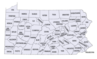
Pennsylvania counties (clickable map)

Current listings[edit]

[1] Name on the Register Image Date listed[2] Location Municipality Description
3 Barree Forge and Furnace March 20, 1990
(#90000405)
2 miles (3.2 km) north of Alexandria along the Juniata River
40°35′18″N 78°06′04″W / 40.588333°N 78.101111°W / 40.588333; -78.101111 (Barree Forge and Furnace)
Porter Township


6 Colerain Forges Mansion March 20, 1990
(#90000406)
Pennsylvania Route 45, 0.75 miles (1.21 km) south of Franklinville
40°38′20″N 78°06′00″W / 40.638889°N 78.1°W / 40.638889; -78.1 (Colerain Forges Mansion)
Franklin Township
9 Frehn Bridge March 20, 1990
(#90000391)
Township Route 313, 2 miles (3.2 km) west of Pennsylvania Route 475
40°08′00″N 77°59′29″W / 40.133333°N 77.991389°W / 40.133333; -77.991389 (Frehn Bridge)
Springfield Township
11 Greenwood Lake Dam May 11, 1987
(#87000050)
5 miles (8.0 km) north of Belleville off Pennsylvania Route 305
40°38′55″N 77°45′32″W / 40.648611°N 77.758889°W / 40.648611; -77.758889 (Greenwood Lake Dam)
Jackson Township
17 Juniata Iron Works March 20, 1990
(#90000404)
Off Pennsylvania Route 885, 1.5 miles (2.4 km) east of Alexandria
40°32′32″N 78°05′08″W / 40.542222°N 78.085556°W / 40.542222; -78.085556 (Juniata Iron Works)
Porter Township
22 Monroe Furnace November 13, 1989
(#89001818)
Junction of Pennsylvania Route 26 and Legislative Route 31076, 6 miles (9.7 km) northwest of McAlevys Fort
40°41′43″N 77°53′41″W / 40.695278°N 77.894722°W / 40.695278; -77.894722 (Monroe Furnace)
Barree Township
24 Christian Oyer Jr. House July 21, 1995
(#95000882)
Township Road 513, northeast of Huntingdon
40°36′34″N 77°53′54″W / 40.609444°N 77.898333°W / 40.609444; -77.898333 (Christian Oyer Jr. House)
Barree Township
26 Pennsylvania Canal Guard Lock and Feeder Dam, Raystown Branch March 20, 1990
(#90000394)
2.5 miles (4.0 km) east of Huntingdon, south of U.S. Route 22 on the Juniata River
40°26′59″N 77°58′09″W / 40.449722°N 77.969167°W / 40.449722; -77.969167 (Pennsylvania Canal Guard Lock and Feeder Dam, Raystown Branch)
Henderson Township
28 Pennsylvania Railroad Bridge over Shavers Creek March 20, 1990
(#90000395)
Over Shavers Creek near its confluence with the Juniata River
40°34′01″N 78°02′54″W / 40.566944°N 78.048333°W / 40.566944; -78.048333 (Pennsylvania Railroad Bridge over Shavers Creek)
Logan Township and Petersburg
29 Pennsylvania Railroad District March 20, 1990
(#90000393)
Conrail mile markers 213.73 to 218.88
40°36′47″N 78°09′07″W / 40.613056°N 78.151944°W / 40.613056; -78.151944 (Pennsylvania Railroad District)
Spruce Creek Township
36 Hugh D. and Martha South Seeds Farm March 12, 1999
(#99000328)
Legislative Route 31061, 1 mile (1.6 km) east of Pemberton
40°37′45″N 78°09′06″W / 40.629167°N 78.151667°W / 40.629167; -78.151667 (Hugh D. and Martha South Seeds Farm)
Spruce Creek Township
39 Spruce Creek Rod and Gun Club February 28, 1991
(#91000228)
Pennsylvania Route 45, northeast of Franklinville (6501 Clubhouse Lane)
40°40′28″N 78°02′52″W / 40.674444°N 78.047778°W / 40.674444; -78.047778 (Spruce Creek Rod and Gun Club)
Franklin Township
41 Whipple Dam State Park Day Use District February 12, 1987
(#87000109)
10 miles (16 km) south of State College, east of Pennsylvania Route 26
40°41′05″N 77°51′53″W / 40.684722°N 77.864722°W / 40.684722; -77.864722 (Whipple Dam State Park Day Use District)
Jackson Township
  1. ^ Numbers represent an alphabetical ordering by significant words. Various colorings, defined here, differentiate National Historic Landmarks and historic districts from other NRHP buildings, structures, sites or objects.
  2. ^ The eight-digit number below each date is the number assigned to each location in the National Register Information System database, which can be viewed by clicking the number.