
Tindfjallajökull
| Tindfjallajökull | |
|---|---|
 Tindfjallajökull | |
| Highest point | |
| Elevation | 1,462 m (4,797 ft) |
| Coordinates | 63°48′N 19°35′W / 63.8°N 19.58°W |
| Geography | |
| Location | Iceland |
| Parent range | Mid-Atlantic Ridge |
| Geology | |
| Mountain type | Stratovolcano |
| Last eruption | Possibly Holocene |
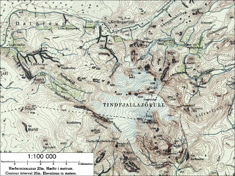
Tindfjallajökull (Icelandic pronunciation: [ˈtʰɪntˌfjatlaˌjœːkʏtl̥] ⓘ) is a stratovolcano in the south of Iceland.[1] It has erupted rocks of basaltic to rhyolitic composition, and a 5-km-wide caldera was formed during the eruption of the 54,000-year-old Thórsmörk Ignimbrite. It is capped by a glacier of 19 km².[2] Its highest peak is Ýmir [ˈiːmɪr̥] (1462m),[2][3] which takes its name from the giant Ýmir of Norse mythology. The most recent eruption was at an unknown time in the Holocene.[1]
The name means "Tindfjöll glacier". Tindfjöll ([ˈtʰɪntˌfjœtl̥], "peak mountains") is a ridge that extends to the south of the glacier.
The rivers that flow from the glacier are Hvítmaga [ˈkʰvitˌmaːɣa] to the north-east, Gilsá [ˈcɪlsˌauː] to the south, Þórólfsá [ˈθouːroul(f)sˌauː] to the south-west, Valá [ˈvaːlˌauː] to the north-west and Blesá [ˈplɛːsˌauː] to the north. Hvítmaga, Gilsá and Þórólfsá drain into Markarfljót while Valá and Blesá drain into Eystri Rangá [ˈeistrɪ ˈrauŋkˌauː].
See also[edit]
References[edit]
- ^ a b "Tindfjallajökull". Global Volcanism Program. Smithsonian Institution.
- ^ a b National Land Survey of Iceland (Icelandic) Archived 2007-04-29 at the Wayback Machine
- ^ "nat.is - Tindfjallajökull". Archived from the original on 2012-07-09. Retrieved 2007-09-12.
External links[edit]
- Tindfjallajökull Archived 2019-03-01 at the Wayback Machine in the Catalogue of Icelandic Volcanoes
- Map of the area
This article about a glacier in Iceland is a stub. You can help Wikipedia by expanding it. |