The Gallops Luas stop
 The Gallops stop | |||||||||||
| General information | |||||||||||
| Location | Dublin Ireland | ||||||||||
| Coordinates | 53°15′40″N 6°12′21″W / 53.26113638645277°N 6.205945484610756°W | ||||||||||
| Owned by | Transdev | ||||||||||
| Operated by | Luas | ||||||||||
| Line(s) | Green | ||||||||||
| Platforms | 2 | ||||||||||
| Construction | |||||||||||
| Structure type | At-grade | ||||||||||
| Other information | |||||||||||
| Fare zone | Green 4 | ||||||||||
| Key dates | |||||||||||
| 16 October 2010 | Stop opened | ||||||||||
| Services | |||||||||||
| |||||||||||
| Location | |||||||||||
| |||||||||||||||||||||||||||||||||||||||||||||||||||||||||||||||||||||||||||||||||||||||||||||||||||||||||||||||||||||||||||||||||||||||||||||||||||||||||||||||||||||||||||||||||||||||||||||||||||||||||||||||||||||||||||||||||||||||||||||||||||||||||||||||||||||||||||||||||||||||||||||||||||||||||||||||||||||||||||||||||||||||||||||||||||||||||||||||||||||||||||||||||||||||
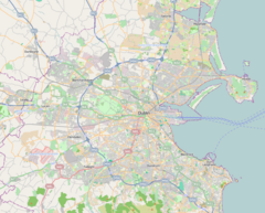
The Gallops (Irish: An Eachrais) is a stop on the Luas light-rail tram system in Dún Laoghaire–Rathdown, County Dublin, Ireland. It opened in 2010 as a stop on the extension of the Green Line south from Sandyford to Brides Glen.[1] The stop provides access to the nearby village of Stepaside.[2] The stop is named for the nearby housing estate (built in the 1990s),[3][4] which is named for its location near Leopardstown Racecourse.[5]
Location and access[edit]
The stop is located at the side of Ballyogan Road. To the south of the stop, the line continues in a section of reserved track next to the road. To the north, the track curves along Murphystown Way.
References[edit]
- ^ "New Luas extension opens". The Irish Times.
- ^ "The Gallops". Luas.
- ^ Brawn, Derek (2009). Ireland's House Party: What the Estate Agents Don't Want You to Know. ISBN 9780717146178.
- ^ McDonald, Frank; Sheridan, Kathy (2 October 2008). The Builders: How a Small Group of Property Developers Fuelled the Building Boom and Transformed Ireland. ISBN 9780141900360.
- ^ "Luas and Dublin Bus". 9 January 2017.

