Tamalaht
Tamalaht | |
|---|---|
Commune and town | |
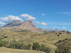
 Ouarsenis range from Tamalaht. Kef Sidi Belkheiret to the right and Kef Sid Amar (1985 m) to the left | |
 | |
| Country | |
| Province | Tissemsilt Province |
| Time zone | UTC+1 (CET) |
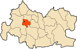
Tamalaht is a town and commune in Tissemsilt Province in northern Algeria. It has a population of roughly 7,600 people, founded in the 1980's[1]
Size[edit]
Tamalaht is a moderately sized town, being a 10.2 km walk from farthest east to west and same from farthest north to south, and a rough area of 52 mkm (Megameter) or 52,441 km.
References[edit]
- ^ "Communes of Algeria". Statoids. Retrieved December 12, 2010.
35°48′45″N 1°37′25″E / 35.81250°N 1.62361°E

