
Třanovice
Třanovice
Trzanowice | |
|---|---|
 Church of Saint Bartholomew | |
 Flag  Coat of arms | |
 Třanovice Location in the Czech Republic | |
| Coordinates: 49°42′45″N 18°31′45″E / 49.71250°N 18.52917°E | |
| Country | |
| Region | Moravian-Silesian |
| District | Frýdek-Místek |
| First mentioned | 1431 |
| Government | |
| • Mayor | Jiří Tomiczek |
| Area | |
| • Total | 8.61 km2 (3.32 sq mi) |
| Elevation | 320 m (1,050 ft) |
| Population (2023-01-01)[1] | |
| • Total | 1,078 |
| • Density | 130/km2 (320/sq mi) |
| Time zone | UTC+1 (CET) |
| • Summer (DST) | UTC+2 (CEST) |
| Postal code | 739 53 |
| Website | www |
ⓘ (Polish: ⓘ, German: Trzanowitz) is a municipality and village in Frýdek-Místek District in the Moravian-Silesian Region of the Czech Republic. It has about 1,100 inhabitants. The municipality has a significant Polish minority.
Etymology[edit]
The name is patronymic in origin derived from personal name Trzenek. The name evolved from Trzenkowicze (1431, 1450) through Trzankowicze (1523, 1578), Strzankowicze (1571) into Trzanowicze beginning from 1610 (Trzanowiczyche), also the division to Upper (Horní/Górne/Ober) and Lower part (Dolní/Dolne/Nieder) of the village began in the 16th and 17th centuries.[2]
Geography[edit]
Třanovice is located about 12 kilometres (7 mi) east of Frýdek-Místek and 19 km (12 mi) southeast of Ostrava. It lies in the Moravian-Silesian Foothills, in the historical region of Cieszyn Silesia. The Stonávka River flows through the municipality.
History[edit]
The first written mention of Třanovice is from 1431.[2][3] According to historian Vincenc Prasek, Třanovice was first mentioned already in 1322.[4]
Politically Třanovice belonged then to the Duchy of Teschen, a fee of the Kingdom of Bohemia, which after 1526 became part of the Habsburg monarchy.
Třanovice became a seat of a Catholic parish probably prior to 16th century. After the 1540s, Protestant Reformation prevailed in the Duchy of Teschen and a local Catholic church was taken over by Lutherans. It was taken from them (as one from around fifty buildings in the region) by a special commission and given back to the Roman Catholic Church on 24 March 1654.[5]
After Revolutions of 1848 in the Austrian Empire, a modern municipal division was introduced in the re-established Austrian Silesia. The village as a municipality was subscribed to the political and legal district of Cieszyn. According to the censuses conducted in 1880–1910 the population of the municipality dropped from 902 in 1880 to 875 in 1910 with a majority being native Polish-speakers (between 95.8% and 97.9%) accompanied by a small German-speaking minority (at most 38 or 4.2% in 1880) and Czech-speaking (at most 12 or 1.4% in 1910). In terms of religion in 1910 the majority were Protestants (53.9%), followed by Roman Catholics (45.2%).[6]
After World War I Polish–Czechoslovak War and the division of Cieszyn Silesia in 1920, it became a part of Czechoslovakia. Following the Munich Agreement, in October 1938 together with the Trans-Olza region it was annexed by Poland, administratively adjoined to Cieszyn County of Silesian Voivodeship.[7] It was then annexed by Nazi Germany at the beginning of World War II. After the war it was restored to Czechoslovakia.
Demographics[edit]
Polish minority makes up 14.4% of the population.[8]
|
|
| ||||||||||||||||||||||||||||||||||||||||||||||||||||||
| Source: Censuses[9][10] | ||||||||||||||||||||||||||||||||||||||||||||||||||||||||
Sights[edit]
The Church of Saint Bartholomew was built in the neo-Gothic style in 1902–1904.[11]
Gallery[edit]
-
 Lutheran church
 -
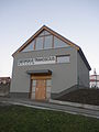
 Municipal office
 -
 Museum of Jiří Třanovský


References[edit]
- ^ "Population of Municipalities – 1 January 2023". Czech Statistical Office. 2023-05-23.
- ^ a b Mrózek, Robert (1984). Nazwy miejscowe dawnego Śląska Cieszyńskiego [Local names of former Cieszyn Silesia] (in Polish). Katowice: University of Silesia in Katowice. p. 176. ISSN 0208-6336.
- ^ Panic, Idzi (2010). Śląsk Cieszyński w średniowieczu (do 1528) [Cieszyn Silesia in Middle Ages (until 1528)] (in Polish). Cieszyn: Starostwo Powiatowe w Cieszynie. p. 307. ISBN 978-83-926929-3-5.
- ^ "Historie obce" (in Czech). Obec Třanovice. Retrieved 2020-11-25.
- ^ Broda, Jan (1992). "Materiały do dziejów Kościoła ewangelickiego w Księstwie Cieszyńskim i Państwie Pszczyńskim w XVI i XVII wieku". Z historii Kościoła ewangelickiego na Śląsku Cieszyńskim (in Polish). Katowice: Dom Wydawniczy i Księgarski „Didache“. pp. 259–260. ISBN 83-85572-00-7.
- ^ Piątkowski, Kazimierz (1918). Stosunki narodowościowe w Księstwie Cieszyńskiem (in Polish). Cieszyn: Macierz Szkolna Księstwa Cieszyńskiego. pp. 265, 284.
- ^ "Ustawa z dnia 27 października 1938 r. o podziale administracyjnym i tymczasowej organizacji administracji na obszarze Ziem Odzyskanych Śląska Cieszyńskiego". Dziennik Ustaw Śląskich (in Polish). 18/1938, poz. 35. Katowice. 31 October 1938. Retrieved 1 July 2014.
- ^ "Population Census 2021: Population by selected ethnicity". Public database. Czech Statistical Office. 2021-03-27.
- ^ "Historický lexikon obcí České republiky 1869–2011 – Okres Frýdek-Místek" (in Czech). Czech Statistical Office. 2015-12-21. pp. 7–8.
- ^ "Population Census 2021: Population by sex". Public Database. Czech Statistical Office. 2021-03-27.
- ^ "Kostel sv. Bartoloměje v Třanovicích" (in Czech). Beskydy.cz. Retrieved 2022-06-08.
External links[edit]


| Authority control databases: National |
|---|