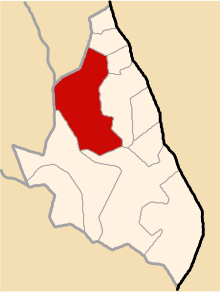
Querobamba District
Querobamba
Qirupampa | |
|---|---|
 Location of Querobamba in the Sucre province | |
| Country | |
| Region | Ayacucho |
| Province | Sucre |
| Capital | Querobamba |
| Subdivisions | 26 populated places |
| Area | |
| • Total | 275.65 km2 (106.43 sq mi) |
| Elevation | 3,502 m (11,490 ft) |
| Population | |
| • Total | 2,737 |
| • Density | 9.9/km2 (26/sq mi) |
| Time zone | UTC-5 (PET) |
| UBIGEO | 050901 |
Querobamba is one of 11 districts of the Sucre Province in the Ayacucho region in Peru.
Population[edit]
The population of Querobamba (2005 census) is 2,737 people, 1,370 men and 1,367 women.[1]
Ethnic groups[edit]
The people in the district are mainly indigenous citizens of Quechua descent. Quechua is the language which the majority of the population (65.32%) learnt to speak in childhood, 34.00 % of the residents started speaking using the Spanish language (2007 Peru Census).[2]
Administrative division[edit]
The populated places in the district are:[1]
|
|
|
References[edit]
- ^ a b INEI Archived June 1, 2007, at the Wayback Machine
- ^ inei.gob.pe Archived January 27, 2013, at the Wayback Machine INEI, Peru, Censos Nacionales 2007, Frequencias: Preguntas de Población: Idioma o lengua con el que aprendió hablar (in Spanish)
