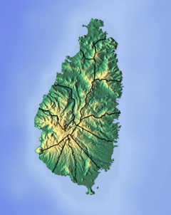
Millet River
| Millet River | |
|---|---|
| Location | |
| Country | Saint Lucia |
| Region | Anse la Raye Quarter |
| Physical characteristics | |
| Mouth | |
• coordinates | 13°55′29″N 60°59′22″W / 13.924778°N 60.989491°W |
The Millet River is a river of Saint Lucia.[1][2]
See also[edit]
References[edit]
- ^ "Millet River". National Geospatial Intelligence Agency. Retrieved August 3, 2021.
- ^ "Integrating the Management of Watersheds and Coastal Areas in St. Lucia". Water Resources Management Unit, Ministry of Agriculture, Forestry and Fisheries Government of St. Lucia. 2001. Retrieved August 3, 2021.
- Higgins, Chris (2001). St. Lucia. Montreal: Ulysses Travel Guides. ISBN 2-89464-396-9.

