
Masunga
Masunga | |
|---|---|
Village | |
 Masunga | |
| Coordinates: 20°40′S 27°25′E / 20.667°S 27.417°E | |
| Country | Botswana |
| District | North-East District |
| Elevation | 1,180 m (3,870 ft) |
| Population (2011)[1] | |
| • Total | 5,696 |
| Time zone | GMT +2 |
| Climate | BSh |
Masunga /ˈmɑːsuŋɡʌ/ is a Bakalanga settlement in the North-East District of Botswana. The village is the Headquarters of the North East District. The nearest city is Francistown which is about 120 km (75 mi) away. The Chief of the region is Kgosi Thabo Maruje Masunga III, who took over from his uncle Christopher Masunga.
Near Masunga are the hills of Domboshaba, which hold a ruined outpost of the Kalanga Empire, more like Great Zimbabwe (Mutapa). It is one of the tourist attractions in Botswana where a yearly Ikalanga cultural ceremony takes place.
The language spoken in the North East Region is Kalanga, not Tswana like the rest of Botswana. Kalanga is closely related to Shona, the main language of Zimbabwe.
Activities and attractions in Masunga[edit]
Things to do in Masunga include:
- Near Masunga are the hills of Domboshaba, which hold a ruined output of the Kalanga Empire
- Rock Art.[2]
- There is a sports complex that caters for different sporting activities.
Schools in Masunga[edit]
Masunga Senior Secondary School[citation needed]
-
 Masunga Senior Secondary School Teachers Residential Houses
 -
 Masunga Senior Secondary School Front Entrance Gate
 -
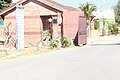 Masunga Senior Secondary School Security Guards building at the front gate


See also[edit]

References[edit]
- ^ "2011 census". Archived from the original on 11 January 2013.
- ^ Botswana information directory
20°40′S 27°25′E / 20.667°S 27.417°E
Capital, District | ||
 | ||
Italics indicates national capital. | ||
This Botswana location article is a stub. You can help Wikipedia by expanding it. |