
Madan Upazila
Madan
মদন | |
|---|---|
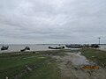
.jpg) Fields in Madan Upazila | |
.svg) | |
| Coordinates: 24°43′N 90°58′E / 24.717°N 90.967°E | |
| Country | |
| Division | Mymensingh |
| District | Netrokona |
| Area | |
| • Total | 225.85 km2 (87.20 sq mi) |
| Population (2011) | |
| • Total | 154,479 |
| • Density | 680/km2 (1,800/sq mi) |
| Time zone | UTC+6 (BST) |
| Website | Official Map of Madan |
Madan (Bengali: মদন) is an upazila of Netrokona District[1] in the Division of Mymensingh, Bangladesh.
Geography[edit]
Madan is located at 24°43′00″N 90°58′00″E / 24.7167°N 90.9667°E. It has 21,808 households and total area 225.85 km2. It is bounded by Atpara and Mohanganj upazilas on the north, Itna and Tarail upazilas on the south, Khaliajuri upazila on the east, Kendua upazila on the west.[1]
Demographics[edit]
According to the 2011 Bangladesh census, Madan Upazila had 31,751 households and a population of 154,479. 47,697 (30.88%) were under 10 years of age. Madan has a literacy rate (age 7 and over) of 30.41%, compared to the national average of 51.8%, and a sex ratio of 987 females per 1000 males. 18,812 (12.18%) lived in urban areas.[3][2]
As of the 1991 Bangladesh census, Madan had a population of 117,613. Males constituted 50.99% of the population, and females 49.01%. This Upazila's eighteen up population was 58,127. Madan had an average literacy rate of 18.7% (7+ years), and the national average of 32.4% literate.[4]
Administration[edit]
Madan Thana was formed in 1917 and it was turned into an upazila in 1983.[1]
Madan Upazila is divided into Madan Municipality and eight union parishads: Fatehpur, Gobindasree, Chandgaon, Kaitail, Madan, Maghan, Nayekpur, and Tiasree. The union parishads are subdivided into 84 mauzas and 114 villages.[5]
Madan Municipality is subdivided into 9 wards and 11 mahallas.[5]
See also[edit]
Gallery[edit]
-
 Uchitpur Ghat at Madan.
 -
 Mogra River from the bridge at Madan Upazila.


References[edit]
- ^ a b c Syed Marufuzzaman (2012), "Madan Upazila", in Sirajul Islam and Ahmed A. Jamal (ed.), Banglapedia: National Encyclopedia of Bangladesh (Second ed.), Asiatic Society of Bangladesh
- ^ a b "Bangladesh Population and Housing Census 2011 Zila Report – Netrokona" (PDF). bbs.gov.bd. Bangladesh Bureau of Statistics.
- ^ "Community Tables: Netrokona district" (PDF). bbs.gov.bd. 2011.
- ^ "Population Census Wing, BBS". Archived from the original on 27 March 2005. Retrieved 10 November 2006.
- ^ a b "District Statistics 2011: Netrokona" (PDF). Bangladesh Bureau of Statistics. Archived from the original (PDF) on 13 November 2014. Retrieved 14 July 2014.
Capital: Netrokona | ||
| Upazilas | ||
| Constituencies | ||
| Attractions and sites | ||
| History | ||
| Inhabited areas | ||
| Rivers | ||
| Educational institutions | ||
| Transport | ||
Headquarters: Mymensingh | ||
| Jamalpur District |  | |
| Mymensingh District | ||
| Netrokona District | ||
| Sherpur District | ||
This Mymensingh Division location article is a stub. You can help Wikipedia by expanding it. |