
Harlan, Kansas
Harlan, Kansas | |
|---|---|
 | |
 Harlan  Harlan | |
| Coordinates: 39°36′20″N 98°46′1″W / 39.60556°N 98.76694°W[1] | |
| Country | United States |
| State | Kansas |
| County | Smith |
| Named for | John Harlan |
| Elevation | 1,585 ft (483 m) |
| Time zone | UTC-6 (CST) |
| • Summer (DST) | UTC-5 (CDT) |
| Area code | 785 |
| FIPS code | 20-30075 |
| GNIS ID | 472153 [1] |
Harlan is an unincorporated community in Smith County, Kansas, United States.[1]
History[edit]
Harlan was named for John C. Harlan, a pioneer settler.[2]
A post office was opened in Harlan in the 1870s, and remained in operation until it was discontinued in 1995.[3]
Education[edit]
Harlan is served by Smith Center USD 237 public school district.[4]
Harlan High School was closed through school unification.[when?] The Harlan High School mascot was Cardinals.[5]
References[edit]
- ^ a b c d "Harlan, Kansas", Geographic Names Information System, United States Geological Survey, United States Department of the Interior
- ^ Gannett, Henry (1905). The Origin of Certain Place Names in the United States. Govt. Print. Off. pp. 149.
- ^ "Kansas Post Offices, 1828-1961". Kansas Historical Society. Archived from the original on October 9, 2013. Retrieved June 23, 2014.
- ^ "Smith Center USD 237". USD 237. Retrieved January 7, 2017.
- ^ "Harlan High School - Cardinal Yearbook (Harlan, KS) - Class of 1950". E-YEARBOOK.COM. Retrieved January 7, 2017.
Further reading[edit]
External links[edit]
Municipalities and communities of Smith County, Kansas, United States | ||
|---|---|---|
| Cities | 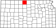 | |
| Unincorporated communities | ||
| Ghost towns | ||
| Townships | ||
This article about a location in Smith County, Kansas is a stub. You can help Wikipedia by expanding it. |