
File:South Sudan topographic map.svg

Size of this PNG preview of this SVG file: 800 × 577 pixels. Other resolutions: 320 × 231 pixels | 640 × 462 pixels | 1,024 × 738 pixels | 1,280 × 923 pixels | 2,560 × 1,846 pixels | 1,553 × 1,120 pixels.
Original file (SVG file, nominally 1,553 × 1,120 pixels, file size: 759 KB)
| This is a file from the Wikimedia Commons. Information from its description page there is shown below. Commons is a freely licensed media file repository. You can help. |
Summary
| Description |
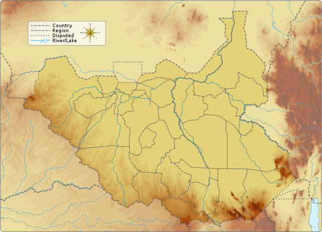
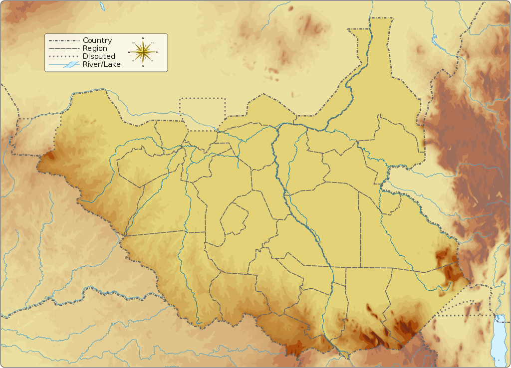
English: Topographic map of South Sudan.
|
||||||||||||||||||||||
| Date | |||||||||||||||||||||||
| Source |
Own work Information from:
|
||||||||||||||||||||||
| Author | Goran_tek-en | ||||||||||||||||||||||
| Permission (Reusing this file) |
This file is licensed under the Creative Commons Attribution-Share Alike 4.0 International license. Attribution: Goran tek-en
|
||||||||||||||||||||||
| Other versions |
|
||||||||||||||||||||||
| SVG development | This vector image was created with Inkscape.
|
||||||||||||||||||||||

| Object location | | View this and other nearby images on: OpenStreetMap |
|---|


Licensing
This file is licensed under the Creative Commons Attribution-Share Alike 4.0 International license.
Attribution: Goran tek-en
- You are free:
- to share – to copy, distribute and transmit the work
- to remix – to adapt the work
- Under the following conditions:
- attribution – You must give appropriate credit, provide a link to the license, and indicate if changes were made. You may do so in any reasonable manner, but not in any way that suggests the licensor endorses you or your use.
- share alike – If you remix, transform, or build upon the material, you must distribute your contributions under the same or compatible license as the original.
File history
Click on a date/time to view the file as it appeared at that time.
| Date/Time | Thumbnail | Dimensions | User | Comment | |
|---|---|---|---|---|---|
| current | 15:32, 5 September 2016 | | 1,553 × 1,120 (759 KB) | Goran tek-en | User created page with UploadWizard |
File usage
The following pages on the English Wikipedia use this file (pages on other projects are not listed):
- 1990 South Sudan earthquakes
- Abara River
- Adar River
- Adar oilfield
- Adda River (South Sudan)
- Aga Falls
- Agwei River
- Air campaign of the Heglig Crisis
- Akobo River
- Aroyo, South Sudan
- Ashana Game Reserve
- Awoda
- Bahr el Zeraf
- Bandingilo National Park
- Bengangai Game Reserve
- Bire Kpatuos Game Reserve
- Biri River
- Block 5A, South Sudan
- Boma National Park
- Boro River
- Chelkou Game Reserve
- Daga River (South Sudan)
- Didinga Hills
- Ez Zeraf Game Reserve
- Fanyikang Game Reserve
- Fula Rapids
- Imatong Mountains
- Iro (South Sudan)
- Ironstone Plateau
- Jikawo River
- Juba Game Reserve
- Jur River
- Kangen River
- Kidepo Game Reserve
- Kidepo River
- Kinyeti
- Kongkong River
- Kuru River
- Lake Ambadi
- Lake No
- Lantoto National Park
- Liffi
- Lol River
- Lotilla River
- Magadhik River
- Mbarizunga Game Reserve
- Medikiret River
- Mongalla, South Sudan
- Nimule National Park
- Numatina Game Reserve
- Pibor River
- Pongo River (South Sudan)
- Raga River
- Shambe National Park
- Sopo River
- Southern National Park
- Tonj River
- Unity oilfield
- Veveno River
- War of the Peters
- Wau River
- Yabus River
- User:Crtew/Christopher Allen (journalist)
- User:Ty654/List of earthquakes from 1950-1999 exceeding magnitude 7+
- User:Ty654/List of earthquakes from 1990-1994 exceeding magnitude 6+
- Module:Location map/data/South Sudan
- Module:Location map/data/South Sudan/doc
- Module:Location map/data/Southern Sudan
Global file usage
The following other wikis use this file:
- Usage on ab.wikipedia.org
- Usage on ar.wikipedia.org
- Usage on av.wikipedia.org
- Usage on az.wikipedia.org
- Usage on be.wikipedia.org
- Usage on bn.wikipedia.org
- Usage on bs.wikipedia.org
- Usage on ceb.wikipedia.org
- Usage on ce.wikipedia.org
- Usage on cs.wikipedia.org
- Usage on de.wikivoyage.org
- Usage on din.wikipedia.org
- Usage on dsb.wikipedia.org
- Usage on el.wikipedia.org
- Usage on eo.wikipedia.org
- Usage on fa.wikipedia.org
- Usage on he.wikivoyage.org
- Usage on hif.wikipedia.org
- Usage on hi.wikipedia.org
- Usage on hr.wikipedia.org
- Usage on hsb.wikipedia.org
- Usage on hu.wikipedia.org
- Usage on it.wikivoyage.org
- Usage on ja.wikipedia.org
View more global usage of this file.