Doorin Peninsula
Dúrian | |
|---|---|
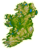
 Location of the Doorin Peninsula | |
 | |
| Geography | |
| Location | Ireland |
| Adjacent to | |
| Area | 20.1 km2 (7.8 sq mi) |
| Administration | |
| County | Donegal |
| Demographics | |
| Population | 495 (2016) |
| Pop. density | 24.6/km2 (63.7/sq mi) |
The Doorin Peninsula (Irish: Dúrian) is a peninsula in County Donegal, Ireland. The peninsula is one of the many rocky outcrops on the northern side of Donegal Bay.
The area is largely agricultural, with small patches of commercial forest. The coastline is most low-lying, however sizable sea-cliffs are present in the south of the peninsula, at Doorin Point, and a small sand beach is located in the west of the peninsula. Extensive wave-cut platforms are exposed along the peninsula at low tide.


