
Bokoro Airport (Democratic Republic of the Congo)
Bokoro Airport | |||||||||||
|---|---|---|---|---|---|---|---|---|---|---|---|
| Summary | |||||||||||
| Airport type | Public | ||||||||||
| Serves | Bokoro | ||||||||||
| Elevation AMSL | 1,080 ft / 329 m | ||||||||||
| Coordinates | 2°53′05″S 18°21′10″E / 2.88472°S 18.35278°E | ||||||||||
| Map | |||||||||||
 Bokoro Location of the airport in Democratic Republic of the Congo | |||||||||||
| Runways | |||||||||||
| |||||||||||
Sources: Google Maps[1] | |||||||||||
Bokoro Airport is an airport serving the city of Bokoro in Mai-Ndombe Province, Democratic Republic of the Congo. The province of Mai-Ndombe is one of three regions the former province of Bandundu has been divided into.
Trivia[edit]
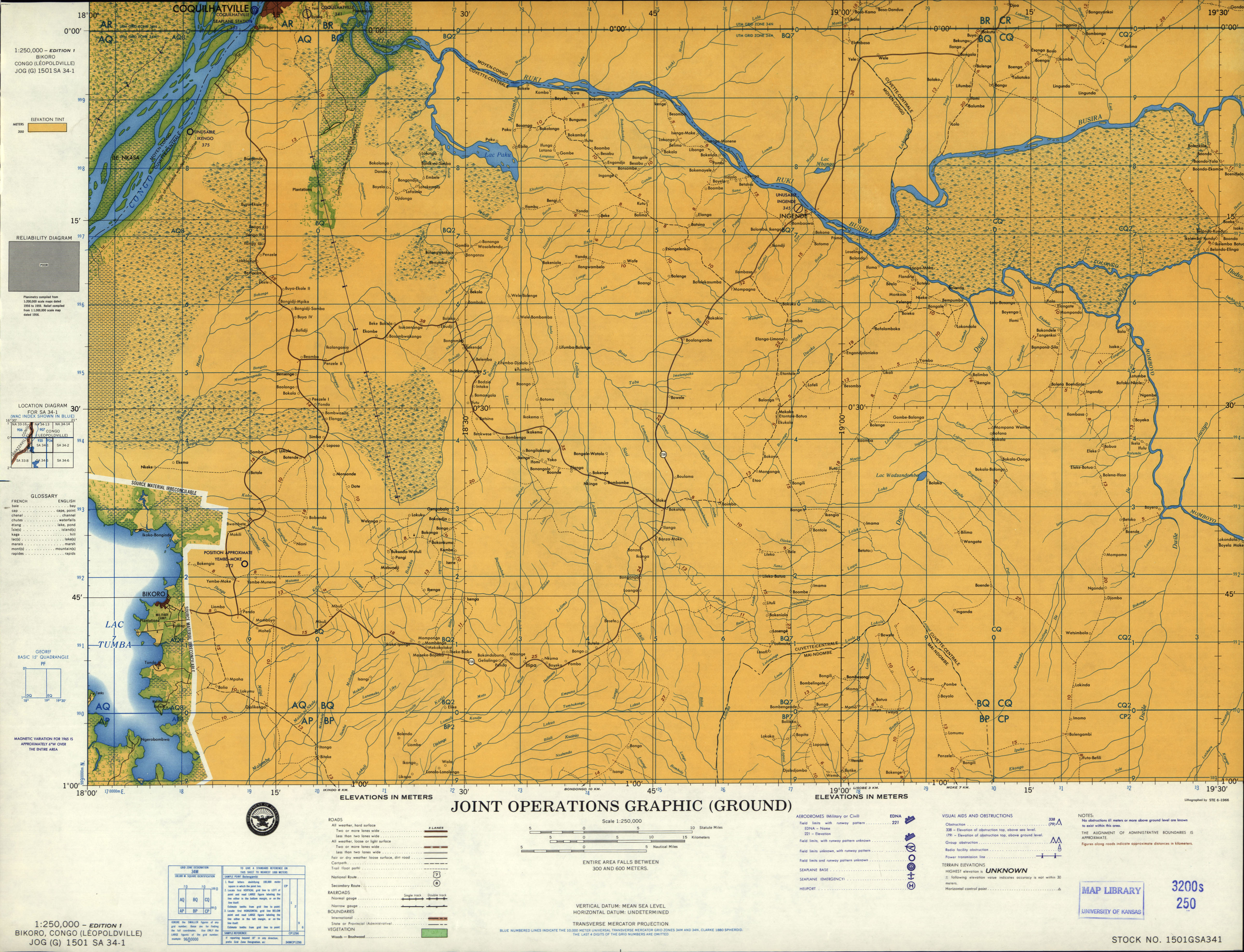
Officially, Bokoro Airport does not have an ICAO-Code. However, the code FZBC is attributed to Bikoro Airport, allegedly serving the town of Bikoro. Bikoro never had an airport as various old maps and aeronautical charts confirm. It is instead served by the airfield of Yembe-Moke (FZEM) located 7 miles north-east of the town.[2] Additionally, the third letter "B" in the code indicates that the airport is located the former province of Bandundu. Bikoro is located in the former province of Equateur. It is therefore assumed that FZBC is actually the ICAO code intended for Bokoro airport that has been wrongly assigned due to a spelling error.
See also[edit]
 Democratic Republic of the Congo portal
 Aviation portal
- Transport in the Democratic Republic of the Congo
- List of airports in the Democratic Republic of the Congo
References[edit]
- ^ Google Maps - Bokoro
- ^ "JOG 1501 SA 34-01". U.S. Defense Intelligence Agency. Retrieved 2019-04-06.
External links[edit]
This article about an airport in the Democratic Republic of the Congo is a stub. You can help Wikipedia by expanding it. |