Ballybrittas
Ballybrittas
Baile Briotáis | |
|---|---|
Village | |
 View of Ballybrittas from the southwest (R445) | |
| Coordinates: 53°06′35″N 7°08′08″W / 53.1097°N 7.1355°W | |
| Country | Ireland |
| Province | Leinster |
| County | County Laois |
| Population | 388 |
| Time zone | UTC+0 (WET) |
| • Summer (DST) | UTC-1 (IST (WEST)) |
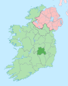
Ballybrittas (Irish: Baile Briotáis, meaning "town of the palisade", IPA:[ˈbˠalʲəˈbʲɾʲɪt̪ˠaːʃ])[2] is a small village in the northeast of County Laois, Ireland situated on the R445 about 5 km SW of Monasterevin, County Kildare. Formerly on the N7 Dublin - Limerick road, the village is now bypassed by the M7 motorway.
Amenities[edit]
Businesses in the village include a pub, a service station, and a number of small businesses.
The local schools and churches are nearby in Rath and Killenard, while the local Gaelic Athletic Association club Courtwood is nearby.
Notable people[edit]
- Fergal Byron (born 1974), Laois Gaelic footballer
- Charlotte Dease (1873-1953), author
- Edmund Dease (1829-1904), Irish politician
- Robert Johnson (1745-1833) Irish judge and pamphleteer
- Eddie Kinsella (born 1966), Gaelic football referee[3]
- James Lalor (1829-1922), Australian politician
- Stephen Radcliffe (1904-1982), first-class cricketer and British Army officer
See also[edit]
References[edit]
- ^ "Sapmap Area - Settlements - Ballybrittas". Census 2016. Central Statistics Office. April 2016. Retrieved 25 January 2020.
- ^ "Baile Briotáis / Ballybrittas". logainm.ie. Irish Placenames Commission. Retrieved 25 January 2020.
- ^ "Eddie Blows Final Whistle at County Level". Laois Nationalist. 16 December 2016. Retrieved 23 January 2024.
External links[edit]
Wikimedia Commons has media related to Ballybrittas.


