Štajngrova
Štajngrova | |
|---|---|
| Coordinates: 46°36′56.88″N 15°54′6.08″E / 46.6158000°N 15.9016889°E | |
| Country | |
| Traditional region | Styria |
| Statistical region | Drava |
| Municipality | Benedikt |
| Area | |
| • Total | 0.91 km2 (0.35 sq mi) |
| Elevation | 318.2 m (1,044.0 ft) |
| Population (2020) | |
| • Total | 234 |
| • Density | 260/km2 (670/sq mi) |
| [1] | |
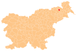
Štajngrova (pronounced [ˈʃtaːi̯nɡɾɔʋa], in older sources also Stangrov,[2] German: Stangelberg[2]) is a settlement in the Slovene Hills (Slovene: Slovenske gorice) in the Municipality of Benedikt in northeastern Slovenia. The area is part of the traditional region of Styria. It is now included in the Drava Statistical Region.[3]
A wayside shrine with a 3-meter (9.8 ft) tall niche containing a crucifix dates to around 1900.[4]
References[edit]
- ^ Statistical Office of the Republic of Slovenia
- ^ a b Leksikon občin kraljestev in dežel zastopanih v državnem zboru, vol. 4: Štajersko. Vienna: C. Kr. Dvorna in Državna Tiskarna. 1904. p. 214.
- ^ Benedikt municipal site
- ^ Slovenian Ministry of Culture register of national heritage reference number ešd 4394


