
User talk:The Anome/archive 12
Generic/list articles tagged by bot[edit]
I've been working through Category:New Zealand articles missing geocoordinate data, and come across a few generic/list articles such as Glaciers of New Zealand, Hot springs in New Zealand, and Pā (Māori) that don't need coords. One pattern I can see is "in" or "of" <country name>, possibly a solution to avoid tagging some. XLerate (talk) 05:15, 27 March 2009 (UTC)
- Thank you! Once you mention it, it's obvious, but I hadn't thought of that. I'll implement that in the next revision of the bot. -- The Anome (talk) 09:39, 27 March 2009 (UTC)
Poland coordinates[edit]
Hi, I've finished making village articles (for now); I've got tables of coordinates for all the counties and all the gminas. Could you wiki-mail me so I can send them to you to have a look at?--Kotniski (talk) 11:50, 27 March 2009 (UTC)
- I don't use wiki-mail, but if you put the data in any reasonably parsable plaintext format into a user page, and let me know here, I can pick up the data from there. There's no need to make it make sense as wikitext: I can just open the page in the edit window and cut and paste. -- The Anome (talk) 20:53, 27 March 2009 (UTC)
- OK, I've put the county information at User:Kotniski/Polish data, and the gmina information at User:Kotniski/Gmina data. It's in the form of semicolon-separated text rows - the fields are explained on the page. Let me know if you'd like any more information. I'm currently preparing (for my own purposes) a table of all the towns/villages we have, in alphabetical order, with indication of what gmina they're in - if you think that would be useful to you, then let me know and I'll provide it. Oh, I've also got a list of outliers - places for which the coordinates we have are likely to be errors as they are too far from the rest of their gmina. I'll add that list to the county page. (However in the past few days I see User:D6 (and D4?) have been adding coordinates to quite a lot of articles - my data doesn't take account of these.)--Kotniski (talk) 13:58, 28 March 2009 (UTC)
- Thanks! I'll get on to it sometime in the next few days. -- The Anome (talk) 14:43, 28 March 2009 (UTC)
- And yes, I'd also appreciate a copy of your list of town/village/gmina mappings: it will save me from having to compile it myself. -- The Anome (talk) 17:12, 28 March 2009 (UTC)
- OK, the first sections (I'm doing it by initial letter) will be appearing
in a minuteat User:Kotniski/Polish data/A and User:Kotniski/Polish data/B (on Monday - link's too slow to upload now). The fields are: (1) name without diacritics and without tag; (2) full name of WP article; (3) number of the gmina per the list at /Gmina data (0 means a town not belonging to any gmina); (4) (if present) R = article currently a redlink.--Kotniski (talk) 17:33, 28 March 2009 (UTC)
- OK, the first sections (I'm doing it by initial letter) will be appearing
- And yes, I'd also appreciate a copy of your list of town/village/gmina mappings: it will save me from having to compile it myself. -- The Anome (talk) 17:12, 28 March 2009 (UTC)
Finished uplodaing the files: User:Kotniski/Polish data/A to User:Kotniski/Polish data/Z, but omitting Q, V, X and Y (which don't occur). There are two separate pages for S: User:Kotniski/Polish data/S1 and User:Kotniski/Polish data/S2.--Kotniski (talk) 10:44, 30 March 2009 (UTC)
- I've now downloaded all the data, and done a quick check to count the number of semicolon-separated records. Based on just parsing for semicolon-separated records of the lengths defined in the comments (ignoring all others in the same file) I get the following counts:
- Gmina page: 2171 unique records with format "%d;%s;%s;%f;%f;%d;%f;%f;%f;%f"
- Powiat page: 314 unique records with format "%d;%s;%f;%f"
- total unique per-article records with format "%s;%s;%d" in the all other files: 52781
- Can you confirm that these are the correct counts? -- The Anome (talk) 12:18, 31 March 2009 (UTC)
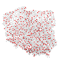
Here's are some initial sanity-check plots of the data:
-
 Powiat map, for comparison purposes
 -
 Plot of powiat and gmina centers from dataset
 -
 Plot of gmina centers colored by powiat, with powiat colors assigned randomly
 -
 Plot of gmina centers colored by voivodeship, overlaid onto voivodeship map, using simple but dumb map projection


(Sidenote: I'm releasing all the images I create from the data into the public domain, as I believe that Feist v. Rural applies to the data values themselves; any stuff which is combined with work released under other licences gets released under those licenses)
Would it be easy for you to add a Vovoideship field to each entry in the powiat data file, User:Kotniski/Polish data? This would be very useful in performing further sanity checking. (If it's a problem, I can do it myself when I next have time.) -- The Anome (talk) 14:45, 31 March 2009 (UTC)
- Right, those figures look correct (I have slightly more towns and villages, 52913, but I guess you've excluded those marked with an R for redlink, and the data I have on this computer isn't the newest - I deleted some duplicates from the master list). The maps also look as I would expect. I'll see what I can do with the voivodeships.--Kotniski (talk) 14:53, 31 March 2009 (UTC)
- Ah! That would explain a lot. I'll re-parse them with the "R" records included. -- The Anome (talk) 14:54, 31 March 2009 (UTC)
- I've added the voivodeships to the list of counties (so it's now %d;%s;%s;%f;%f, field 3 being the voivodeship).--Kotniski (talk) 15:03, 31 March 2009 (UTC)
- Thanks, I've got and re-parsed the data, and tweaked the map projection a bit more. The gmina center dots, when colored by voivodeship, now line up well with the corresponding boundaries on the SVG map. There is, however, a big hole in the gmina data in the Silesian Voivodeship. -- The Anome (talk) 20:40, 31 March 2009 (UTC)
- Yes, that's to be expected - the Katowice metro area consists of cities which don't belong to any gmina (well, they are gminas in their own right, but that class of entity are included in the placename data with gmina number zero, not in the gmina data). There's a similar hole at Warsaw for the same reason.--Kotniski (talk) 07:37, 1 April 2009 (UTC)
- Thanks! That's another part of the puzzle solved; I had no idea about the Katowice metro area being special like the Warsaw area. It's this sort of local knowledge that is crucial to getting this right. I'll add the "gmina 0" points to the map. In other news, I now have an experimental lat/long to voivodeship classifier almost ready to go; if it works OK once I've made the changes above, I will apply the same techniques to later powiat- and gmina-level processing. -- The Anome (talk) 08:38, 1 April 2009 (UTC)
- Thanks, I've got and re-parsed the data, and tweaked the map projection a bit more. The gmina center dots, when colored by voivodeship, now line up well with the corresponding boundaries on the SVG map. There is, however, a big hole in the gmina data in the Silesian Voivodeship. -- The Anome (talk) 20:40, 31 March 2009 (UTC)
- I've added the voivodeships to the list of counties (so it's now %d;%s;%s;%f;%f, field 3 being the voivodeship).--Kotniski (talk) 15:03, 31 March 2009 (UTC)
- Ah! That would explain a lot. I'll re-parse them with the "R" records included. -- The Anome (talk) 14:54, 31 March 2009 (UTC)
Preliminary results[edit]
Here's some preliminary sample data from the voivodeship matcher (note that links to placenames are not yet disambiguated -- that will need a global analysis of both datasets):
- GNS-matcher Wilanow Brzezinski 51°50′00″N 19°33′00″E / 51.8333°N 19.5500°E Łódź Voivodeship (provisional)
- GNS-matcher Tadeuszow 50°57′00″N 21°46′00″E / 50.9500°N 21.7667°E Świętokrzyskie Voivodeship (provisional)
- GNS-matcher Zbarzewo 51°52′00″N 16°23′00″E / 51.8667°N 16.3833°E Lubusz Voivodeship (provisional)
- GNS-matcher Ruda 50°18′00″N 21°48′00″E / 50.3000°N 21.8000°E Subcarpathian Voivodeship (provisional)
- GNS-matcher Potaszniki 51°50′00″N 21°43′00″E / 51.8333°N 21.7167°E Masovian Voivodeship (provisional)
- GNS-matcher Kolonia Niewodnica Nargilewska 53°04′00″N 23°11′00″E / 53.0667°N 23.1833°E Podlaskie Voivodeship (provisional)
- GNS-matcher Lesnica 50°43′00″N 17°29′00″E / 50.7167°N 17.4833°E Opole Voivodeship (provisional)
- GNS-matcher Morawiany 50°13′00″N 20°37′00″E / 50.2167°N 20.6167°E Świętokrzyskie Voivodeship (provisional)
- GNS-matcher Nowy Gaj 51°38′00″N 22°14′00″E / 51.6333°N 22.2333°E Lublin Voivodeship (provisional)
- GNS-matcher Przemyslaw 54°18′00″N 18°58′00″E / 54.3000°N 18.9667°E BOUNDARY_REGION (provisional)
- GNS-matcher Prinzlaff 54°18′00″N 18°58′00″E / 54.3000°N 18.9667°E BOUNDARY_REGION (provisional)
- GNS-matcher Przerosl Mala 54°14′00″N 22°40′00″E / 54.2333°N 22.6667°E Podlaskie Voivodeship (provisional)
- GNS-matcher Skludzewo-Borek 53°07′00″N 18°19′00″E / 53.1167°N 18.3167°E Kuyavian-Pomeranian Voivodeship (provisional)
- GNS-matcher Otalaz 51°41′00″N 20°43′00″E / 51.6833°N 20.7167°E BOUNDARY_REGION (provisional)
- GNS-matcher Stryczowiec 50°52′00″N 21°17′00″E / 50.8667°N 21.2833°E Świętokrzyskie Voivodeship (provisional)
- GNS-matcher Szczutki 53°13′00″N 17°54′00″E / 53.2167°N 17.9000°E Kuyavian-Pomeranian Voivodeship (provisional)
- GNS-matcher Zyczyn 51°41′00″N 21°44′00″E / 51.6833°N 21.7333°E Masovian Voivodeship (provisional)
- GNS-matcher Osetno 53°26′00″N 19°19′00″E / 53.4333°N 19.3167°E Warmian-Masurian Voivodeship (provisional)
- GNS-matcher Rakoszyn 50°39′00″N 20°06′00″E / 50.6500°N 20.1000°E Świętokrzyskie Voivodeship (provisional)
- GNS-matcher Rakcice 52°30′00″N 20°10′00″E / 52.5000°N 20.1667°E Masovian Voivodeship (provisional)
- GNS-matcher Sokole 53°39′00″N 16°58′00″E / 53.6500°N 16.9667°E Pomeranian Voivodeship (provisional)
- GNS-matcher Samborowice 50°37′00″N 17°14′00″E / 50.6167°N 17.2333°E Opole Voivodeship (provisional)
- GNS-matcher Probark Maly 53°48′00″N 21°21′00″E / 53.8000°N 21.3500°E Warmian-Masurian Voivodeship (provisional)
- GNS-matcher Podkrajewo 53°05′00″N 20°17′00″E / 53.0833°N 20.2833°E Masovian Voivodeship (provisional)
- GNS-matcher Podkomorek 50°04′00″N 19°15′00″E / 50.0667°N 19.2500°E Lesser Poland Voivodeship (provisional)
- GNS-matcher Kaszowka 50°43′00″N 17°11′00″E / 50.7167°N 17.1833°E Lower Silesian Voivodeship (provisional)
- GNS-matcher Mielno 52°41′00″N 17°53′00″E / 52.6833°N 17.8833°E Kuyavian-Pomeranian Voivodeship (provisional)
- GNS-matcher Mariampol 52°54′00″N 21°17′00″E / 52.9000°N 21.2833°E Masovian Voivodeship (provisional)
- GNS-matcher Kwieciszewo 52°37′00″N 18°03′00″E / 52.6167°N 18.0500°E Kuyavian-Pomeranian Voivodeship (provisional)
- GNS-matcher Kietlanka 52°45′00″N 22°10′00″E / 52.7500°N 22.1667°E Masovian Voivodeship (provisional)
- GNS-matcher Zerkowice 50°10′00″N 20°20′00″E / 50.1667°N 20.3333°E BOUNDARY_REGION (provisional)
It's still quite possible that this data contains gross errors; this is produced by first-hack as-yet-undebugged code.
How matching works[edit]
A quick worked example of how matching is intended to work: at the moment, the matcher finds three places called "Kosin"
- GNS-matcher Kosin 50°50′00″N 21°55′00″E / 50.8333°N 21.9167°E Lublin Voivodeship (provisional)
- GNS-matcher Kosin 52°02′00″N 19°20′00″E / 52.0333°N 19.3333°E Łódź Voivodeship (provisional)
- GNS-matcher Kosin 53°07′00″N 15°03′00″E / 53.1167°N 15.0500°E West Pomeranian Voivodeship (provisional)
Wikipedia has five:
- Kosin, Łódź Voivodeship (central Poland)
- Kosin, Lublin Voivodeship (east Poland)
- Kosin, Lubusz Voivodeship (west Poland)
- Kosin, Drawsko County in West Pomeranian Voivodeship (north-west Poland)
- Kosin, Pyrzyce County in West Pomeranian Voivodeship (north-west Poland)
On the basis that if a place in GNS and a place in Wikipedia are, when disambiguated, identical and unique within their own databases, they are the same, I can uniquely identify both Kosin, Lublin Voivodeship and Kosin, Łódź Voivodeship from this. (For now, if a place cannot be clearly resolved to a single voivodeship, it will both be regarded as unmatchable, and also block all other places of the same name in any other voivodeship from matching, because it could actually be in any of them: I can fine-tune this later to be more discriminating.)
This is pretty reliable; for it to go wrong, both Wikipedia and the GNS have to miss places out, or mislabel them, in the same way. If only one is erroneous, it simply fails to identify the place, rather than giving bad data.
However, Kosin, Lubusz Voivodeship is not in the GNS dataset, and only one of the "Kosin"s in West Pomeranian Voivodeship is in the GNS. Which it is, I can't work out at the moment; but when I have better data for the counties, I should be able to work out which. So, at the moment, I can find two of five; when I have better data, I should be able to get three of five.
On the other hand:
- GNS-matcher Samborowice 50°37′00″N 17°14′00″E / 50.6167°N 17.2333°E Opole Voivodeship (provisional)
occurs nowhere in Wikipedia, so either I've made a gross error (like mislabeling a Voivodeship), or the GNS is wrong, Wikipedia is wrong, or Wikipedia has simply missed this out. No matter which is the case, it will simply fail to match.
- Update: 50°37′00″N 17°14′00″E / 50.6167°N 17.2333°E is actually in Lower Silesian Voivodeship, but very near the boundary between Opole Voivodeship: I clearly need to increase the fuzz factor a bit more, so it will resolve to BOUNDARY_REGION instead. -- The Anome (talk) 12:41, 1 April 2009 (UTC)
All of this should become clearer when I've done the data runs, and started spot-checking results and statistical analysis looking for oddities in matching rates. -- The Anome (talk) 12:18, 1 April 2009 (UTC)
- Glad to see things are progressing. I'll have some more time tomorrow if you need me to take a look at anything or provide more data.--Kotniski (talk) 18:00, 1 April 2009 (UTC)
- Yes, please! At the moment, the current dataset does not have any gmina data for places which are also their own gmina (since they all have gmina code 0), so I can't just look up the county, and hence the voivodeship, from there. Could you arrange things so I can find this for every place on your list, even if they have no gmina other than themselves, for example by adding a county field to each place entry, as well as to each gmina? -- The Anome (talk) 19:11, 1 April 2009 (UTC)
- Right, I've added this information at the bottom of User:Kotniski/Polish data. The fields this time are: (1) name of town; (2) county which the town is in or is the seat of (if any, otherwise empty); (3) voivodeship; (4)+(5) coordinates of the town. Kotniski (talk) 12:04, 2 April 2009 (UTC)
- Yes, please! At the moment, the current dataset does not have any gmina data for places which are also their own gmina (since they all have gmina code 0), so I can't just look up the county, and hence the voivodeship, from there. Could you arrange things so I can find this for every place on your list, even if they have no gmina other than themselves, for example by adding a county field to each place entry, as well as to each gmina? -- The Anome (talk) 19:11, 1 April 2009 (UTC)
- I've now grabbed and parsed that file. In your main data, you have both the town name and Wikipedia article name: all of these appear to be article titles, which with two exceptions (Hel, Poland, Reda, Poland) seem to be the same as the town name. Now I've got all of these, I should have everything that's needed for the rest of the analysis. -- The Anome (talk) 16:36, 2 April 2009 (UTC)
To do[edit]
Sort the entries of Category:Former Yugoslavia articles missing geocoordinate data into their respective modern countries. -- The Anome (talk) 14:43, 28 March 2009 (UTC)
Caves of Hertfordshire[edit]
I'm not sure there are any more other than the Royston one and i suppose Scott's Grotto (no article at present, see Ware) would count. Do you know of any others? Simply south (talk) 16:40, 28 March 2009 (UTC)
The Hellfire Caves?-- The Anome (talk) 16:42, 28 March 2009 (UTC)- Correction: No, they're in Buckinhamshire, apparently. But there must surely be other caves in Hertfordshire. -- The Anome (talk) 16:43, 28 March 2009 (UTC)
- And yes, thanks for nudging me to create the Scott's Grotto article. -- The Anome (talk) 16:58, 28 March 2009 (UTC)
- When i have the time, i will expand it a bit. If you want the externa link, it is this. Simply south (talk) 17:13, 28 March 2009 (UTC)
To do[edit]
Add coord missing entries for Category:Individual trees. -- The Anome (talk) 03:37, 29 March 2009 (UTC)
Coordinates[edit]
Hi, in regards to Norwood Morialta High School, there are two separate locations for this school (as it is dual campus), and I am not aware of how (or whether it is possible) to list two different coordinates. Any help with this would be much appreciated as I have tried before with no success. Cheers Natski-asnd8 (talk) 05:28, 29 March 2009 (UTC).
- Just use the {{coord}} template twice, once for each site, placed in the running text of the article, and use "display=inline" on each one, instead of the normal "display=title" parameter which would put it at the top of the article. If you need any more help, just let me know the coordinates, and I'll make the changes for you. -- The Anome (talk) 09:51, 29 March 2009 (UTC)
False positive[edit]
I don't know what criteria your bot uses for judging whether an article is geographical or not, but this clearly fails as it's an organisation (I'm not sure if it has a specific headquarters). — Tivedshambo (t/c) 21:30, 29 March 2009 (UTC)
It'd be helpful to have this subdivided by county. Trying to provide coordinates for 2,960 articles is a daunting task, especially when 90% of them are in counties with which I have little or no familiarity. --Stepheng3 (talk) 23:17, 29 March 2009 (UTC)
Noticed that you put in one of your "Coodinates missing" notes. This is widely scattered, disjointed, discontiguous across a vast area. This is, for example, a lot bigger than Sherwood Forest. Picking a coordinate is problematical at best. It's like asking for the ""coordinates" of New Hampshire and Delaware. [[New 7&6=thirteen (talk) 00:21, 30 March 2009 (UTC) Stan
- There's a general awareness that a single coordinate does not well describe an area or a linear feature. We're slowly working on that problem. Meanwhile HNF differs somewhat in that it is a couple of discrete places, a problem solved by adding two coordinates. Even coords which do not well describe the complete area are at least a help to users who wish to traverse to a map having read the article. Such coords are now added. --Tagishsimon (talk) 08:53, 31 March 2009 (UTC)
Image copyright problem with File:Wojewodztwa overlaid with gminas colored by voivodeship.png[edit]
Thanks for uploading File:Wojewodztwa overlaid with gminas colored by voivodeship.png. The image has been identified as not specifying the copyright status of the image, which is required by Wikipedia's policy on images. Even if you created the image yourself, you still need to release it so Wikipedia can use it. If you don't indicate the copyright status of the image on the image's description page, using an appropriate copyright tag, it may be deleted some time in the next seven days. If you made this image yourself, you can use copyright tags like {{PD-self}} (to release all rights), {{self|CC-by-sa-3.0|GFDL}} (to require that you be credited), or any tag here - just go to the image, click edit, and add one of those. If you have uploaded other images, please verify that you have provided copyright information for them as well.
For more information on using images, see the following pages:
This is an automated notice by STBotI. For assistance on the image use policy, see Wikipedia:Media copyright questions. NOTE: once you correct this, please remove the tag from the image's page. STBotI (talk) 20:53, 31 March 2009 (UTC)
Good work[edit]
Thanks for all your work maintaining the HBC NameWatcherBot's blacklist and whitelist. It is very nice to see something I started being used so regularly. One of these days I am going to devote a weekend to adding a few new features to the bot.
One new feature I had in mind was for it to recognize when the "Wait till user edits" template is added to a name on the UAA, then monitor that user's contributions to report when the user does edit. Do you think this feature would be useful enough to spend a day or so coding it? Chillum 14:46, 1 April 2009 (UTC)
My UAA report[edit]
I have replied here to your question. I am certain I saw that username in the account creation log. There is absolutely no way I could have dreamed up that username. Ever. I don't know what's happening. Antivenin 17:52, 1 April 2009 (UTC)
- Thanks. As I said on WP:UAA, I assumed that you were acting in good faith, and that something weird had happened. Please don't be discouraged! -- The Anome (talk) 18:31, 1 April 2009 (UTC)
Replacing geodata[edit]
I saw a note "Replacing geodata" in the revision history for Holy Cross Church (New York City). I don't see any geodata on the article page, which is what I expected to do after reading the note. Did I misunderstand it? Thanks.
p.s. I was glad to think geodata would be there, because I was interested in adding it, myself, when I wrote the article. I wasn't able to find the coordinates, though. Any suggestions would be appreciated. Hammerdrill (talk) 20:16, 3 April 2009 (UTC)
- You saw The Anome's bot changing a category argument in a {{coord missing}} tag. Meanwhile, we have ways of finding coordinates for such things as churches... --Tagishsimon (talk) 22:55, 4 April 2009 (UTC)
Coordinates missing on a book?[edit]
Interesting article to add coordinates to [1]? If I remove the template, is it likely you will put it back again? ++ MortimerCat (talk) 21:38, 3 April 2009 (UTC)
- I've removed it myself, and modified the article's categories in such a way that the same mistake will not be made again. (Even if I had not done so, and you had removed it yourself, the bot is programmed not to re-tag articles it has already tagged once.) -- The Anome (talk) 21:43, 3 April 2009 (UTC)
Suggestions[edit]
I've been adding coordinates to Bulgaria- related articles, and would like to suggest not to add coordinates missing tags to articles about things that don't exist yet (planned, under construction, etc.), for instance AMBO pipeline, and to add them to articles about battles. Preslav (talk) 07:32, 6 April 2009 (UTC)
- The bot is programmed to avoid tagging articles on planned projects when it can detect them as such. Unfortunately, the heuristics programmed into the bot failed to pick these articles up. I'm working on geotagging battle articles, but it's a long-term project. -- The Anome (talk) 10:40, 6 April 2009 (UTC)
Please instruct the bot not to add {{coord missing}} to the article Shinto shrine. The article is about shrines generally, and they are found in every part of the country (and are found outside Japan too). It makes no more sense than asking for coordinates of "Church" or "McDonald's." Thank you Fg2 (talk) 23:11, 6 April 2009 (UTC)
- This is quite similar to the topic "Generic/list articles tagged by bot" in this Talk page. Fg2 (talk) 23:17, 6 April 2009 (UTC)
- Ouch. I've just discovered that I had forgotten to turn one of the bot's generic-article heuristics back on, after commenting it out for a specialized run earlier on. The bot would have caught this case otherwise. This particular set of circumstances shouldn't recur again, since I've turned it back on now. This might also explain some of the other recent problems. -- The Anome (talk) 23:23, 6 April 2009 (UTC)
How's Poland going?[edit]
Hi, how are the Poland coordinates going? Did most of your data points match up?--Kotniski (talk) 14:29, 8 April 2009 (UTC)
- Very well so far: once I removed the 5% worst matches (at the expense of rejecting quite a lot of good matches at the same time), I haven't found a single wrong coordinate in any of my manual cross-checks, so about 3500 articles should now have accurate geocodes where none were before.
- I was quite surprised by the number of articles that had already been geocoded: in all, I found 18000 matches in my database, but only 3500 of those appeared to need geocoding.
- The next step is to use the county data (both yours and mine generated from the earlier voivodeship-disambiguated pass) to perform per-county disambiguation using a k-nearest neighbor algorithm, and use the gmina data to cross-check that, before finally building up a final per-gmina dataset to handle the last cases.
- Using this approach should also help remove the extra fuzz factor needed to prevent errors from mismatches of the coloured-in voivodeship map I used for the first pass (which loses about 10% of land area), and I should be operating on pure wiki-derived data at that point, without any help from external maps. I hope that with all of these measures, I should be able to roughly double my hit rate.
- However, I've got a lot of off-wiki work to do that will stop me from investigating any of this for at least a week. -- The Anome (talk) 15:38, 8 April 2009 (UTC)
Sexology journals[edit]
I noticed that you have created a category for sexology journals. You might therefore be interested to know that I added a (nearly, but not completely) comprehensive list of such journals at Sexology#Scholarly_journals. — James Cantor (talk) 21:27, 8 April 2009 (UTC)
- Thank you! I have added links to your list, with disambiguation as needed to keep journal article titles from colliding with possible article titles. -- The Anome (talk) 08:34, 9 April 2009 (UTC)
Vietnam[edit]
Hi. Any chance you could try to add coordinates to Category:Vietnam articles missing geocoordinate data. I think a lot of commune coordinates can be extracted from wikimapia. Dr. Blofeld White cat 17:39, 9 April 2009 (UTC)
Why don't you talk anymore? Dr. Blofeld White cat 14:00, 27 April 2009 (UTC)
- Sorry: I intended to get back to you earlier, then forgot. I hope to catch a lot of those articles when the next enwiki dump occurs. If they don't match, I may need to write some custom code to deal with special naming conventions for the communes. I'm generally dubious about the idea of mass-extracting coordinates from Wikimapia, because of licensing issues. -- The Anome (talk) 14:04, 27 April 2009 (UTC)
- On review: the GNS data for Vietnam is surprisingly poor, given that the U.S. might reasonably have been expected to have mapped Vietnam rather thoroughly some decades ago. Does the Vietnamese government make its geodata public? -- The Anome (talk) 14:29, 27 April 2009 (UTC)
Possible username violation[edit]
User:Theanommebot2 recently came up at UAA. I assume this is not one of your accounts, but wanted to drop you a note to check. Best, TNXMan 17:49, 13 April 2009 (UTC)
- No, it's an impostor account. I've now indefblocked it. Thanks for the heads-up. -- The Anome (talk) 18:33, 13 April 2009 (UTC)
Physical location of 71.193.118.38[edit]
I take your point about 71.193.118.38 being located in South Bend per the traceroute, however Geolocate tells a different story here. Is it possible traffic for St Joseph, MI is route via South Bend, IN? Tonywalton Talk 15:34, 15 April 2009 (UTC)
- Several different data sources -- reverse DNS, WHOIS netname SOUTHBEND-7, "sbend", "in", and "mishawaka" in the traceroute (Comcast seem to use the state initials as part of several naming schemes), and the fact that South Bend, IN has a Comcast reseller, all point to South Bend being the right location. Of course, I could be wrong. -- The Anome (talk) 15:51, 15 April 2009 (UTC)
- Hmmm. I reckon Geolocate is guessing. It puts my IP in London, England whereas traceroute's packets get to Sheffield, putting my IP in the right half of the UK at least ☺ Tonywalton Talk 16:01, 15 April 2009 (UTC)
- I'm surprised that geolocation providers don't use data from large online sellers (with a bit of careful wording in their T&C's to make it all legal) to try to build their mappings of locations to network addresses. I can understand not getting the UK right; BT Wholesale's ADSL infrastructure underlies a lot of the ADSL market, and flattens out the layer 2 network topology for many ISPs so that large parts of the whole country appear as a single PoP.-- The Anome (talk) 16:14, 15 April 2009 (UTC)
geoloc for Palatine, Lake Zurich and Wauconda Railroad[edit]
- What geoloc is appropriate for a railroad that spanned about 20 miles through three communities?--DAW0001 (talk) 13:43, 18 April 2009 (UTC)
- The railroad has been defunct since 1924 or so. All track has been removed and all stations long demolished.
- Best landmark might be the current Palatine, Illinois, station on the Union Pacific Railway, which was near the south terminus of the PLZ&W. From that infobox, the coords are coordinates=42°06′47″N 88°02′54″W / 42.1131°N 88.0484°W.
- WP's coordinates for Wauconda, IL are 42°16′1″N 88°8′34″W, which is about one mile due north of where the north terminus of the railroad was, at the corner of what is now Main and Liberty streets.
- WP's coordinates for Lake Zurich, IL are 42°11′32″N 88°5′17″W, which is about 2000 feet SE from from where the LZ station was, north of the corner of what is now Old Main Street and Lions Drive.
What needs coords?[edit]
Hi, What criterion does your bot use in deciding whether an article needs coordinates? It's tagged David Davis by-election campaign, 2008, but not the Haltemprice and Howden by-election, 2008 to which it relates, or Haltemprice and Howden (UK Parliament constituency). I'm not sure that the first two need coords anyway, though the third is certainly a specific geographical location. PamD (talk) 13:10, 20 April 2009 (UTC)
- The basic criterion is whether an article can meaningfully be associated with a single location, however narrow or broad.
- To attempt to approximate this, the bot performs multiple tree traversals of Wikipedia's category graph, using a variety of sets of seed categories, combined with a messy set of text pattern matching heuristics used to filter the arcs used with each particular set of seeds, with a final set of checks based on the article's title, categories, source text and rendered HTML just before editing to try to reject the most common types of false positives. It seems to have gone wrong here; I'll add some more patches to the rules to catch this type of error. -- The Anome (talk) 13:15, 20 April 2009 (UTC)
Large scale events[edit]
The bot just tagged Space Shuttle Columbia disaster as missing coords. Given that the breakup covered much of the northern hemisphere and the wreckage was across four states, how would you suggest providing coordinates? Thanks! -- Autopilot (talk) 15:16, 20 April 2009 (UTC)
To do[edit]
Category:United Kingdom Parliamentary constituencies -- The Anome (talk) 13:23, 20 April 2009 (UTC)
ANTARCTICA.txt -- The Anome (talk) 11:49, 22 April 2009 (UTC)
2004 financial buildings plot[edit]
You recently moved this page claiming that 2004 is a capital so the F doesn't need to be. I have never heard of this idea (so I have no opinion on the move). Any links to style guides with this rule? Rmhermen (talk) 17:14, 20 April 2009 (UTC)
- I haven't got a reference, but it seems logical, and it appears to be the current common practice on Wikipedia. (see for example [2]) If you consider numbers written as digits as abbreviations for the full number written out in words, it follows logically from the general rule of capitalizing only the first character of the first word in the title, except where required by proper noun rules or other standard orthographic conventions. Thus, for example, article titles like 2000 in rail transport ("Two thousand in rail transport") and 2000 in music ("Two thousand in music") follow this rule, as do 2000 in New Zealand ("Two thousand in New Zealand") and 2000 in LGBT rights ("Two thousand in LGBT rights"). 2006 transatlantic aircraft plot security reaction ("Two thousand and six transatlantic aircraft plot security reaction") and many others also follow the same rule. -- The Anome (talk) 23:24, 20 April 2009 (UTC)
UK Parliamentary Constituencies[edit]
You have been adding "Geodata missing" to these articles. I would suggest that this is mistaken. They all have maps (or should have). Furthermore, the constuency covers a significant area, whereas the geodata is essentially a spot. Worse still the boundaries are not constant: the maps deal with the present boundaries. Identifying the article as relating to one spot is far too simplistic. Peterkingiron (talk) 23:48, 22 April 2009 (UTC)
- The "type" parameter differentiates the type of feature the coordinates designate (see Wikipedia:WikiProject Geographical coordinates#type:T) -- User:Docu
AWB autotagging -> Infoboxes for coord missing[edit]
When doing general fixes, AWB adds or suggests to add a series of templates to articles (e.g. {{wikify}}, {{uncategorised}}, etc.). I was wondering if it was worth including {{coord missing}} to this list. It could probably only be based the presence of a series of infoboxes, e.g. geobox or infobox settlement. I'm a bit hesitant as it's likely that these would end up in Category:Unclassified articles missing geocoordinate data and you probably already track all these. -- User:Docu
- Finally, it was easier to use the templates in Category:Templates generating hCards and Geo to generate a list than to divise a way to tag.
- Would you have a look at the file at Wikipedia_talk:Database_reports#Coordinates and tell me what you think. It's probably close to the lists you are generating. I looked through some of the result and it looks ok except for the one or the other organizational infoboxes. I will do some more sampling. The report can be re-run to add the categories the articles are in. This should simplify adding countries to the tags. Do you want to load them into your batches or do you want me to upload them? --User:Docu
I did the ones for {{Infobox_Australian_Place}}. Seemed fairly safe ![]()
Besides, I also came across Template_talk:Citytrain_Station#Coordinates. -- User:Docu 06:08, 7 May 2009 (UTC)
- Thanks for doing that. {{Infobox_Indian_Jurisdiction}} looks like it might be another simple case to handle. I'm currently analyzing the latest en: database dump, the tables part of which was completed yesterday, and I'll have more information when that's finished.
- About templates without coordinate display, or templates which have been filled in with coordinates but with a misnamed parameter: yes, there are quite a few of these around, and it might be worth making a concerted effort to find them. -- The Anome (talk) 10:02, 7 May 2009 (UTC)
- yes Anome, It will be great if you can populate {{Infobox_Indian_Jurisdiction}} instead of {{coord}} if available. -- Tinu Cherian - 10:34, 7 May 2009 (UTC)
By matching the names of coord missing categories with the ones of the categories in the articles, I could find matching names for about 66%. It seems quite reliable. I'm uploading a few other ones. I haven't looked into how to check for overlaps with the oscoor stuff though.
Templatetiger has a tool to find field names in different templates and I think they are updating its data too (with March data though). Maybe we can do something with that. Template:Infobox Falkland island had some unused elements too. In other cases, checking for the presence of "{{coor" when uploading should avoid me tagging too many. -- User:Docu
- Just a question, do you also use the various "-geo-stub" templates? -- User:Docu
- Ok, I wont try to do a query on these then. BTW, please have a look at Template_talk:Coord_missing#Coord_missing_transcluded_in_other_templates. -- User:Docu
Bouquet Bay[edit]
Hi Anome. I am a little puzzled as to why you have added Bouquet Bay as a new stub article. It lies between two islands, which are also stub articles, in the Palmer Archipelago which is also a stub article. Surely these sort of things should be added as subsections, if at all. Bouquet Bay after all is only 7 miles wide. If every rock the USGS puts a name to becomes a wikipedia article then things can become unmanageable.
I say this because I have just removed the Pine Island Bay article (much more important than Bouquet Bay) and put in a redirect to a subsection of the Amundsen Sea. Bits of information were being added to the Pine Island Bay article which had nothing specifically to do with the bay and were often wrong. It is difficult to keep track of all of the minor articles in a geographical region. I think this type of stub is unnecessary. As there is nothing to say about Bouquet Bay beyond the entry by the USGS I would propose deletion and let people decide if this is worth an article in the future. A 7 mile bay in the vastness of the Antarctic continent and surrounding islands is not necessarily wikipedia material. Polargeo (talk) 15:50, 24 April 2009 (UTC)
- I had no idea how bad it was. People have genuinely gone through the USGS names and added rocks as stub articles to Wikipedia. This is total nonsense. Do these things really deserve articles?
- Gillies Rock a rock named after a telephone/radio operator.
- Miller Crag a bit of rock probably seen by less than 10 people (I know a bit about the Jones Mountains)
- Gill Bluff !!
- Gilbert Bluff !!!
- Gillick Rock !!!!
I think that I should go through Wikiproject Antarctica and suggest some general tidying up. Polargeo (talk) 16:26, 24 April 2009 (UTC)
- See my reply at the Wikipedia talk:WikiProject Antarctica page. -- The Anome (talk) 22:27, 24 April 2009 (UTC)
Neurolysis[edit]
I could be wrong, but if you look at User:Neurolysis's logs, you might want to unblock User talk:Neurolysis exhibiting himself in public. I asked him at User talk:Neurolysis#Is this... to verify that it is indeed his account. Cheers —Travistalk 14:18, 27 April 2009 (UTC)
- Given the above log entry, they do indded appear to be who they say they are, and not the attack account I had supposed. I've unblocked them. -- The Anome (talk) 14:31, 27 April 2009 (UTC)
Hi Anome[edit]
I am a new to wikipedia and was drawn to help based on your courtous response to my issue with the Swine flu page. I don't want to impose on you, but I was hoping you can give me some tips on how to create a page for myself. I tried looking at the template and was a bit confused. I am the older type unfortunately.
On another note, with regards to the swine flu page, I have tried to contribute in a way that can homologize the information provided in the template but there seems to be no response. I would appreciate it if you would look at it and make comments about it.
Well, thanks a lot and sorry to be so forward with you.
GaussianCopula (talk) 22:50, 1 May 2009 (UTC)
- You're welcome! Wikipedia can be a very agreeable collegial environment, as well as being, unfortunately, sometimes a hostile one. Most experienced editors try to assume good faith unless given reason to believe otherwise. You just have to remember that anyone can edit, so not everyone will be as pleasant as might be hoped.
- To create a new page, I find that the easiest way to do it is to create the URL yourself by editing an existing page URL in your browser bar, and then visit that page. For example, to create a page called (for example) "Test page 199", I would suggest you visited the URL http://en.wikipedia.org/wiki/Test_page_199 (note the substitution of underscores for spaces): you could then click on the tab marked "create this page" at the top of the page to open an edit window to start entering your page content. Alternatively, you might want to create an internal wiki link to the desired page title within another page (like this: test page 199), and visit that link, which will take you directly to the edit box. -- The Anome (talk) 12:25, 2 May 2009 (UTC)
- Thanks Anome. Glad to be on board. Look forward to working with you and the rest of the editors.
- GaussianCopula (talk) 19:13, 2 May 2009 (UTC)
Wednesbury Central railway station & Wednesbury Town railway station[edit]
I added the subject stations to "User:The_Anome/Disused_and_heritage_UK_railway_stations_still_lacking_coordinates". The bot ran, struck though the names that I had added, but had not put coordinates on the articles. Efficacy (talk) 11:13, 4 May 2009 (UTC)
- Ouch. That's a bug. I'll turn off the strike-through feature for now, until I can find a fix. -- The Anome (talk) 11:17, 4 May 2009 (UTC)
Just notifying you of this user's unblock request. Comment would be appreciated, if you have a moment. – Luna Santin (talk) 21:01, 4 May 2009 (UTC)
- Cool beans, thanks for having a look! – Luna Santin (talk) 22:24, 4 May 2009 (UTC)
Any more news on Poland?[edit]
How's it going on with the Poland coordinates? Have you finished or are there going to be some more?--Kotniski (talk) 13:15, 7 May 2009 (UTC)
New Zealand placenames[edit]
Just letting you know that there's a recent list of New Zealand placenames at http://www.linz.govt.nz/placenames/find-names/nz-gazetteer-official-names/index.aspx. Two important features are (a) coverage of Antarctic place names (which are officially recognised in New Zealand by treaty) and (b) macrons in some place names (modern orthography for Maori includes macrons and these are systematically being reintroduced nationally). Stuartyeates (talk) 09:31, 10 May 2009 (UTC)
{{Coord missing}} in templates[edit]
Hi, Anome! Thank you for your note and the offer. I am, however, wondering, if taking time to make the {{coord missing}} and {{Infobox Russian federal subject2}} work well together is worth the effort. There are 83 federal subjects in Russia, 81 of which will be using the federal subject infobox (the other two are federal cities and utilize an infobox of a different type). Seeing that so far I added {{Infobox Russian federal subject2}} only to the articles about the republics and krais, it does not seem terribly difficult to just go back add the darn coordinates, and then continue adding them as I go through the remaining articles about oblasts and autonomous entities (those are currently either using deprecated {{Infobox Russian federal subject}}, which should be replaced, or don't have infoboxes at all). Once that's done, there would remain no articles needing {{coord missing}}, so {{Infobox Russian federal subject2}} wouldn't need means to support it either.
If that's something that will work for your project, please let me know, and I'll start adding those coordinates ASAP. If there are some other problems with this approach I am not seeing, then let's discuss this further. Thanks again! Best,—Ëzhiki (Igels Hérissonovich Ïzhakoff-Amursky) • (yo?); 14:36, May 11, 2009 (UTC)
Stourbridge Canal[edit]
How do you apply one coordinate to a linear feature? This one has four ends and two junctions. One end is not in the West Midlands (county) but Staffordshire. Peterkingiron (talk) 17:21, 16 May 2009 (UTC)
- There is a guideline for geotagging linear features: see Wikipedia:WikiProject Geographical coordinates/Linear. However, I agree that this is too complex to code like that. I suggest that if the subject of an article is too vague and/or complex to geocode, you should just remove the tag. -- The Anome (talk) 17:29, 16 May 2009 (UTC)
File:Rtimes2.png missing description details[edit]
- It's not really of any but historical interest, as it's only used in talk pages, and has been made obsolete by proper TeX support. -- Please feel free to delete it. The Anome (talk) 22:54, 24 May 2009 (UTC)
Coord missing on bio articles[edit]
Do you add the template to biographies such as Laura_Secord that include an infobox about a museum? I'm a bit hesitant despite that these can be geocoded. -- User:Docu
- Perhaps the solution is to create a redirect from the building to the biog, and add coords to the redirect (I've just created one now for Laura Secord Homestead, making a link from Niagara Heritage Trail). That way the coord is linked to the specific building, even though the building isn't enough to merit a whole article. Adding a coord to a biog article could surely be very confusing, as many people move from between birth and death and their museum or other associated building might be somewhere completely different! PamD (talk) 08:26, 21 May 2009 (UTC)
- The coordinates can use the parameter "name=Laura Secord Homestead" and don't need to be displayed elsewhere than in the section about the museum (that is without "display=title"). Using coordinates on redirects is complicated, and IMO a bit confusing. -- User:Docu
Discussion at Wikipedia:Administrators' noticeboard/Incidents#Continued problems with unresponsive editor Indianwhite[edit]
Hi! You might be interested in the discussion at Wikipedia:Administrators' noticeboard/Incidents#Continued problems with unresponsive editor Indianwhite. Thank you. The Ogre (talk) 19:47, 23 May 2009 (UTC) (Using {{Please see}})
Turkmenistan[edit]
Hi could you find the coordinates for Category:Turkmenistan articles missing geocoordinate data? It's tricky as these names of the towns keep changing! Dr. Blofeld White cat 20:50, 24 May 2009 (UTC)
- Bot-generated matching works best in cases where there are thousands of articles to match (for example, the recently-matched places in Poland), and will often still leave lots of special cases uncoded.
- A lack of systematic naming conventions, stable place names, or well-defined transliteration conventions can make machine-matching difficult or impossible. Even when possible, writing the code for matching places in some countries can require considerable research and debugging, but it's sometimes worth it for special projects like the Nepalese VDCs and Polish locations, where hundreds or even thousands of articles can be coded at once using machine matching. I've had a quick look at the data I have access to for Turkmenistan, and unfortunately I can't find any way of doing this that's easier than doing it by hand, something for which I do not in any case have source data. I'm sorry I can't help.
- (Unless, of course, you know of a suitable location dataset available somewhere?) -- The Anome (talk) 22:25, 24 May 2009 (UTC)
Shall I not bother adding coord missing then? OK thanks. Dr. Blofeld White cat 12:02, 25 May 2009 (UTC)
- No, please add {{coord missing}} to these articles in the usual way. Eventually, someone with the appropriate references should be able to geocode them by hand. -- The Anome (talk) 12:25, 25 May 2009 (UTC)