User:SunriseInBrooklyn/sandbox1
The apartment building at 1200 Broadway, once the Gilsey House Hotel (built 1869–1871),[1] is an example of Second Empire Baroque architecture[2]
Kips Bay | |
|---|---|
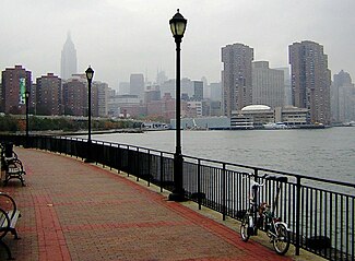
 Looking north from Stuyvesant Cove Park on the East River to Waterside Plaza in Kips Bay on a drizzly day | |
| Coordinates: 40°44′29″N 73°58′42″W / 40.74139°N 73.97833°W | |
| Country | |
| State | |
| County | New York |
| City | New York City |
| Borough | Manhattan |
| Population (2010) | |
| • Total | 83,828 |
| Ethnicity | |
| • White | 82.4% |
| • Asian | 11.6% |
| • Hispanic | 2.7% |
| • Black | 2.2% |
| • Other | 0.3% |
| • Summer (DST) | [[UTCUTC−05:00]] |
| ZIP Codes | 10016 |
Crown Heights | |
|---|---|
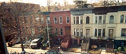
 Typical Crown Heights row houses | |
| Coordinates: 40°39′47″N 73°56′41″W / 40.66306°N 73.94472°W | |
| Country | United States |
| State | New York |
| City | New York City |
| Borough | Brooklyn |
| Area | |
| • Total | 1.418 sq mi (3.67 km2) |
| Population (2016)[3] | |
| • Total | 85,886 |
| • Density | 61,000/sq mi (23,000/km2) |
| Ethnicity | |
| • White | 19.1% |
| • Black | 74.7% |
| • Hispanic | 4.2% |
| • Asian | 2% |
| Economics | |
| • Median income | $45,776 |
| ZIP codes | 11238, 11213, 11216, 11233 |
Midtown Manhattan | |
|---|---|
 The East Side of Midtown Manhattan, showing the terraced crown of the Chrysler Building lit at twilight. | |
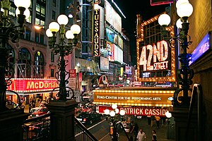
 42nd Street, in the Broadway Theatre District | |
| Country | United States |
| State | New York |
| City | New York City |
| Borough | Manhattan |
| Population (2010) | |
| • Total | 391,371 |
| ZIP Codes | 10001, 10003, 10009, 10010, 10011, 10016, 10017, 10018, 10019, 10020, 10022, 10036 |
| Median household income | $139,796 |
Achievements[edit]
pre 1990[edit]
- July 23, 1980: Michelle Williams is born in Rockford, Illinois.
- Febrauary 11, 1981: Kelly Rowland is born in Atlanta, Georgia.
- March 11, 1981: LaToya Luckett is born in Houston, Texas.
- May 3, 1981: Farrah Franklin is born in Los Angeles, California.
- September 4, 1981: Beyoncé is born in Houston, Texas.

RuPaul's Drag Race winners[edit]
 Jamaica Avenue at Guy R. Brewer Boulevard | |
| Owner | City of New York |
|---|---|
| Maintained by | NYCDOT |
| Length | 4.4 mi (7.1 km)[4] |
| Location | Brooklyn |
| Postal code | 11211 11206 11221 11207 |
| Nearest metro station | Jamaica Line Broadway |
This template's initial visibility currently defaults to autocollapse, meaning that if there is another collapsible item on the page (a navbox, sidebar, or table with the collapsible attribute), it is hidden apart from its title bar; if not, it is fully visible.
To change this template's initial visibility, the |state= parameter may be used:
{{SunriseInBrooklyn|state=collapsed}}will show the template collapsed, i.e. hidden apart from its title bar.{{SunriseInBrooklyn|state=expanded}}will show the template expanded, i.e. fully visible.
| Color | Name | Front | Antenna |
|---|---|---|---|
| Matte Black | Black | Black | |
| Silver | White | Light Grey | |
| Gold | White | White | |
| Rose Gold | White | White | |
| Jet Black | Black | Black |
This timeline lists significant dates in the history of the network. Station names shown are current names; many stations have previously had different names.
| Contents |
|---|
|
1820s 1860s 1890s 1900s 1910s 1920s 1930s 1940s 1950s 1960s 1970s 1980s 1990s 2000s 2010s 2020s |
1820s[edit]
- 1827
- The 12-seat stagecoach "Accommodation" was the first public transportation route established by Abraham Brower. It went up Broadway from the Battery at the southern edge of Manhattan to Greenwich Village. [5]
1860s[edit]
- 1869
==1890s
Notes[edit]
- ^ Cite error: The named reference
aia4was invoked but never defined (see the help page). - ^ "Gilsey House". NYC-Architecture.com. Archived from the original on June 26, 2014. Retrieved 2010-06-06.
- ^ a b "Bedford Stuyvesant neighborhood in New York". Retrieved June 4, 2014.
- ^ Google (February 22, 2017). "SunriseInBrooklyn" (Map). Google Maps. Google. Retrieved February 22, 2017.
- ^ Ormsbree, Brian (December 2004). "100 Years Underground: A Historical Look at the New York City Subway". CooperatorNews.
References[edit]
- Range, Thomas E. (2002). New York City Subways. Arcadia Publishing. ISBN 9780738510866.
| Part of a series of articles on |


