| [2]
|
Landmark name[3]
|
Image
|
Date listed[3]
|
Location[3]
|
Neighborhood
|
Description
|
| 1
|
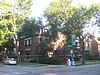
Robert S. Abbott House
|

|
December 8, 1976
|
4742 S. Dr. Martin Luther King Jr. Drive
41°48′36″N 87°36′58″W / 41.81000°N 87.61611°W / 41.81000; -87.61611 (Abbott, Robert S., House)
|
Grand Boulevard
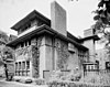
|
Home of Robert S. Abbott, founder of the Chicago Defender newspaper
|
| 2
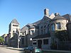
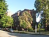
|
Armour Square
|

|
August 19, 2003
|
Bounded by W. 33rd Street, W. 34th Place, S. Wells Street and S. Shields Avenue
41°50′1″N 87°38′2″W / 41.83361°N 87.63389°W / 41.83361; -87.63389 (Armour Square)
|
Armour Square
|
|
| 3
|
AVR 661
|
|
November 19, 1980
|
Calumet Harbor
41°39′43″N 87°34′30″W / 41.66194°N 87.57500°W / 41.66194; -87.57500 (AVR 661)
|
South Deering
|
|
| 4
|
Belmonte Flats
|
|
February 5, 1998
|
4257-4259 S. Dr. Martin Luther King Jr. Drive, and 400-412 E. 43rd Street
41°49′0″N 87°36′17″W / 41.81667°N 87.60472°W / 41.81667; -87.60472 (Belmonte Flats)
|
Grand Boulevard
|
|
| 5
|
Calumet Park
|

|
August 21, 2003
|
9801 S. Avenue G
41°43′0″N 87°31′41″W / 41.71667°N 87.52806°W / 41.71667; -87.52806 (Calumet Park)
|
East Side
|
|
| 6
|
Chicago Beach Hotel
|

|
May 14, 1986
|
5100-5110 S. Cornell Avenue
41°48′8″N 87°35′13″W / 41.80222°N 87.58694°W / 41.80222; -87.58694 (Chicago Beach Hotel)
|
Hyde Park
|
|
| 7
|
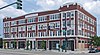
Chicago Bee Building
|

|
April 30, 1986
|
3647-3655 S. State Street
41°49′41″N 87°37′34″W / 41.82806°N 87.62611°W / 41.82806; -87.62611 (Chicago Bee Building)
|
Douglas
|
|
| 8
|
Arthur H. Compton House
|

|
May 11, 1976
|
5637 S. Woodlawn Avenue
41°47′31″N 87°35′47″W / 41.79194°N 87.59639°W / 41.79194; -87.59639 (Compton, Arthur H., House)
|
Hyde Park
|
|
| 9
|
Cornell Square
|
|
August 11, 2005
|
1809 W. 50th Street
41°48′8″N 87°40′16″W / 41.80222°N 87.67111°W / 41.80222; -87.67111 (Cornell Square)
|
New City
|
|
| 10
|
Davis Square
|
|
August 18, 2003
|
Roughlu bounded by W. 44th Street, W, 45th Street, S. Marshfield Avenue and S. Hemitage Avenue
41°48′47″N 87°40′3″W / 41.81306°N 87.66750°W / 41.81306; -87.66750 (Davis Square)
|
New City
|
|
| 11
|
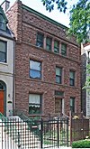
Oscar Stanton De Priest House
|

|
May 15, 1975
|
4536-4538 S. Dr. Martin Luther King, Jr. Drive
41°48′42″N 87°37′5″W / 41.81167°N 87.61806°W / 41.81167; -87.61806 (De Priest, Oscar Stanton, House)
|
Grand Boulevard
|
|
| 12
|
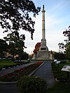
Douglas Tomb State Memorial
|
|
May 28, 1976
|
636 E. 35th Street
41°49′54″N 87°36′30″W / 41.83167°N 87.60833°W / 41.83167; -87.60833 (Douglas Tomb State Memorial)
|
Douglas
|
|
| 13
|
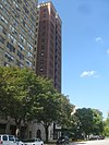
East Park Towers
|

|
May 14, 1986
|
5236-5252 S. Hyde Park Boulevard
41°47′59″N 87°35′4″W / 41.79972°N 87.58444°W / 41.79972; -87.58444 (East Park Towers)
|
Hyde Park
|
|
| 14
|
Eighth Regiment Armory
|

|
April 30, 1986
|
3533 S. Giles Avenue
41°49′50″N 87°37′10″W / 41.83056°N 87.61944°W / 41.83056; -87.61944 (Eighth Regiment Armory)
|
Douglas
|
|
| 15
|
Site of First Self-Sustaining Nuclear Reaction
|
|
October 15, 1966
|
S. Ellis Avenue between E. 56th Street and 57th Street
41°47′33″N 87°36′4″W / 41.79250°N 87.60111°W / 41.79250; -87.60111 (First Self-Sustaining Nuclear Reaction, Site of)
|
Hyde Park
|
|
| 16
|
Flamingo-on-the-Lake Apartments
|
|
May 14, 1986
|
5500-5520 S. Shore Drive
41°47′41″N 87°34′51″W / 41.79472°N 87.58083°W / 41.79472; -87.58083 (Flamingo-On-The-Lake Apartments)
|
Hyde Park
|
|
| 17
|
Four Nineteen Building
|
|
August 12, 1999
|
419 E. 83rd Street
41°44′41″N 87°36′8″W / 41.74472°N 87.60222°W / 41.74472; -87.60222 (Four Nineteen Building)
|
Chatham
|
|
| 18
|
Fuller Park
|
|
November 20, 2002
|
331 W. 45th Street
41°48′46″N 87°38′3″W / 41.81278°N 87.63417°W / 41.81278; -87.63417 (Fuller Park)
|
Fuller Park
|
|
| 19
|
Garden Homes Historic District
|
|
February 28, 2005
|
Roughly bounded by S. Wabash Avenue, E. 87th Street, S. Indiana Avenue and E. 89th Street
41°44′11″N 87°37′18″W / 41.73639°N 87.62167°W / 41.73639; -87.62167 (Garden Homes Historic District)
|
Chatham
|
|
| 20
|
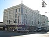
Goldblatt Bros. Department Store
|
|
November 15, 2006
|
4700 S. Ashland Avenue
41°48′30″N 87°39′55″W / 41.80833°N 87.66528°W / 41.80833; -87.66528 (Goldblatt Bros. Department Store)
|
New City
|
|
| 21
|
Grand Crossing Park
|
|
August 8, 2006
|
7655 S. Ingleside Avenue
41°45′25″N 87°36′1″W / 41.75694°N 87.60028°W / 41.75694; -87.60028 (Grand Crossing Park)
|
Greater Grand Crossing
|
|
| 22
|
John W. Griffiths Mansion
|

|
March 5, 1982
|
3806 S. Michigan Avenue
41°49′32″N 87°37′26″W / 41.82556°N 87.62389°W / 41.82556; -87.62389 (Griffiths, John W., Mansion)
|
Douglas
|
|
| 23
|
Hamilton Park
|
|
April 20, 1995
|
513 W. 72nd Street
41°45′42″N 87°38′14″W / 41.76167°N 87.63722°W / 41.76167; -87.63722 (Hamilton Park)
|
Englewood
|
|
| 24
|
Anton E. Hanson House
|
|
February 9, 2006
|
7610 S. Ridgeland Avenue
41°45′31″N 87°34′57″W / 41.75861°N 87.58250°W / 41.75861; -87.58250 (Hanson, Anton, E., House)
|
South Shore
|
|
| 25
|
Isadore H. Heller House
|
|
March 16, 1972
|
5132 S. Woodlawn Avenue
41°48′5″N 87°35′35″W / 41.80139°N 87.59306°W / 41.80139; -87.59306 (Heller, Isadore H., House)
|
Hyde Park
|
|
| 26
|
Charles Hitchcock Hall
|

|
December 30, 1974
|
1009 E. 57th Street
41°47′28″N 87°36′3″W / 41.79111°N 87.60083°W / 41.79111; -87.60083 (Hitchcock, Charles, Hall)
|
Hyde Park
|
|
| 27
|
Hotel Del Prado
|

|
May 14, 1986
|
5307 S. Hyde Park Boulevard
41°47′58″N 87°35′2″W / 41.79944°N 87.58389°W / 41.79944; -87.58389 (Hotel Del Prado)
|
Hyde Park
|
|
| 28
|
Hotel Windermere East
|

|
October 19, 1982
|
1642 E. 56th Street
41°47′35″N 87°35′0″W / 41.79306°N 87.58333°W / 41.79306; -87.58333 (Hotel Windermere East)
|
Hyde Park
|
|
| 29
|
Hyde Park-Kenwood Historic District
|
|
February 14, 1979
|
Roughly bounded by E. 47th Street and E. 59th Street, S. Cottage Grove Avenue and S. Lake Park Avenue; also 821-829 and 816-826 E. 49th Street; also 825-833 and 837-849 E. 52nd Street
41°47′53″N 87°35′51″W / 41.79806°N 87.59750°W / 41.79806; -87.59750 (Hyde Park-Kenwood Historic District)
|
Hyde Park and Kenwood
|
Second and third sets of boundaries represent boundary increases of August 16, 1984 and May 16, 1986 respectively
|
| 30
|
Illinois Institute of Technology Academic Campus
|
|
August 12, 2005
|
Roughly bounded by 31st Street, State Street, 35th Street and the Dan Ryan Expressway
41°50′6″N 87°37′42″W / 41.83500°N 87.62833°W / 41.83500; -87.62833 (Illinois Institute of Technology Academic Campus)
|
Douglas
|
|
| 31
|
Jackson Park Historic Landscape District and Midway Plaisance
|

|
December 15, 1972
|
Jackson and Washington Parks and Midway Plaisance roadway
41°46′48″N 87°34′38″W / 41.78000°N 87.57722°W / 41.78000; -87.57722 (Jackson Park Historic Landscape District and Midway Plaisance)
|
Hyde Park, Washington Park and Woodlawn
|
|
| 32
|
Jackson Shore Apartments
|
|
April 12, 2010
|
5490 S. Shore Drive
41°47′43.80″N 87°34′51.10″W / 41.7955000°N 87.5808611°W / 41.7955000; -87.5808611 (Jackson Shore Apartments)
|
Hyde Park
|
|
| 33
|
Jeffery-Cyril Historic District
|
|
May 5, 1986
|
7146-7148, 7128-7138 S. Cyril Avenue, 7144-7148, 7147 and 7130 S. Jeffrey Boulevard, and 1966-1974 E. 71st Place
41°45′53″N 87°34′36″W / 41.76472°N 87.57667°W / 41.76472; -87.57667 (Jeffery--Cyril Historic District)
|
South Shore
|
|
| 34
|
Kehilath Anshe Ma'ariv Synagogue
|

|
April 26, 1973
|
3301 S. Indiana Avenue
41°50′4″N 87°37′20″W / 41.83444°N 87.62222°W / 41.83444; -87.62222 (Kehilath Anshe Ma'ariv Synagogue)
|
Douglas
|
|
| 35
|
Sydney Kent House
|

|
November 17, 1977
|
2944 S. Michigan Avenue
41°50′26″N 87°37′27″W / 41.84056°N 87.62417°W / 41.84056; -87.62417 (Kent, Sydney, House)
|
Douglas
|
|
| 36
|
Kenwood Evangelical Church
|
|
May 16, 1991
|
4600-4608 S. Greenwood Avenue
41°48′41″N 87°36′0″W / 41.81139°N 87.60000°W / 41.81139; -87.60000 (Kenwood Evangelical Church)
|
Kenwood
|
|
| 37
|
Lake-Side Terrace Apartments
|
|
November 13, 1984
|
7425-7427 S. South Shore Drive
41°45′44″N 87°33′25″W / 41.76222°N 87.55694°W / 41.76222; -87.55694 (Lake-Side Terrace Apartments)
|
South Shore
|
|
| 38
|
Frank R. Lillie House
|
|
May 11, 1976
|
5801 S. Kenwood Avenue
41°47′22″N 87°35′34″W / 41.78944°N 87.59278°W / 41.78944; -87.59278 (Lillie, Frank R., House)
|
Hyde Park
|
|
| 39
|
Mayfair Apartments
|
|
May 14, 1986
|
1650-1666 E. 56th Street
41°47′43″N 87°35′3″W / 41.79528°N 87.58417°W / 41.79528; -87.58417 (Mayfair Apartments)
|
Hyde Park
|
|
| 40
|
Allan Miller House
|
|
August 23, 1991
|
7121 S. Paxton Avenue
41°45′57″N 87°34′16″W / 41.76583°N 87.57111°W / 41.76583; -87.57111 (Miller, Allan, House)
|
South Shore
|
|
| 41
|
Robert A. Millikan House
|
|
May 11, 1976
|
5605 S. Woodlawn Avenue
41°47′34″N 87°35′47″W / 41.79278°N 87.59639°W / 41.79278; -87.59639 (Millikan, Robert A., House)
|
Hyde Park
|
|
| 42
|
The Narragansett
|

|
April 18, 2005
|
1640 E. 50th Street
41°48′16″N 87°35′5″W / 41.80444°N 87.58472°W / 41.80444; -87.58472 (Narragansett, The)
|
Kenwood
|
|
| 43
|
Old Stone Gate of Chicago Union Stockyards
|

|
December 27, 1972
|
W. Exchange Avenue & S. Peoria Street
41°49′7″N 87°38′54″W / 41.81861°N 87.64833°W / 41.81861; -87.64833 (Old Stone Gate of Chicago Union Stockyards)
|
New City
|
|
| 44
|
Overton Hygienic Building
|
|
April 30, 1986
|
3619-3627 S. State Street
41°49′41″N 87°37′34″W / 41.82806°N 87.62611°W / 41.82806; -87.62611 (Overton Hygienic Building)
|
Douglas
|
|
| 45
|
Palmer Park
|
|
August 30, 2007
|
201 E. 111th Street
41°41′33.35″N 87°37′5.62″W / 41.6925972°N 87.6182278°W / 41.6925972; -87.6182278 (Palmer Park)
|
Roseland
|
|
| 46
|
Poinsettia Apartments
|

|
May 14, 1986
|
5528 S. Hyde Park Boulevard
41°47′39″N 87°35′3″W / 41.79417°N 87.58417°W / 41.79417; -87.58417 (Poinsettia Apartments)
|
Hyde Park
|
|
| 47
|
Promontory Apartments
|

|
November 21, 1996
|
5530-5532 S. Shore Drive
41°47′39″N 87°34′51″W / 41.79417°N 87.58083°W / 41.79417; -87.58083 (Promontory Apartments)
|
Hyde Park
|
|
| 48
|
Pullman Historic District
|

|
October 8, 1969
|
Bounded by E. 103rd Street, C.S.S. and S.B. Railroad spur tracks, E. 115th Street and S. Cottage Grove Avenue
41°41′50″N 87°36′34″W / 41.69722°N 87.60944°W / 41.69722; -87.60944 (Pullman Historic District)
|
Pullman
|
|
| 49
|
Ridge Historic District
|
|
May 28, 1976
|
Roughly bounded by RR tracks, W. 87th Street, S. Prospect Avenue, S. Homewood Avenue, W. 115th Street, S. Lothair Avenue, S. Hamilton Avenue, and S. Western Avenue
41°42′36″N 87°40′13″W / 41.71000°N 87.67028°W / 41.71000; -87.67028 (Ridge Historic District)
|
Beverly and Morgan Park
|
|
| 50
|
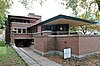
Frederick C. Robie House
|
|
October 15, 1966
|
5757 S. Woodlawn Avenue
41°47′23″N 87°35′45″W / 41.78972°N 87.59583°W / 41.78972; -87.59583 (Robie, Frederick C., House)
|
Hyde Park
|
|
| 51
|
Martin Roche-John Tait House
|
|
November 8, 2000
|
3614 S. Dr. Martin Luther King Jr. Drive
41°49′46″N 87°37′4″W / 41.82944°N 87.61778°W / 41.82944; -87.61778 (Roche, Martin--John Tait House)
|
Douglas
|
|
| 52
|
Robert Roloson Houses
|
|
June 30, 1977
|
3213-3219 S. Calumet Avenue
41°50′8″N 87°37′4″W / 41.83556°N 87.61778°W / 41.83556; -87.61778 (Roloson, Robert, Houses)
|
Douglas
|
|
| 53
|
Room 405, George Herbert Jones Laboratory, The University of Chicago
|
|
May 28, 1967
|
S. Ellis Avenue between E. 57th Street and 58th Street
41°47′25″N 87°36′4″W / 41.79028°N 87.60111°W / 41.79028; -87.60111 (Room 405, George Herbert Jones Laboratory, The University of Chicago)
|
Hyde Park
|
|
| 54
|
Rosenwald Apartment Building
|
|
August 13, 1981
|
4618 - 4646 S. Michigan Avenue
41°48′37″N 87°37′26″W / 41.81028°N 87.62389°W / 41.81028; -87.62389 (Rosenwald Apartment Building)
|
Grand Boulevard
|
|
| 55
|
S.R. Crown Hall
|

|
August 7, 2001
|
3360 S. State Street
41°50′0.9″N 87°37′36.3″W / 41.833583°N 87.626750°W / 41.833583; -87.626750 (S.R. Crown Hall)
|
Douglas
|
|
| 56
|
St. Thomas Church and Convent
|
|
December 18, 1978
|
5472 S. Kimbark Avenue
41°47′44″N 87°35′43″W / 41.79556°N 87.59528°W / 41.79556; -87.59528 (St. Thomas Church and Convent)
|
Hyde Park
|
|
| 57
|
Schulze Baking Company Plant
|

|
November 12, 1982
|
40 E. Garfield Boulevard
41°47′44″N 87°37′29″W / 41.79556°N 87.62472°W / 41.79556; -87.62472 (Schulze Baking Company Plant)
|
Washington Park
|
|
| 58
|
Sherman Park
|
|
May 21, 1990
|
Bounded by W. 52nd Street, S. Racine Avenue, W. Garfield Boulevard, and S. Loomis Street
41°47′48″N 87°39′18″W / 41.79667°N 87.65500°W / 41.79667; -87.65500 (Sherman Park)
|
New City
|
|
| 59
|
Shoreland Hotel
|

|
May 14, 1986
|
5450-5484 S. Shore Drive
41°47′45″N 87°34′52″W / 41.79583°N 87.58111°W / 41.79583; -87.58111 (Shoreland Hotel)
|
Hyde Park
|
|
| 60
|
South Park Manor Historic District
|
|
February 25, 2004
|
Roughly bounded by S. Dr. Martin Luther King Jr. Drive., S. State Street, E. 75th Street and E. 79th Street
41°45′25″N 87°37′9″W / 41.75694°N 87.61917°W / 41.75694; -87.61917 (South Park Manor Historic District)
|
Greater Grand Crossing
|
|
| 61
|
South Shore Beach Apartments
|
|
June 9, 1976
|
7321 S. South Shore Drive
41°45′50″N 87°33′34″W / 41.76389°N 87.55944°W / 41.76389; -87.55944 (South Shore Beach Apartments)
|
South Shore
|
|
| 62
|
South Shore Bungalow Historic District
|
|
December 10, 2008
|
Bounded roughly by S. Crandon Avenue on the East, E. 78th Street on the South, S. Clyde Avenue on the West, E. 75th Street on the North
41°45′12.61″N 87°34′7.18″W / 41.7535028°N 87.5686611°W / 41.7535028; -87.5686611 (South Shore Bungalow Historic District)
|
South Shore
|
|
| 63
|
South Shore Country Club
|

|
March 4, 1975
|
7059 S. South Shore Drive
41°46′11″N 87°33′46″W / 41.76972°N 87.56278°W / 41.76972; -87.56278 (South Shore Country Club)
|
South Shore
|
|
| 64
|
Spiegel Office Building
|
|
February 18, 2009
|
1038 W. 35th Street
41°49′50″N 87°39′9″W / 41.83056°N 87.65250°W / 41.83056; -87.65250 (Spiegel Office Building)
|
Bridgeport
|
|
| 65
|
Swift House
|
|
June 9, 1978
|
4500 S. Michigan Avenue
41°48′47″N 87°37′24″W / 41.81306°N 87.62333°W / 41.81306; -87.62333 (Swift House)
|
Grand Boulevard
|
|
| 66
|
Lorado Taft Midway Studios
|

|
October 15, 1966
|
6016 S. Ingleside Avenue
41°47′8″N 87°36′13″W / 41.78556°N 87.60361°W / 41.78556; -87.60361 (Taft, Lorado, Midway Studios)
|
Woodlawn
|
|
| 67
|
Trumbull Park
|
|
April 20, 1995
|
2400 E. 105th Street
41°42′23″N 87°33′52″W / 41.70639°N 87.56444°W / 41.70639; -87.56444 (Trumbull Park)
|
South Deering
|
|
| 68
|
U-505 (IX C U-Boat)
|

|
June 29, 1989
|
Jackson Park
41°47′31″N 87°34′55″W / 41.79194°N 87.58194°W / 41.79194; -87.58194 (U-505 (IX C U-Boat))
|
Hyde Park
|
|
| 69
|
Unity Hall
|

|
April 30, 1986
|
3140 S. Indiana Avenue
41°50′16″N 87°37′21″W / 41.83778°N 87.62250°W / 41.83778; -87.62250 (Unity Hall)
|
Douglas
|
|
| 70
|
University Apartments
|
|
December 22, 2005
|
1401 and 1451 E. 55th Street;1401 and 1450 E. 55th Place
41°47′50″N 87°35′27″W / 41.79722°N 87.59083°W / 41.79722; -87.59083 (University Apartments)
|
Hyde Park
|
|
| 71
|
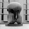
Victory Sculpture
|

|
April 30, 1986
|
E. 35th Street at S. Dr. Martin Luther King Jr. Drive
41°49′52″N 87°37′3″W / 41.83111°N 87.61750°W / 41.83111; -87.61750 (Victory Sculpture)
|
Douglas
|
|
| 72
|
Wabash Avenue YMCA
|

|
April 30, 1986
|
3763 S. Wabash Avenue
41°49′33″N 87°37′29″W / 41.82583°N 87.62472°W / 41.82583; -87.62472 (Wabash Avenue YMCA)
|
Douglas
|
|
| 73
|
Washington Park
|

|
August 20, 2004
|
5531 S. Dr. Martin Luther King Jr. Drive
41°47′45″N 87°36′40″W / 41.79583°N 87.61111°W / 41.79583; -87.61111 (Washington Park)
|
Washington Park
|
|
| 74
|
Ida B. Wells-Barnett House
|

|
May 30, 1974
|
3624 S. Martin Luther King Jr. Drive
41°49′47″N 87°37′3″W / 41.82972°N 87.61750°W / 41.82972; -87.61750 (Wells-Barnett, Ida B., House)
|
Douglas
|
|
| 75
|
West Chatham Bungalow Historic District
|
|
April 19, 2010
|
Bounded roughly by S. Perry Ave (E), 82nd St. (S), S. Stewart Ave. (W), and W. 79th St. (N)
41°44′53.43″N 87°37′50.08″W / 41.7481750°N 87.6305778°W / 41.7481750; -87.6305778 (West Chatham Bungalow Historic District)
|
Chatham
|
|
| 76
|
Dr. Daniel Hale Williams House
|

|
May 15, 1975
|
445 E. 42nd Street
41°49′7″N 87°36′55″W / 41.81861°N 87.61528°W / 41.81861; -87.61528 (Williams, Dr. Daniel Hale, House)
|
Grand Boulevard
|
|
| 77
|
The Yale
|

|
March 5, 1998
|
6565 S. Yale Avenue
41°46′28″N 87°37′53″W / 41.77444°N 87.63139°W / 41.77444; -87.63139 (Yale, The)
|
Englewood
|
|


.jpg)

_and_North_elevations_-_HABS_ILL,16-CHIG,48-1.jpg)


.jpg)


.jpg)


.JPG)


.JPG)

