
User:Huldra/Beit Sakariya
This is a page for collecting data for Beit Sakariya, which was deleted from Talk:Beit Sakariya
Beit Sakariya[edit]
- palgrid=160/118
- Should possibly be called "Khallet Sakarya".
Bibliography[edit]
- Conder, Claude Reignier; Kitchener, H. H. (1883). The Survey of Western Palestine: Memoirs of the Topography, Orography, Hydrography, and Archaeology. Vol. 3. London: Committee of the Palestine Exploration Fund. (p. 108)
- Guérin, Victor (1869). Description Géographique Historique et Archéologique de la Palestine (in French). Vol. 1: Judee, pt. 3. Paris: L'Imprimerie Nationale. (pp. 316-319)
- Palmer, E. H. (1881). The Survey of Western Palestine: Arabic and English Name Lists Collected During the Survey by Lieutenants Conder and Kitchener, R. E. Transliterated and Explained by E.H. Palmer. Committee of the Palestine Exploration Fund. (p. 302)
- Peleg, Yuval; Feller, Yaron (2004-05-31). "Rosh Zurim" (116). Hadashot Arkheologiyot – Excavations and Surveys in Israel.
{{cite journal}}: Cite journal requires|journal=(help) - Pringle, Denys (1993). The Churches of the Crusader Kingdom of Jerusalem: A-K (excluding Acre and Jerusalem). Vol. I. Cambridge University Press. ISBN 0 521 39036 2. (p. 204: “Casale Zacharie,” “like nearby al-Khidr, this was probably a Christian village, but it was granted with al-Khidr to the church of Bethlehem between c. 1155 and c. 1186." )
- Robinson, Edward; Smith, Eli (1856). Later Biblical Researches in Palestine and adjacent regions: A Journal of Travels in the year 1852. London: John Murray. (pp. 283-284)
- Singer, Amy (1994). Palestinian Peasants and Ottoman Officials: Rural Administration Around Sixteenth-Century Jerusalem. Cambridge University Press. ISBN 9780521476799. (p. 165)
- Socin, A. (1879). "Alphabetisches Verzeichniss von Ortschaften des Paschalik Jerusalem". Zeitschrift des Deutschen Palästina-Vereins. 2: 135–163. (p. 148, but no data)
- van de Velde, Carel Willem Meredith (1858). Memoir to Accompany the Map of the Holy Land. Gotha: Justus Perthes. (p. 166)
External links[edit]
- Survey of Western Palestine, Map 17: IAA, Wikimedia commons
- Beit Sakariya Village (Fact Sheet), ARIJ
- Beit Sakariya Village Profile, ARIJ
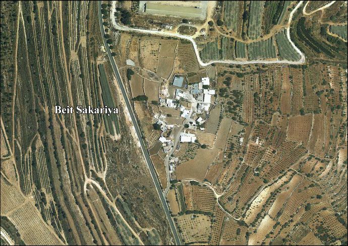
- Beit Sakariya Areal photo, ARIJ
- The priorities and needs for development in Beit Sakariya village based on the community and local authorities’ assessment), ARIJ
- Land Grab continues in Bethlehem District, Posted: 09/03/04, POICA
- Threats of House Demolitions in Beit Sakariya Hamlet, 10/04/2007, POICA
- When Settlers Attack, Thejerusalemfund
| Cities |  | |
|---|---|---|
| Municipalities | ||
| Villages |
| |
| Religion | ||
| Refugee camps | ||
| Other | ||
Contents of the delete talk page[edit]
Sources[edit]
- http://vprofile.arij.org/bethlehem/pdfs/VP/Beit%20Sakariya_vp_en.pdf (broad overview with excellent maps)
- http://population.mongabay.com/population/occupied-palestinian-territory/283124/khallat-sakarya (for alt names to find more sources :
"Alternative names for Khallat Sakāryā, Occupied Palestinian Territory include: Khallat Sakarya,Khallat Sakāryā,Khirbat Bayt Sakariyah,Khirbat Bayt Sakarīyah,Khirbat Bayt Zakariya,Khirbat Bayt Zakarīyā,Khirbat Beit Sakariya,Khirbat Beit Zakariya,khlt skarya,خلة سكاريا"
- http://www.imemc.org/article/71573 (current home demolitions)
- https://books.google.ca/books?id=GJQSAAAAIAAJ&q=beit+zakariya+shrine&dq=beit+zakariya+shrine&hl=en&sa=X&ei=2JpTVePpAYHCUuCTgYAP&ved=0CBsQ6AEwAA (mention of a shrine & herbs offered there)
Miss editing a lot, but time & focus are scant. If people start building this I will pitch up what I can. Tiamuttalk 18:45, 13 May 2015 (UTC)
Also should mention that I'm not sure if Beit Sakariya is more common than Khallet Zakariya (another possible spelling) or if one of the other names above is more prevalent. The news article on the home demolitions alerted me to the fact that there is no article on this village at Wikipedia. Also not sure what its relationship to Az-Zakariyya and Khirbat az-Zakariyya is, if any. Tiamuttalk 18:57, 13 May 2015 (UTC)
- It is in Bethlehem district, pretty sure it is there as the red-linked "Khallet Sakariya"; adding sources below, Huldra (talk) 21:38, 13 May 2015 (UTC)
Is this 116/118? I see Guerin, Judee III, pp. 316-319. And some more in Tsafrir. Zerotalk 01:57, 29 May 2015 (UTC)
- Kh. Beit Skaria on SWP 17 (just S of Nahalin, NE of Khirbet Safa (on SWP 21) (btw, Khirbet Safa is strange: large on SWP 21, tiny in the 1940s maps.)
- SWP III, p. 108, Palmer p. 302
- Kh. Beit Sakaria on 12Hebron.jpg map. Huldra (talk) 22:01, 29 May 2015 (UTC)
More[edit]
The 1942 1:20,000 map at 1617/1189 shows shrine "En Nabi Zakariya" but no other building. However there are substantial village lands with a few other small places. Zerotalk 11:34, 2 November 2015 (UTC)
WBADB sourcebook has: Additional names: Rosh Zurim, En-Nabi Zakariya, Excavators: Yuval Peleg, Yaron Feller ('98-'99), Major Period: Per, Hel, Rom1, Rom2, Byz, Mam. Other periods: IA2c, Med, (Ott); Components: Three Rom1 rock-cut burial caves (excavated); church: columns, capitals, chancel screen; oil press?; modern mosque on church remains; limekiln. Publication: HA-ESI 116 (2004): 56. Zerotalk 11:34, 2 November 2015 (UTC)
Mention, needs checking, Van de Velde, Memoir 1858, p116. Appears as village Beit Zakaria on his Map 7. Zerotalk 11:34, 2 November 2015 (UTC)
Robinson 1852: p283–4. Zerotalk 11:43, 2 November 2015 (UTC)
Clermont Ganneau, Archaeological Researches II, p99. Zerotalk 11:48, 2 November 2015 (UTC)
Singer, Palestinian Peasants, p165. (If you don't have that book I can send it.) Zerotalk 11:51, 2 November 2015 (UTC)
- Thanks for the undelete!
- Clermont-Ganneau, Charles Simon (1896). [ARP] Archaeological Researches in Palestine 1873-1874, translated from the French by J. McFarlane. Vol. 2. London: Palestine Exploration Fund. (p. 99) —> Map 16, between Aqir and Kasla, Jerusalem —> Az-Zakariyya --->Not this place, me thinks, Huldra (talk) 21:37, 2 November 2015 (UTC)