
Township 7, Rooks County, Kansas
Township 7 | |
|---|---|
 Location in Rooks County | |
| Coordinates: 39°21′02″N 99°32′54″W / 39.35056°N 99.54833°W | |
| Country | United States |
| State | Kansas |
| County | Rooks |
| Richland | 1880 est. |
| Elevation | 1,972 ft (601 m) |
| Population (2010) | |
| • Total | 185 |
| Time zone | UTC-6 (CST) |
| GNIS feature ID | 472217[1] |
Township 7 is a township in Rooks County, Kansas, United States. Damar is the largest population center in Township 7.
History[edit]
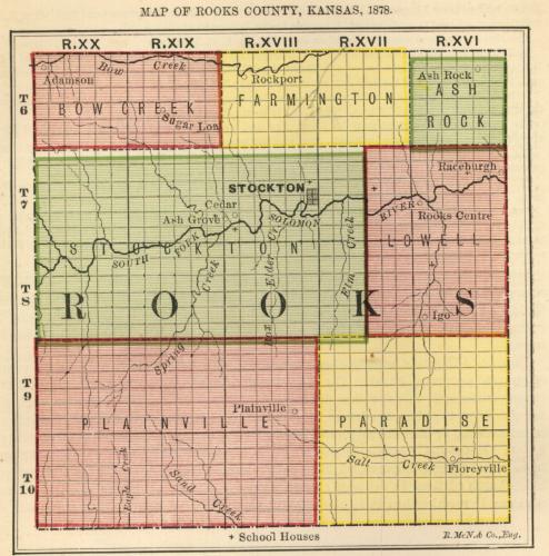
Rooks County was established with four townships: Bow Creek, Lowell, Paradise and Stockton. That number increased to seven by 1878[2] and twenty three in 1925. The twenty three townships were in place until 1971 when the number was reduced to the current twelve townships.[3]
Township 7 was formed by renaming Richland Township[4] in 1971.[5] While other Rooks County townships were combined pursuant to Kansas Statute 80-1110,[6] Richland was just renamed using the new naming standard.
The South Fork Solomon River traverses the township.
Richland Township[edit]
Richland Township was formed in approximately 1880 from part of Stockton Township.[7]
References[edit]
- ^ "US Board on Geographic Names". United States Geological Survey. October 13, 1978. Retrieved January 7, 2018.
- ^ "MAP OF ROOKS COUNTY, KANSAS, 1878". KS Gen Web. Retrieved February 10, 2018.
- ^ "Rooks County Kansas". Kansas Historical Society. Retrieved February 10, 2018.
- ^ "Kansas Civil Townships and Independent Cities". Kansas Historical Society. Retrieved January 7, 2018.
- ^ BOARD OF COUNTY COMMISSIONERS, ROOKS COUNTY KANSAS (January 7, 1971). "LEGAL ADVERTISING". Plainville Times. p. 10.
- ^ "Chapter 80.:-TOWNSHIPS AND TOWNSHIP OFFICERS". Kansas Office of Revisor of Statutes. Retrieved February 10, 2018.
- ^ Vanduvall, Leonard C (November 23, 1961). "A History of Richland Township". Plainville Times. p. 3.
Municipalities and communities of Rooks County, Kansas, United States | ||
|---|---|---|
| Cities | 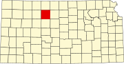 | |
| Unincorporated communities | ||
| Ghost towns | ||
| Townships | ||
| Footnotes | †This community is designated a Census-Designated Place (CDP) by the United States Census Bureau. | |
This article about a location in Rooks County, Kansas is a stub. You can help Wikipedia by expanding it. |