
Schwülper
Schwülper | |
|---|---|
 Coat of arms | |
Location of Schwülper within Gifhorn district  | |
 Schwülper  Schwülper | |
| Coordinates: 52°20′N 10°27′E / 52.333°N 10.450°E | |
| Country | Germany |
| State | Lower Saxony |
| District | Gifhorn |
| Municipal assoc. | Papenteich |
| Subdivisions | 6 |
| Government | |
| • Mayor | Uwe-Peter Lestin (SPD) |
| Area | |
| • Total | 20.89 km2 (8.07 sq mi) |
| Elevation | 64 m (210 ft) |
| Population (2022-12-31)[1] | |
| • Total | 7,395 |
| • Density | 350/km2 (920/sq mi) |
| Time zone | UTC+01:00 (CET) |
| • Summer (DST) | UTC+02:00 (CEST) |
| Postal codes | 38179 |
| Dialling codes | 05303 |
| Vehicle registration | GF |
| Website | www.papenteich.de |
Schwülper is a municipality in the district of Gifhorn, in Lower Saxony, Germany. It is a member municipality of the Samtgemeinde Papenteich. The Municipality Schwülper includes the villages of Groß Schwülper, Hülperode, Klein Schwülper, Lagesbüttel, Rothemühle, and Walle
-
 The Lutheran church in Groß Schwülper
 -
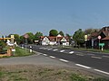 Main street in Hülperode
 -
 Old watermill in Rothemühle
_IMG_6444.jpg)


Municipal Council[edit]
The council of the Municipality Schwülper consists of 20 councilmen and woman:
- Christian Democratic Union 8 mandates
- Social Democratic Party 12 mandates
(Status: community election 10. September 2006 with a voter participation of 57,52%)

References[edit]

| International | |
|---|---|
| National | |
| Geographic | |