
Poleň
Poleň | |
|---|---|
 General view | |
 Flag  Coat of arms | |
 Poleň Location in the Czech Republic | |
| Coordinates: 49°25′30″N 13°10′36″E / 49.42500°N 13.17667°E | |
| Country | |
| Region | Plzeň |
| District | Klatovy |
| First mentioned | 1245 |
| Area | |
| • Total | 17.66 km2 (6.82 sq mi) |
| Elevation | 458 m (1,503 ft) |
| Population (2023-01-01)[1] | |
| • Total | 282 |
| • Density | 16/km2 (41/sq mi) |
| Time zone | UTC+1 (CET) |
| • Summer (DST) | UTC+2 (CEST) |
| Postal code | 339 01 |
| Website | www |
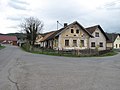
Poleň is a municipality and village in Klatovy District in the Plzeň Region of the Czech Republic. It has about 300 inhabitants. The village of Poleň is well preserved and is protected by law as a village monument zone.
Administrative parts[edit]
The villages of Mlýnec, Poleňka, Pušperk and Zdeslav are administrative parts of Poleň.
Geography[edit]
Poleň is located about 8 km (5 mi) northwest of Klatovy and 37 km (23 mi) southwest of Plzeň. It lies in the Švihov Highlands, in the valley of the Poleňka Stream. The highest point is the peak of Velký Bítov at 713 m (2,339 ft) above sea level, located on the southern municipal border.
History[edit]
The first written mention of Poleň is in a document of Queen Kunigunde of Hohenstaufen from 1245, where Blažej of Poleň is recorded as a witness.[2]
The history of the village was then connected with the Pušperk Castle, which was first mentioned in 1266 and founded shortly before. It was conquered and destroyed before 1434. The castle was repaired between 1465 and 1473, but in 1473 it was demolished again and definitely became a ruin.[3]
Demographics[edit]
|
|
| ||||||||||||||||||||||||||||||||||||||||||||||||||||||
| Source: Censuses[4][5] | ||||||||||||||||||||||||||||||||||||||||||||||||||||||||
Transport[edit]
,_n%C3%A1ves.jpg)
There are no railways or major roads passing through the municipality.
Sights[edit]
The Church of All the Saints dates from the 14th century. It has valuable oil painting of Madonna with Child from the 16th century. Behind the church is the ruin of Church of Saint Margaret, abolished in 1786. Other sacral monuments include the Chapel of Saint Salvador, and the Chapel of Saint John of Nepomuk in Zdeslav.[6]
Notable people[edit]
- Abraham Klauber (1831–1911), American entrepreneur
Gallery[edit]
-
 Crossroads
 -
 Centre of Poleň
 -
 The village of Zdeslav


.jpg)
References[edit]
- ^ "Population of Municipalities – 1 January 2023". Czech Statistical Office. 2023-05-23.
- ^ "Ze života obce" (in Czech). Obec Poleň. Retrieved 2022-01-28.
- ^ "Zřícenina hradu Pušperk" (in Czech). National Heritage Institute. Retrieved 2022-01-28.
- ^ "Historický lexikon obcí České republiky 1869–2011 – Okres Klatovy" (in Czech). Czech Statistical Office. 2015-12-21. pp. 23–24.
- ^ "Population Census 2021: Population by sex". Public Database. Czech Statistical Office. 2021-03-27.
- ^ "Historické zajímavosti" (in Czech). Obec Poleň. Retrieved 2022-01-28.
External links[edit]
| Authority control databases: National |
|---|