
Plymouth, Kansas
Plymouth, Kansas | |
|---|---|
 Old 1882 schoolhouse (2019) | |
 | |
 Plymouth  Plymouth | |
| Coordinates: 38°24′50″N 96°19′56″W / 38.41389°N 96.33222°W[1] | |
| Country | United States |
| State | Kansas |
| County | Lyon |
| Founded | 1850s |
| Platted | 1858 |
| Elevation | 1,165 ft (355 m) |
| Time zone | UTC-6 (CST) |
| • Summer (DST) | UTC-5 (CDT) |
| Area code | 620 |
| FIPS code | 20-56900 |
| GNIS ID | 477277[1] |
Plymouth is an unincorporated community in Lyon County, Kansas, United States.[1] It is located approximately 5 miles west of the city of Emporia along Rd B2.
History[edit]
Plymouth was laid out in 1858.[2] The first school class was taught in 1862, the first school house was built in 1864. The present old school house was built in 1882.[3][4]
Plymouth was a station and shipping point on the Atchison, Topeka and Santa Fe Railway.[5]
A post office was opened in Plymouth in 1858, and remained in operation until it was discontinued in 1930.[6]
Education[edit]
The community is served by Emporia USD 253 public school district.
References[edit]
- ^ a b c d U.S. Geological Survey Geographic Names Information System: Plymouth, Kansas
- ^ French, Laura M. (1929). History of Emporia and Lyon County, Kansas. Heritage Books. p. 132. ISBN 9780788403460.
- ^ "Plymouth School". September 20, 2019.
- ^ "Kansas One Room Schools: Plymouth, Kansas". September 20, 2019.
- ^ Blackmar, Frank Wilson (1912). Kansas: A Cyclopedia of State History, Volume 2. Standard Publishing Company. pp. 484.
- ^ "Kansas Post Offices, 1828-1961". Kansas Historical Society. Retrieved June 10, 2014.
Further reading[edit]
External links[edit]
Municipalities and communities of Lyon County, Kansas, United States | ||
|---|---|---|
| Cities | 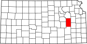 | |
| Unincorporated communities | ||
| Townships | ||
This article about a location in Lyon County, Kansas is a stub. You can help Wikipedia by expanding it. |