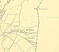
Omrit is situated atop a foothill of Mount Hermon, overlooking Hula Lake. The site is located approximately 2.5 miles (c. 4 km) southwest of Banias, adjacent to a Roman road connecting Scythopolis and Damascus.
According to the first-century historian Josephus, in addition to reconstructing he Second Temple in Jerusalem, Herod built another three temples: one in Caesarea Maritima, one in Sebastia, and one near Banias. Given Omrit's proximity to Banias and the presence of an ancient temple adorned with Corinthian capitals, it is very likely that Omrit is the site of the fourth temple built by Herod.
After a brushfire cleared the area in 1998, archaeological excavations began, being led by Professor Andrew J. Overman of Macalester College, with the assistance of nearby Kfar Szold.[3] The region was well trodden by Roman influence, and thus far excavations have yielded three phases of temple construction approximated at mid 1st century BCE, 20 BCE and 1st century CE. The temple compound, in the center of the hill, was connected to the road by way of a street lined with columns, as was customary in the eastern provinces of the Roman Empire. It continued to be used into the Byzantine period. The remains of shops and installations such as a wine press, were discovered there.[4]
^Hourani, M.M.; Heyda, C.M.; United States Board on Geographic Names; United States. Defense Mapping Agency (1983). Gazetteer of Syria: Names Approved by the United States Board on Geographic Names. Gazetteer (United States Board on Geographic Names). Defense Mapping Agency. p. 72. Retrieved 2022-05-31. 'Amrit, Horbat : see ' Umayrī , Khirbat
J. Andrew Overman, Daniel N. Schowalter (eds.): The Roman Temple Complex at Horvat Omrit: An Interim Report. BAR International Series vol. 2205. Oxford: Archaeopress 2011. 978-1-4073-0763-3
Michael C. Nelson (ed.): The Temple Complex at Horvat Omrit 1: The Architecture. The Brill Reference Library of Judaism vol. 45. Leiden/Boston: Brill 2015. ISBN978-900425063-5


.jpg)

 Horvat Omrit
 Horvat Omrit
 Horvat Omrit's courtyard
 Modern reconstruction of the temple in Omrit, Israel Museum
.jpg)


