Mount Minto (Nunavut)
| Mount Minto | |
|---|---|
| Highest point | |
| Elevation | 213 m (699 ft) |
| Listing | Mountains of Nunavut |
| Coordinates | 63°56′N 80°57′W / 63.933°N 80.950°W[1] |
| Geography | |
| Location | Bell Peninsula, Southampton Island, Nunavut, Canada |
| Topo map | NTC 45P15 Gorden Bay[1] |
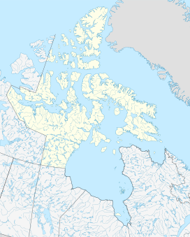
Mount Minto (previously, Conical Hill)[2] is a mountain located on northern Bell Peninsula, Southampton Island, in Kivalliq Region, Nunavut, Canada. From eastward, it has a conical shape.[3]
It is named after Gilbert Elliot-Murray-Kynynmound, 2nd Earl of Minto, first Lord of the Admiralty.[2]
References[edit]
- ^ a b "Mount Minto". Geographical Names Data Base. Natural Resources Canada. Retrieved 2023-08-18.
- ^ a b "Narrative of an expedition in H. M. S. Terror, undertaken with a view to geographical discovery on the Arctic shores, in the years 1836-7". Marine Biological Laboratory Library. Retrieved 2008-10-14.
- ^ Royal Geographical Society (1837). "North-Eastern Shore of Southampton Island". Journal of the Royal Geographical Society of London. 7. J. Murray: 466.

