
Lo-Ghekar Damodarkunda Rural Municipality
Lo-Ghekar Damodarkunda
लो-घेकर दामोदरकुण्ड गाउँपालिका | |
|---|---|
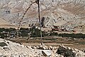
 View from Syangboche La | |
 | |
 Lo-Ghekar Damodarkunda Location in province  Lo-Ghekar Damodarkunda Lo-Ghekar Damodarkunda (Nepal) | |
| Coordinates: 29°5′34″N 83°55′57″E / 29.09278°N 83.93250°E | |
| Country | |
| Province | Gandaki Province |
| District | Mustang |
| Established | 10 March 2017 |
| Government | |
| • Type | Rural council |
| • Body | Dalome Rural Council |
| • Chairperson | Raju Bist (Ind) |
| • Deputy-Chairperson | Dhoka Gurung (NCP) |
| Area | |
| • Total | 1,344 km2 (519 sq mi) |
| • Rank | 7th (Nepal) |
| Population (2011) | |
| • Total | 1,423 |
| • Density | 1.1/km2 (2.7/sq mi) |
| Time zone | UTC+5:45 (Nepal Time) |
| Headquarters | Charang |
| Website | loghekardamodarkundamun |
Lo-Ghekar Damodarkunda (Nepali: लोकेघर दामोदरकुण्ड) (earlier:Dalome) is a rural municipality situated in Mustang District of Gandaki Province of Nepal.[1] The municipality is situated on the northern part of the Mustang, surrounded by Lomanthang rural municipality on the north, Barhagaun Muktichhetra on the south, Manang District on the south-east and Dolpa District on the west, while the north-eastern border of the rural municipality touches the border of Tibet in southwest China.
The total area of the rural municipality is 1,344 square kilometres (519 sq mi) and its population, according to the 2011 Nepal census, was 1423. The rural municipality is divided into 5 wards. The admin center of the rural municipality is at Charang.[2]
Charang, Surkhang and Dhami Village development committees were Incorporated while established this rural municipality.[2] The rural municipality came into existence on 10 March 2017, fulfilling the requirement of the new Constitution of Nepal 2015, Ministry of Federal Affairs and General Administration replaced all old VDCs and Municipalities into 753 new local level bodies.[3][4]
Demographics[edit]
At the time of the 2011 Nepal census, Lo-Ghekar Damodarkunda Rural Municipality had a population of 1,569. Of these, 69.1% spoke Lhopa, 23.1% Gurung, 3.5% Nepali, 1.6% Rai and 2.6% other languages as their first language.[5]
In terms of ethnicity/caste, 40.1% were Lhopa, 30.8% Chhetri, 23.3% Gurung, 1.2% Hill Brahmin, 0.8% Chhantyal, 0.8% Kulung, 0.8% Rai and 2.2% others.[6]
In terms of religion, 65.4% were Buddhist, 33.3% Hindu, 0.8% Kirati, 0.1% Bon, 0.1% Prakriti and 0.4% others.[7]
In terms of literacy, 44.6% could read and write, 2.7% could only read and 52.7% could neither read nor write.[8]
- Dalome
-
 Charang
 -
 Charang Gompa
 -
 Road Tsarang - Ghami
 -
 Ghami
Ghami -
 Ghami wall
 -
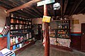 Hotel in Zhaite
 -
 Ghiling gompa
 -
 Syangboche


References[edit]
- ^ "स्थानीय तहहरुको विवरण" [Details of the local level bodies]. www.mofald.gov.np/en (in Nepali). Ministry of Federal Affairs and Local Development. Retrieved 17 July 2018.
- ^ a b "District Corrected Last for RAJAPATRA" (PDF). www.mofald.gov.np. Retrieved 17 July 2018.
- ^ "New local level structure comes into effect from today". www.thehimalayantimes.com. The Himalayan Times. 10 March 2017. Retrieved 17 July 2018.
- ^ "New local level units come into existence". www.kathmandupost.ekantipur.com. 11 March 2017. Retrieved 18 July 2018.
- ^ NepalMap Language
- ^ NepalMap Caste
- ^ NepalMap Religion
- ^ NepalMap Literacy
Headquarters: Jomsom (today part of Gharpajhong Rural Municipality) | ||
| Rural municipalities |  | |