
Draft:Oppidum of Moulay
The oppidum de Moulay or oppidum du Mesnil is an oppidum in the commune of Moulay, in the departement of Mayenne, of the Pays de la Loire region. Excavations took place on the site between 1972 and 1975, when the commune was subdivided. The first rampart was uncovered, suggesting an area of 12 hectares, as well as a certain number of artifacts now exhibited at the Musée archéologique départemental de Jublains. On 26 May 1986 the site was declared a monument historique.[1]
In 2004, roadwork in Moulay and Mayenne uncovered a second rampart 1,200 meters long. The total area of the enclosure is 135 hectares, making it one of the ten largest oppida in France and the largest on the Armorican Massif. An 11 hectare excavation ended in June 2011.[2]
Location[edit]

The site of Moulay favors a settlement: at the confluence of the Mayenne and the Aron rivers, whose rugged valleys outline a trapezoid, it appears to guard the access to a ford over the Mayenne.
First excavations[edit]

The site has long been known as "Camp de César", (Caesar's Camp), although its Gaulish origin was determined in the preliminary excavations carried out when a subdivision was put in between 1972 and 1975, which brought to light a defensive wall of the murus gallicus type surroundimg an area of twelve hectares.[2]
The first rampart[edit]
The first rampart, 370 m long, initially was six meters high and 20 meters wide, preceded by a ditch. To the north, a postern with a dry stone wall three meters thick overlooks the site.[3]
Inside the first wall[edit]
Excavations inside the first wall found little beyond hearths and a few sparse items. Some of these were linked to bronze handicrafts: molds for bracelets and lapilli. Also, a lovely pottery vase decorated with cordons was discovered, of a type known in Armorica, and whose clay came from present-day Lamballe. Apart from the furniture, dated to the end of the Gaulish era, wattle and daub elements have been found.[4]
More than 200 grindstones were discovered 800 meters from the first enclosure, dating from the late La Tène period.
Discovery of the second enclosure[edit]
A diagnostic excavation in 2004 prior to the construction of a detour identified a second rampart 1,000 m from the first, also known as the rempart du Petit Mesnil, a murus gallicus, 2.50 m high.[2] The estimated footprint of the oppidum was revised upward to 135 hectares, and the site seemed related to the barred spur type, with multiple bars.[4]
An important excavation[edit]

A team of 29 archeologists took over. The archeological work at the oppidum were to end in mid-2011.
Two farms were excavated for eight months, beginning in mid-2011.
The second phase of excavations was authorized in part within the framework of the 2008-2009 economic stimulus plan of France.
Excavations[edit]
L'oppidum was without doubt the capital of the Aulerques Diablintes in the 1st and second century BCE. Besides the oppodium wall, two Gaulish farms have been identified, one in Moulay, the other in Aron. The first results of the excavations suggest a densely occupied 80-hectare space,[2] possibly larger, but do not quite prove this hypothesis.
The oppidum is organised orthogonally, into residential neighborhoods and artisanal and religious land uses. The residential enclosures usually consisted of a house and a storehouse, and were delimited by ditches. An artisanal and commercial quarter occupied the centre of the oppidum enclosure.
Water supply points.and a sewer network have been uncovered. The space between the first and second walls may have been caused by an expansion of the settlement in the 1st century BCE.[2] No trace of destruction, violence or sudden abandonment explains the depopulation of this site, in the centre of a territory as large as a modern département, surrounded by secondary centers such as Entrammes and Jublains.
Interpretation[edit]
The dating and function of the first enclosure are difficult to understand, particularly with respect to its relationship to the second; perhaps a matter for future research.[2]
The site was abandoned in the Roman era in favor of Jublains; there is no evidence of violence or a fire. The site was developed in a planned manner, which implies a local élite. Moulay constitutes the largest fortified settlement in the area, according to E. Le Goff. Surrounded by secondary centers, among which may have been Jublains, Moulay also seemed to Le Goff to have been the heart of a powerful political system.[5]
-
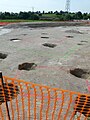 Post holes.
 -
 Reconstitution of a Gaulish dwelling.
 -
 Reconstruction of a Gaulish storehouse.


Notes and references[edit]
- ^ Base Mérimée: Oppidum gaulois (restes), Ministère français de la Culture. (in French)
- ^ a b c d e f L'archéologue -archéologie nouvelle No. 113, April-May 2011, Mayenne. Moulay. Ville gauloise fortifiée, p. 9
- ^ Jacques Naveau, Le chasseur, l'agriculteur et l'artisan (The Hunter, the Farmer and the Artisan), 1998
- ^ a b E. Le Goff, Moulay (Mayenne), ville gauloise fortifiée, p. 43
- ^ E. Le Goff, Moulay (Mayenne), ville gauloise fortifiée, p. 45