Darbandokeh
Darbandokeh
دەربەندۆک | |
|---|---|
| Coordinates: 36°35′00″N 44°18′42″E / 36.58343°N 44.31153°E | |
| Country | Iraq |
| Region | Kurdistan Region |
| Governorate | Erbil |
| District | Shaqlawa |
| Time zone | AST (UTC+3) |
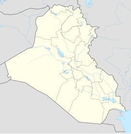
Darbandokeh (Arabic: دربيدونكه,[1] Kurdish: دەربەندۆک)[2][nb 1] is a village in Erbil Governorate in Kurdistan Region, Iraq. It is located in the Shaqlawa District.
In the village, there was a church of Mar Quryaqos.[4]
Etymology[edit]
The name of the village is derived from "enclosed place" in Kurdish.[3]
History[edit]
Darbandokeh was founded in 1928 by Assyrians from the refugee camp at Baqubah in the aftermath of the Assyrian genocide in the First World War, most of whom belonged to the Nochiya clan from Shemsdin in the Hakkari mountains in Turkey.[3][5] By 1938, the village was inhabited by 108 Assyrians in 15 families.[3]
In 1963, amidst the First Iraqi–Kurdish War, Darbandokeh was attacked and its Assyrian population was either killed or expelled by pro-government Kurds, who subsequently resettled the village; the church of Mar Quryaqos was also destroyed.[4]
Notable people[edit]
- Dinkha IV (1935–2015), Catholicos-Patriarch of the Assyrian Church of the East
- Emanuel Kamber (b. 1949), Assyrian-American physicist
References[edit]
Notes
Citations
- ^ "افتخروا لأنكم أشوريين وحافظوا على لغتكم و ثقافتكم و تاريخكم" (in Arabic). 7 April 2015. Retrieved 16 December 2020.
- ^ "گەشتێکی شاخەوانی بۆ گەلی کەڕەک". Rûdaw (in Kurdish). Retrieved 16 December 2020.
- ^ a b c d Donabed (2015), p. 273.
- ^ a b Donabed (2015), p. 276.
- ^ "Population Project". Shlama Foundation. Retrieved 19 August 2021.
Bibliography[edit]
- Donabed, Sargon George (2015). Reforging a Forgotten History: Iraq and the Assyrians in the Twentieth Century. Edinburgh University Press.


