
Alberta Highway 666
Highway 666 | ||||
|---|---|---|---|---|
 | ||||
| Route information | ||||
| Maintained by Alberta Transportation | ||||
| Length | 36.85 km[1] (22.90 mi) | |||
| Major junctions | ||||
| West end | Creek crossing on Range Road 85 | |||
| East end | ||||
| Location | ||||
| Country | Canada | |||
| Province | Alberta | |||
| Specialized and rural municipalities | Municipal District of Greenview No. 16 | |||
| Highway system | ||||
|
| ||||
| ||||

Alberta Provincial Highway No. 666, commonly referred to as Highway 666,[2] is a highway in the province of Alberta, Canada. It runs mostly west-east, on mostly existing township and range roads in the Municipal District of Greenview No. 16 in Northern Alberta, for 37 km.
Route description[edit]
The highway starts on Range Road 85 at a creek crossing, south of this point Weyerhaeuser Canada Corporation maintains a network of forestry roads, extending approximately 100 km (62 mi) south to the Two Lakes Provincial Park and Nose Mountain camping areas, and further to the 30 m (98 ft) high Kakwa Falls on the Kakwa River. Highway 666 travels north east on Township Road 692, Range Road 82, and Township Road 700, to the hamlet of Grovedale. It then follows the south bank of Wapiti River, with O'Brien Provincial Park in between, before meeting up with Highway 40.[1] The Highway 40 bridge over Wapiti River south of Grande Prairie also crosses Highway 666, and with separate northbound and southbound exits to Hwy 666, it makes a Trumpet/Directional-T hybrid.[3]
It is used by Forestry and the Oil and Gas industry working in the area of the Wapiti River valley, as well as for recreational use (two summer campgrounds are open in this wilderness area). It is paved for its entire length.[1]
Major intersections[edit]
Starting from the west end of Highway 666:
| Rural/specialized municipality | Location | km[3] | mi | Destinations | Notes | ||
|---|---|---|---|---|---|---|---|
| Continues as Two Lakes Road towards Two Lakes Provincial Park | |||||||
| M.D. of Greenview No. 16 | | 0 | 0.0 | Creek | Western terminus 54°57′3″N 119°11′44″W / 54.95083°N 119.19556°W | ||
| Grovedale | 29 | 18 | Range Road 64, Township Road 700 | Hwy 666 branches north 55°1′24″N 118°51′55″W / 55.02333°N 118.86528°W | |||
| | 32 | 20 | Road – O'Brien Provincial Park | 55°3′18″N 118°51′27″W / 55.05500°N 118.85750°W | |||
| 36 | 22 | Partially grade separated; eastern terminus 55°4′18″N 118°47′46″W / 55.07167°N 118.79611°W | |||||
| 1.000 mi = 1.609 km; 1.000 km = 0.621 mi | |||||||
Gallery[edit]
-
 Hwy 40 bridge over Wapiti River and Hwy 666 east terminus
 -
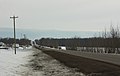 Highway 666 leading to Grovedale, Alberta
 -
 Highway 666 under the Wapiti River bridge.


See also[edit]
References[edit]
- ^ a b c "Provincial Highways 500 - 986 Progress Chart" (PDF). Alberta Transportation. March 2016. Retrieved May 3, 2017.
- ^ Provincial Highways Designation Order, Alberta Transportation, p. 22
- ^ a b Google (May 3, 2017). "Highway 666 in Alberta" (Map). Google Maps. Google. Retrieved May 3, 2017.
External links[edit]
![]() Media related to Alberta Highway 666 at Wikimedia Commons
Media related to Alberta Highway 666 at Wikimedia Commons
This Alberta road, road transport or highway-related article is a stub. You can help Wikipedia by expanding it. |