Čičarovce
This article needs additional citations for verification. (February 2022) |

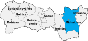
Čičarovce (Slovak pronunciation: [ˈtʂitʂarɔwtse]; Hungarian: Csicser) is a village and municipality in Michalovce District in the Kosice Region of eastern Slovakia.
History[edit]
In historical records the village was first mentioned in 1263.
Geography[edit]
The village lies at an altitude of 106 metres and covers an area of 26.63 km2 (10.28 sq mi) (2020-06-30/-07-01).[1]
Ethnicity[edit]
The population is 93% Magyar and 7% Slovak in ethnicity.
Population[edit]
It has a population of 885 people (2020-12-31).[2]
Economy[edit]
The village has a food store and a general store.
Culture[edit]
The village has a small public library and a football pitch.
Transport[edit]
The nearest railway station is located 3 kilometres away at Veľké Kapušany which also contains many of the government institutions for the village.
Genealogical resources[edit]
The records for genealogical research are available at the state archive "Statny Archiv in Presov, Slovakia"
- Roman Catholic church records (births/marriages/deaths): 1781-1876 (parish A)
- Greek Catholic church records (births/marriages/deaths): 1789-1886 (parish A)
- Reformated church records (births/marriages/deaths): 1771-1856 (parish A)
See also[edit]
References[edit]
- ^ "Statistic of Slovak places by Dušan Kreheľ – Export". Retrieved 2021-07-05.
- ^ "Statistic of Slovak places by Dušan Kreheľ – Export". Retrieved 2021-07-05.
External links[edit]
48°33′N 22°02′E / 48.550°N 22.033°E
