
Portal:World
The World Portal


The world is the totality of entities, the whole of reality, or everything that exists. The nature of the world has been conceptualized differently in different fields. Some conceptions see the world as unique while others talk of a "plurality of worlds". Some treat the world as one simple object while others analyze the world as a complex made up of parts.
In scientific cosmology, the world or universe is commonly defined as "[t]he totality of all space and time; all that is, has been, and will be". Theories of modality talk of possible worlds as complete and consistent ways how things could have been. Phenomenology, starting from the horizon of co-given objects present in the periphery of every experience, defines the world as the biggest horizon or the "horizon of all horizons". In philosophy of mind, the world is contrasted with the mind as that which is represented by the mind. Theology conceptualizes the world in relation to God, for example, as God's creation, as identical to God or as the two being interdependent. In religions, there is a tendency to downgrade the material or sensory world in favor of a spiritual world to be sought through religious practice. A comprehensive representation of the world and our place in it, as is found in religions, is known as a worldview. Cosmogony is the field that studies the origin or creation of the world while eschatology refers to the science or doctrine of the last things or of the end of the world.
In various contexts, the term "world" takes a more restricted meaning associated, for example, with the Earth and all life on it, with humanity as a whole or with an international or intercontinental scope. In this sense, world history refers to the history of humanity as a whole and world politics is the discipline of political science studying issues that transcend nations and continents. Other examples include terms such as "world religion", "world language", "world government", "world war", "world population", "world economy", or "world championship". (Full article...)
Selected articles -
-
 Globalism has multiple meanings. In political science, it is used to describe "attempts to understand all of the interconnections of the modern world—and to highlight patterns that underlie (and explain) them". While primarily associated with world-systems, it can be used to describe other global trends. The concept of globalism is also classically used to focus on ideologies of globalization (the subjective meanings) instead of its processes (the objective practices); in this sense, "globalism" is to globalization what "nationalism" is to nationality.
The term is now frequently used as a pejorative by right wing movements and conspiracy theorists, as in the New World Order; it is sometimes associated with antisemitism, as antisemites frequently appropriate the term globalist to refer to certain Jews. (Full article...) -
Around the World in 80 Days with Michael Palin is a 7-part BBC television travel series first broadcast on BBC1 in 1989. It was presented by comedian and actor Michael Palin. The show was inspired by Jules Verne's classic 1873 novel Around the World in Eighty Days, in which a character named Phileas Fogg accepts a wager to circumnavigate the globe in eighty days or less.
Palin was given the same deadline, and not allowed to use aircraft, which did not exist in Jules Verne's time and would make completing the journey far too easy. He followed Phileas Fogg's route as closely as possible. Along the way he commented on the sights and cultures he encountered. Palin encountered several setbacks during his voyage, partly because he travelled with a five-person film crew, who are collectively named after Passepartout, Phileas Fogg's manservant. (Full article...) -

The supercontinent Pangaea in the early Mesozoic (at 200 Ma)
Pangaea or Pangea (/pænˈdʒiː.ə/) was a supercontinent that existed during the late Paleozoic and early Mesozoic eras. It assembled from the earlier continental units of Gondwana, Euramerica and Siberia during the Carboniferous approximately 335 million years ago, and began to break apart about 200 million years ago, at the end of the Triassic and beginning of the Jurassic. In contrast to the present Earth and its distribution of continental mass, Pangaea was C-shaped, with the bulk of its mass stretching between Earth's northern and southern polar regions and surrounded by the superocean Panthalassa and the Paleo-Tethys and subsequent Tethys Oceans. Pangaea is the most recent supercontinent to have existed and the first to be reconstructed by geologists. (Full article...) -

In world history, post-classical history refers to the period from about 500 CE to 1500 CE, roughly corresponding to the European Middle Ages. The period is characterized by the expansion of civilizations geographically and the development of trade networks between civilizations. This period is also called the medieval era, post-antiquity era, post-ancient era, pre-modernity era, or pre-modern era.
In Asia, the spread of Islam created a series of caliphates and inaugurated the Islamic Golden Age, leading to advances in science in the medieval Islamic world and trade among the Asian, African, and European continents. East Asia experienced the full establishment of the power of Imperial China, which established several prosperous dynasties influencing Japan, Korea, and Vietnam. Religions such as Buddhism and neo-Confucianism spread in the region. Gunpowder was developed in China during the post-classical era. The Mongol Empire connected Europe and Asia, creating safe trade and stability between the two regions. In total, the population of the world doubled in the time period, from approximately 210 million in 500 CE to 461 million in 1500 CE. The population generally grew steadily throughout the period but endured some incidental declines due to events including the Plague of Justinian, the Mongol invasions, and the Black Death. (Full article...) -
The Rugby World Cup is a men's rugby union tournament contested every four years between the top international teams, the winners of which are recognised as the World champions of the sport.
The tournament is administered by World Rugby, the sport's international governing body. The winners are awarded the Webb Ellis Cup, named after William Webb Ellis who, according to a popular legend, invented rugby by picking up the ball during a football game and running with it. (Full article...) -

The Blue Marble, taken by either Ron Evans or Harrison Schmitt of the Apollo 17 crew in 1972. The original photograph was taken with the South Pole facing the top, however this version is the most widely distributed.
The Blue Marble is a photograph of Earth taken on December 7, 1972, from a distance of around 29,400 kilometers (18,300 miles) from the planet's surface.
The original image (NASA designation AS17-148-22727) was taken by either Ron Evans or Harrison Schmitt of the crew of the Apollo 17 spacecraft on its way to the Moon, and showed the Earth with the south pole facing upwards; since then, a cropped and rotated version has become one of the most reproduced images in history. (Full article...) -
"We Are the World" is a charity single originally recorded by the supergroup USA for Africa in 1985. It was written by Michael Jackson and Lionel Richie and produced by Quincy Jones and Michael Omartian for the album We Are the World. With sales in excess of 20 million copies, it is the eighth-best-selling physical single of all time.
Soon after the British group Band Aid released "Do They Know It's Christmas?" in December 1984, the musician and activist Harry Belafonte decided to create an American benefit single for African famine relief. With the fundraiser Ken Kragen, he enlisted several musicians. Jackson and Richie completed the writing the night before the first recording session, on January 21, 1985. The event brought together some of the era's best-known musicians. (Full article...)


General images -
-

-

-
 Chloroplasts in the cells of a moss (from History of Earth)
 -
 Artist's conception of Devonian flora (from History of Earth)
 -
 Japanese depiction of a Portuguese carrack. European maritime innovations led to proto-globalization.
 -
 A view of Earth with different layers of its atmosphere visible: the troposphere with its clouds casting shadows, a band of stratospheric blue sky at the horizon, and a line of green airglow of the lower thermosphere around an altitude of 100 km, at the edge of space (from Earth)
 -
 Earth's history with time-spans of the eons to scale (from History of Earth)
 -
 A composite image of artificial light emissions at night on a map of Earth (from Earth)
 -

-
 Battle during 1281 Mongol invasion of Japan
 -
 "Lucy", the first Australopithecus afarensis skeleton found. Lucy was only 1.06 m (3 ft 6 in) tall.
 -
 Great Mosque of Kairouan, Tunisia, founded 670 CE
 -
 Artist's impression of the enormous collision that probably formed the Moon (from History of Earth)
 -
 Persepolis, Achaemenid Empire, 6th century BCE
 -
 The pale orange dot, an artist's impression of the early Earth which might have appeared orange through its hazy methane rich prebiotic second atmosphere. Earth's atmosphere at this stage was somewhat comparable to today's atmosphere of Titan. (from History of Earth)
 -
 The Pantheon, originally a Roman temple, now a Catholic church
 -
 A 580 million year old fossil of Spriggina floundensi, an animal from the Ediacaran period. Such life forms could have been ancestors to the many new forms that originated in the Cambrian Explosion. (from History of Earth)
 -
 A computer-generated image mapping the prevalence of artificial satellites and space debris around Earth in geosynchronous and low Earth orbit (from Earth)
 -
 Chennakesava Temple, Belur, India
 -
 Artist's conception of Hadean Eon Earth, when it was much hotter and inhospitable to all forms of life. (from History of Earth)
 -
 Artist's impression of Earth during the later Archean, the largely cooled planetary crust and water-rich barren surface, marked by volcanoes and continents, features already round microbialites. The Moon, still orbiting Earth much closer than today and still dominating Earth's sky, produced strong tides. (from History of Earth)
 -
 A composite image of Earth, with its different types of surface discernible: Earth's surface dominating Ocean (blue), Africa with lush (green) to dry (brown) land and Earth's polar ice in the form of Antarctic sea ice (grey) covering the Antarctic or Southern Ocean and the Antarctic ice sheet (white) covering Antarctica. (from Earth)
 -
 Change in average surface air temperature and drivers for that change. Human activity has caused increased temperatures, with natural forces adding some variability. (from Earth)
 -

-
 Satellite time lapse imagery of Earth's rotation showing axis tilt (from Earth)
 -
 Fall of the Berlin Wall, 1989
 -
 Image of the physical world, captured by the Hubble Space Telescope (from World)
 -

-
 Vitruvian Man by Leonardo da Vinci epitomizes the advances in art and science seen during the Renaissance. (from History of Earth)
 -
 An artist's rendering of a protoplanetary disk (from History of Earth)
 -

-
 Great Pyramids of Giza, Egypt
 -
 Earth's night-side upper atmosphere appearing from the bottom as bands of afterglow illuminating the troposphere in orange with silhouettes of clouds, and the stratosphere in white and blue. Next the mesosphere (pink area) extends to the orange and faintly green line of the lowest airglow, at about one hundred kilometers at the edge of space and the lower edge of the thermosphere (invisible). Continuing with green and red bands of aurorae stretching over several hundred kilometers. (from Earth)
 -
Pale orange dot, an artist's impression of Early Earth, featuring its tinted orange methane-rich early atmosphere (from Earth)
-
 Ming dynasty section, Great Wall of China
 -
 Earth's western hemisphere showing topography relative to Earth's center instead of to mean sea level, as in common topographic maps (from Earth)
 -

-
 View of Earth from the Moon by the Lunar Reconnaissance Orbiter (from Earth)
 -
 Shanghai. China urbanized rapidly in the 21st century.
 -

-
 Machu Picchu, Inca Empire, Peru
 -
 Obelisk of Axum, Ethiopia
 -

-
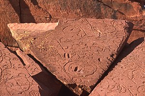
 A pillar at Göbekli Tepe
 -

-
 A 2012 artistic impression of the early Solar System's protoplanetary disk from which Earth and other Solar System bodies were formed (from Earth)
 -
 A banded iron formation from the 3.15 Ga Moodies Group, Barberton Greenstone Belt, South Africa. Red layers represent the times when oxygen was available; gray layers were formed in anoxic circumstances. (from History of Earth)
 -
 Cross-section through a liposome (from History of Earth)
 -
 A reconstruction of Pannotia (550 Ma). (from History of Earth)
 -
 An artist's impression of ice age Earth at glacial maximum. (from History of Earth)
 -
 Tracy Caldwell Dyson, a NASA astronaut, observing Earth from the Cupola module at the International Space Station on 11 September 2010 (from Earth)
 -
 A Benin Bronze head from Nigeria
 -
 A map of heat flow from Earth's interior to the surface of Earth's crust, mostly along the oceanic ridges (from Earth)
 -
 Lithified stromatolites on the shores of Lake Thetis, Western Australia. Archean stromatolites are the first direct fossil traces of life on Earth. (from History of Earth)
 -
 Standing Buddha from Gandhara, 2nd century CE
 -
 Map of peopling of the world (Southern Dispersal paradigm), in thousands of years ago.
 -
 Empires of the world in 1898
 -
 Artist's impression of a Hadean landscape with the relatively newly formed Moon still looming closely over Earth and both bodies sustaining strong volcanism. (from History of Earth)
 -

-
 The replicator in virtually all known life is deoxyribonucleic acid. DNA is far more complex than the original replicator and its replication systems are highly elaborate. (from History of Earth)
 -
 A view of Earth with its global ocean and cloud cover, which dominate Earth's surface and hydrosphere; at Earth's polar regions, its hydrosphere forms larger areas of ice cover. (from Earth)
 -
 Graph showing range of estimated partial pressure of atmospheric oxygen through geologic time (from History of Earth)
 -
 Florence, birthplace of the Italian Renaissance
 -
 Dinosaurs were the dominant terrestrial vertebrates throughout most of the Mesozoic (from History of Earth)
 -
 Pangaea was a supercontinent that existed from about 300 to 180 Ma. The outlines of the modern continents and other landmasses are indicated on this map. (from History of Earth)
 -
 A schematic view of Earth's magnetosphere with solar wind flowing from left to right (from Earth)
 -
 Angkor Wat temple complex, Cambodia, early 12th century
 -
 Tiktaalik, a fish with limb-like fins and a predecessor of tetrapods. Reconstruction from fossils about 375 million years old. (from History of Earth)
 -
 Taj Mahal, Mughal Empire, India
 -

-

-

-
 Artist's rendition of an oxinated fully-frozen Snowball Earth with no remaining liquid surface water. (from History of Earth)
 -
 Geologic map of North America, color-coded by age. From most recent to oldest, age is indicated by yellow, green, blue, and red. The reds and pinks indicate rock from the Archean.
 -
 Olmec colossal head, now at the Museo de Antropología de Xalapa
 -
An artist's impression of the Archean, the eon after Earth's formation, featuring round stromatolites, which are early oxygen-producing forms of life from billions of years ago. After the Late Heavy Bombardment, Earth's crust had cooled, its water-rich barren surface is marked by continents and volcanoes, with the Moon still orbiting Earth half as far as it is today, appearing 2.8 times larger and producing strong tides. (from Earth)
-

-
 Ajloun Castle, Jordan
 -
 Trilobites first appeared during the Cambrian period and were among the most widespread and diverse groups of Paleozoic organisms. (from History of Earth)
 -

-
 Earth's axial tilt causing different angles of seasonal illumination at different orbital positions around the Sun (from Earth)
 -

-

-
 Notre-Dame de Paris, France
 -
 Last Moon landing: Apollo 17 (1972)
 -

-
 A reconstruction of human history based on fossil data. (from History of Earth)
 -
 An animation of the changing density of productive vegetation on land (low in brown; heavy in dark green) and phytoplankton at the ocean surface (low in purple; high in yellow) (from Earth)
 -
 Earth's land use for human agriculture in 2019 (from Earth)
 -
 First airplane, the Wright Flyer, flew on 17 December 1903.
 -

-
 Yggdrasil, an attempt to reconstruct the Norse world tree which connects the heavens, the world, and the underworld. (from World)


.jpg)


.jpg)


.jpeg)


.svg)


.jpg)


Megacities of the world -

Los Angeles, often referred to by its initials L.A., is the most populous city in the U.S. state of California. With roughly 3.9 million residents within the city limits , Los Angeles is the second-most populous city in the United States, behind only New York City; it is also the commercial, financial and cultural center of Southern California. Los Angeles has an ethnically and culturally diverse population, and is the principal city of a metropolitan area of 13.2 million people. Greater Los Angeles, which includes the Los Angeles and Riverside–San Bernardino metropolitan areas, is a sprawling metropolis of over 18 million residents.
The majority of the city proper lies in a basin in Southern California adjacent to the Pacific Ocean in the west and extending partly through the Santa Monica Mountains and north into the San Fernando Valley, with the city bordering the San Gabriel Valley to its east. It covers about 469 square miles (1,210 km2), and is the county seat of Los Angeles County, which is the most populous county in the United States with an estimated 9.86 million residents . It is the fourth-most visited city in the U.S. with over 2.7 million visitors as of 2022. (Full article...)Did you know -

- ... that James B. Tapp was the first United States Army Air Forces pilot to be recognized as a flying ace for flying very-long-range missions over Japan in P-51s during World War II?
- ... that homes in urban areas must have earthquake insurance before being connected to electricity in Turkey?
- ... that the Morowali Industrial Park is the largest center of nickel industry in Indonesia, the world's top nickel producer?
- ... that the 1995 Aigio earthquake caused the strongest ground acceleration ever recorded in Greece?
- ... that almost 40 years into their career, American indie rock band Yo La Tengo released their first self-produced album, This Stupid World, in 2023?
- ... that VMB-611 was the only United States Marine Corps bombing squadron to operate in the Philippines during World War II?
- ... that the Pestalozzi Children's Village in Switzerland was established in 1946 after Walter Corti called for the establishment of a village for orphans of World War II?
- ... that a willow maze in Sussex, England, planted in the shape of a quotation from the Bible in the 1990s, only came to wider notice when it was spotted on Google Earth in 2013?
Countries of the world -

Spain, or the Kingdom of Spain, is a country located in Southwestern Europe, with parts of its territory in the Atlantic Ocean, the Mediterranean Sea and Africa. It is the largest country in Southern Europe and the fourth-most populous European Union member state. Spanning across the majority of the Iberian Peninsula, its territory also includes the Canary Islands in the Atlantic Ocean, the Balearic Islands in the Mediterranean Sea, and the autonomous cities of Ceuta and Melilla in Africa. Peninsular Spain is bordered to the north by France, Andorra, and the Bay of Biscay; to the east and south by the Mediterranean Sea and Gibraltar; and to the west by Portugal and the Atlantic Ocean. Spain's capital and largest city is Madrid, and other major urban areas include Barcelona, Valencia, Zaragoza, Seville, Málaga, Murcia, Palma de Mallorca, Las Palmas de Gran Canaria, and Bilbao.
In early antiquity, the Iberian Peninsula was inhabited by Celtic and Iberian tribes, along with other local pre-Roman peoples. With the Roman conquest of the Iberian Peninsula, the province of Hispania was established. Following the Romanization and Christianization of Hispania, the fall of the Western Roman Empire ushered in the inward migration of tribes from Central Europe, including the Visigoths, who formed the Visigothic Kingdom centred on Toledo. In the early eighth century, most of the peninsula was conquered by the Umayyad Caliphate, and during early Islamic rule, Al-Andalus became a dominant peninsular power centred in Córdoba. Several Christian kingdoms emerged in Northern Iberia, chief among them Asturias, León, Castile, Aragon, Navarre, and Portugal; made an intermittent southward military expansion and repopulation, known as the Reconquista, repelling Islamic rule in Iberia, which culminated with the Christian seizure of the Nasrid Kingdom of Granada in 1492. The dynastic union of the Crown of Castile and the Crown of Aragon in 1479 under the Catholic Monarchs is often considered the de facto unification of Spain as a nation-state. (Full article...)
The Seven Wonders of the Ancient World, also known as the Seven Wonders of the World or simply the Seven Wonders, is a list of seven notable structures present during classical antiquity. The first known list of seven wonders dates back to the 2nd–1st century BC.
While the entries have varied over the centuries, the seven traditional wonders are the Great Pyramid of Giza, the Colossus of Rhodes, the Lighthouse of Alexandria, the Mausoleum at Halicarnassus, the Temple of Artemis, the Statue of Zeus at Olympia, and the Hanging Gardens of Babylon. Using modern-day countries, two of the wonders were located in Greece, two in Turkey, two in Egypt, and one in Iraq. Of the seven wonders, only the Pyramid of Giza, which is also by far the oldest of the wonders, still remains standing, while the others have been destroyed over the centuries. There is scholarly debate over the exact nature of the Hanging Gardens, and there is doubt as to whether they existed at all. (Full article...)Related portals
Protected areas of the world -
-
Protected areas of Ukraine (Ukrainian: охоронні території) are special areas of Ukraine established with the goal of protecting the natural and cultural heritage of the country from excessive changes as a result of human activity. The protection of the areas is the responsibility of the government of Ukraine, specifically the Cabinet of Ministers of Ukraine.
Ukraine has several categories of protected areas of Ukraine and the protected areas include: (Full article...) -

Kejimkujik National Park, Little River
This is a list of protected areas of Nova Scotia. (Full article...) -
The protected areas of Nepal cover mainly forested land and are located at various altitudes in the Terai, in the foothills of the Himalayas and in the mountains, thus encompassing a multitude of landscapes and preserving a vast biodiversity in the Palearctic and Indomalayan realms.
Nepal covers 147,181 km2 (56,827 sq mi) in the central part of the Himalayas. Altitudes range from 67 m (220 ft) in the south-eastern Terai to 8,848 m (29,029 ft) at Mount Everest within a short horizontal span. This extreme altitudinal gradient has resulted in 11 bio-climatic zones ranging from lower tropical below 500 m (1,600 ft) to nival above 5,000 m (16,000 ft) in the High Himalayas, encompassing nine terrestrial ecoregions with 36 vegetation types.
Additionally, nine Ramsar sites were declared between 1988 and 2008. Two wildlife reserves were declared as national parks in 2017. (Full article...) -
Protected areas of Tasmania consist of protected areas located within Tasmania and its immediate onshore waters, including Macquarie Island. It includes areas of crown land (withheld land) managed by Tasmanian Government agencies as well as private reserves. As of 2016, 52% of Tasmania's land area has some form of reservation classification, the majority is managed by the Tasmania Parks & Wildlife Service (about 42% of total Tasmanian land area). Marine protected areas cover about 7.9% of state waters.
Within each classification of reserve there may be a variation of IUCN categories Australia is a signatory to the Convention of Biological Diversity and as such has obligations to report the status of its National Reserve System.IUCN provides on its website a prescription for activities consistent with the categorisation system. Changes made to the Nature Conservation Act 2002 in 2014 permit timber harvesting. These changes made in addition to the already established right to access minerals means that many of the IUCN categorisations assigned to individual reserves in Tasmania are no longer fit for purpose. In addition many reserves have had their reserve status downgraded from a class excluding timber harvesting and mineral extraction to ones where these activities are now permitted. This mis-application of the IUCN protected area categories needs to be remedied or the reserves protected land class under the Nature Conservation Act 2002 should be adjusted to reflect its currently assigned IUCN category. (Full article...) -
The protected areas of Finland include national parks, nature reserves and other areas, with a purpose of conserving areas of all of Finland's ecosystems and biotopes.
Protected areas include:- National parks of Finland (Kansallispuisto/Nationalpark) - 8,170 km2
- Strict nature reserves of Finland (Luonnonpuisto/Naturreservat) - 1,530 km2
- Mire reserves of Finland (Soidensuojelualue/Myrskyddsområde) - 4,490 km2
- Protected herb-rich forest areas (Lehtojensuojelualue/Lundskyddsområde) - 13 km2
- Protected old-growth forest areas (Vanhat metsät/Gamla skogar) - 100 km2
- Grey seal protection areas (Hylkeidensuojelualue/Sälskyddsområde) - 190 km2
- Other protected areas on state-owned land - 468 km2
-
Protected areas of Eswatini include any geographical area protected for a specific use inside the landlocked country of Eswatini, in southern Africa.
Within Eswatini there is a mix of national, private and community-owned protected areas. They include national parks, nature reserves, wildlife sanctuaries and game reserves. (Full article...) -
Protected areas of Sri Lanka are administrated by Department of Forest Conservation and Department of Wildlife Conservation of Sri Lanka.There are 501 protected areas in Sri Lanka. The protected areas that fall under supervision of the Department of Forest Conservation include forests defined in National Heritage Wilderness Area Act in 1988, forest reservations, and forests managed for sustainability. Sinharaja Forest Reserve is an example for a National Heritage forest (it is also a World Heritage Site). There are 32 forests categorized as conservation forests including Knuckles Mountain Range. Strict nature reserves, national parks, nature reserves, forest corridors, and sanctuaries recognized under the Flora and Fauna Protection Ordinance are managed by Department of Wildlife Conservation. Total of all protected areas is 1,767,000 ha. Protected areas in Sri Lanka account for 26.5 percent of the total area. This is a higher percentage of protected areas than in all of Asia and much of the World. (Full article...)
-
The Protected areas of Portugal (Portuguese: Áreas protegidas de Portugal) are classified under a legal protection statute that allows for the adequate protection and maintenance of biodiversity, while providing services for ecosystem that maintains the natural and geological patrimony. (Full article...)
-
Rock carvings at the Ewaninga Rock Carvings Conservation Reserve
The protected areas of the Northern Territory consists of protected areas managed by the governments of the Northern Territory and Australia and private organisations with a reported total area of 335,527 square kilometres (129,548 sq mi) being 24.8% of the total area of the Northern Territory of Australia. (Full article...) -
The following list of protected areas of British Columbia includes all federally and provincially protected areas within the Canadian province of British Columbia. As of 2015, approximately 15.46% of the province's land area and 3.17% of the province's waters are protected. (Full article...)
-

The sun over the Lake Niassa Reserve
Protected areas in Mozambique are known as conservation areas, and are currently grouped into national parks, national reserves, forest reserves, wildlife utilisation areas (coutadas), community conservation areas, and private game farms (fazendas de bravio). There are also a number of areas that have been declared as protected areas under a variety of different legislation, which for reasons of simplicity are here grouped together as "other protected areas." Under the Conservation Law of 2014 (Law 16/2014 of June 20), protected areas will need to be reclassified into a much more flexible series of new categories which are closer to the international system used by the IUCN. International initiatives such as transfrontier parks are grouped at the end of the page. (Full article...) -
The northernmost tip of Prins Karls Forland in Forlandet National Park
Svalbard is an Arctic wilderness archipelago comprising the northernmost part of Norway. There are twenty-nine protected natural areas, consisting of seven national parks, six nature reserves, fifteen bird sanctuaries and one geotope protected area. In addition, human traces dating from before 1946 are automatically protected. The protected areas make up 39,800 square kilometers (15,400 sq mi) or 65% of the land area, and 78,000 square kilometers (30,000 sq mi) or 86.5% of the territorial waters. The largest protected areas are Nordaust-Svalbard Nature Reserve and Søraust-Svalbard Nature Reserve, which cover most of the areas east of the main island of Spitsbergen, including the islands of Nordaustlandet, Edgeøya, Barentsøya, Kong Karls Land and Kvitøya. Six of the national parks are located on Spitsbergen. Ten of the bird sanctuaries and the Moffen Nature Reserve are located within national parks. Five of the bird sanctuaries are Ramsar sites and fourteen of the bird sanctuaries are islands. Svalbard is on Norway's tentative list for nomination as a UNESCO World Heritage Site.
The supreme responsibility for conservation lies with the Norwegian Ministry of the Environment, which has delegated the management to the Governor of Svalbard and the Norwegian Directorate for Nature Management. The foundation for conservation was established in the Svalbard Treaty of 1920, and has been further specified in the Svalbard Environmental Act of 2001. The first round of protection took force on 1 July 1973, when most of the current protected areas came into effect. This included the two large nature reserves and three of the national parks. Moffen Nature Reserve was established in 1983, followed by four national parks, three nature reserves and one geotope protection area between 2002 and 2005. (Full article...) -
Protected areas of the European Union are areas which need and/or receive special protection because of their environmental, cultural or historical value to the member states of the European Union.
(Full article...) -

Tijuca Forest National Park
Protected areas of Brazil included various classes of area according to the National System of Nature Conservation Units (SNUC), a formal, unified system for federal, state and municipal parks created in 2000. (Full article...) -

Overview of IUCN Protected area - WAP (W, Arli, Pendjari) area - Niger, Burkina Faso, and Benin
The following is a list of protected areas of Burkina Faso. (Full article...)


.jpg)


Selected world maps
-
 The world map by Gerardus Mercator (1569), the first map in the well-known Mercator projection
 -
 Index map from the International Map of the World (1:1,000,000 scale)
 -
 Time zones of the world
 -
 United Nations Human Development Index map by country (2016)
 -
 Only a few of the largest large igneous provinces appear (coloured dark purple) on this geological map, which depicts crustal geologic provinces as seen in seismic refraction data
 -
 A plate tectonics map with volcano locations indicated with red circles
 -
 1516 map of the world by Martin Waldseemüller
 -
 The Goode homolosine projection is a pseudocylindrical, equal-area, composite map projection used for world maps.
 -
 Mollweide projection of the world


World records
- List of Olympic records in athletics
- List of world records in athletics
- List of junior world records in athletics
- List of world records in masters athletics
- List of world youth bests in athletics
- List of IPC world records in athletics
- List of world records in canoeing
- List of world records in chess
- List of cycling records
- List of world records in track cycling
- List of world records in finswimming
- List of world records in juggling
- List of world records in rowing
- List of world records in speed skating
- List of world records in swimming
- List of IPC world records in swimming
- List of world records in Olympic weightlifting
Topics

Continents of Earth | ||||||||
|---|---|---|---|---|---|---|---|---|
| ||||||||
| ||||||||
| ||||||||


| Cenozoic Era (present–66.0 Ma) |
| ||||||||||||
|---|---|---|---|---|---|---|---|---|---|---|---|---|---|
| Mesozoic Era (66.0–252 Ma) |
| ||||||||||||
| Paleozoic Era (252–539 Ma) |
| ||||||||||||
| Proterozoic Eon (539 Ma–2.5 Ga) |
| ||||||||||||
| Archean Eon (2.5–4 Ga) | |||||||||||||
| Hadean Eon (4–4.6 Ga) | |||||||||||||
ka = kiloannum (thousands years ago); Ma = megaannum (millions years ago); Ga = gigaannum (billions years ago). See also: Geologic time scale • | |||||||||||||
| Locations | ||
|---|---|---|
| Related | ||

| |||||||||||||||||||
| |||||||||||||||||||
| |||||||||||||||||||

Economic classification of countries | |||||
|---|---|---|---|---|---|
| Three-World Model | |||||
| Gross domestic product (GDP) |
| ||||
| Gross national income (GNI) | |||||
| Wages | |||||
| Wealth | |||||
| Other national accounts | |||||
| Human development | |||||
| Digital divide | |||||
| Net international investment position (NIIP) | |||||
| Technological |
| ||||
|---|---|---|---|---|---|
| Sociological | |||||
| Ecological |
| ||||
| Biological |
| ||||
| Astronomical | |||||
| Eschatological |
| ||||
| Others |
| ||||
| Fictional | |||||
| Organizations | |||||
Categories

Wikimedia
The following Wikimedia Foundation sister projects provide more on this subject:
-
 Commons
Free media repository -
 Wikibooks
Free textbooks and manuals -
 Wikidata
Free knowledge base -
 Wikinews
Free-content news -
 Wikiquote
Collection of quotations -
 Wikisource
Free-content library -
 Wikispecies
Directory of species -
 Wikiversity
Free learning tools -
 Wikivoyage
Free travel guide -
 Wiktionary
Dictionary and thesaurus


