
Portal:World
The World Portal


The world is the totality of entities, the whole of reality, or everything that exists. The nature of the world has been conceptualized differently in different fields. Some conceptions see the world as unique while others talk of a "plurality of worlds". Some treat the world as one simple object while others analyze the world as a complex made up of parts.
In scientific cosmology, the world or universe is commonly defined as "[t]he totality of all space and time; all that is, has been, and will be". Theories of modality talk of possible worlds as complete and consistent ways how things could have been. Phenomenology, starting from the horizon of co-given objects present in the periphery of every experience, defines the world as the biggest horizon or the "horizon of all horizons". In philosophy of mind, the world is contrasted with the mind as that which is represented by the mind. Theology conceptualizes the world in relation to God, for example, as God's creation, as identical to God or as the two being interdependent. In religions, there is a tendency to downgrade the material or sensory world in favor of a spiritual world to be sought through religious practice. A comprehensive representation of the world and our place in it, as is found in religions, is known as a worldview. Cosmogony is the field that studies the origin or creation of the world while eschatology refers to the science or doctrine of the last things or of the end of the world.
In various contexts, the term "world" takes a more restricted meaning associated, for example, with the Earth and all life on it, with humanity as a whole or with an international or intercontinental scope. In this sense, world history refers to the history of humanity as a whole and world politics is the discipline of political science studying issues that transcend nations and continents. Other examples include terms such as "world religion", "world language", "world government", "world war", "world population", "world economy", or "world championship". (Full article...)
Selected articles -
-
 The International Monetary Fund (IMF) is a major financial agency of the United Nations, and an international financial institution funded by 190 member countries, with headquarters in Washington, D.C. It is regarded as the global lender of last resort to national governments, and a leading supporter of exchange-rate stability. Its stated mission is "working to foster global monetary cooperation, secure financial stability, facilitate international trade, promote high employment and sustainable economic growth, and reduce poverty around the world."
Established in July 1944 at the Bretton Woods Conference, primarily according to the ideas of Harry Dexter White and John Maynard Keynes, it started with 29 member countries and the goal of reconstructing the international monetary system after World War II. It now plays a central role in the management of balance of payments difficulties and international financial crises. Through a quota system, countries contribute funds to a pool from which countries can borrow if they experience balance of payments problems. The IMF works to stabilize and foster the economies of its member countries by its use of the fund, as well as other activities such as gathering and analyzing economic statistics and surveillance of its members' economies. (Full article...) -

Unemployed people lined up outside a soup kitchen in Chicago.
The Great Depression (1929–1939) was a severe global economic downturn that affected many countries across the world. It became evident after a sharp decline in stock prices in the United States, leading to a period of economic depression. The economic contagion began around September 1929 and led to the Wall Street stock market crash of 24 October (Black Thursday). This crisis marked the start of a prolonged period of economic hardship characterized by high unemployment rates and widespread business failures.
Between 1929 and 1932, worldwide gross domestic product (GDP) fell by an estimated 15%. By comparison, worldwide GDP fell by less than 1% from 2008 to 2009 during the Great Recession. Some economies started to recover by the mid-1930s. However, in many countries,[specify] the negative effects of the Great Depression lasted until the beginning of World War II. Devastating effects were seen in both rich and poor countries with falling personal income, prices, tax revenues, and profits. International trade fell by more than 50%, unemployment in the U.S. rose to 23% and in some countries rose as high as 33%. Cities around the world were hit hard, especially those dependent on heavy industry. Construction was virtually halted in many countries. Farming communities and rural areas suffered as crop prices fell by about 60%. Faced with plummeting demand and few job alternatives, areas dependent on primary sector industries suffered the most. (Full article...) -
Countries with World Heritage Sites in danger. Number of sites indicated by colour: - Six or more sites
- Five sites
- Four sites
- Three sites
- Two sites
- One site
The List of World Heritage in Danger is compiled by the United Nations Educational, Scientific and Cultural Organization (UNESCO) through the World Heritage Committee according to Article 11.4 of the World Heritage Convention, which was established in 1972 to designate and manage World Heritage Sites. Entries in the list are threatened World Heritage Sites for the conservation of which major operations are required and for which "assistance has been requested". The list is intended to increase international awareness of the threats and to encourage counteractive measures. Threats to a site can be either proven imminent threats or potential dangers that could have adverse effects on a site.
In the case of natural sites, ascertained dangers include the serious decline in the population of an endangered or other valuable species or the deterioration of natural beauty or scientific value of a property caused by human activities such as logging, pollution, settlement, mining, agriculture and major public works. Ascertained dangers for cultural properties include serious deterioration of materials, structure, ornaments or architectural coherence and the loss of historical authenticity or cultural significance. Potential dangers for both cultural and natural sites include development projects, armed conflicts, insufficient management systems or changes in the legal protective status of the properties. In the case of cultural sites, gradual changes due to geology, climate or environment can also be potential dangers. (Full article...) -
Proto-globalization or early modern globalization is a period of the history of globalization roughly spanning the years between 1600 and 1800, following the period of archaic globalization. First introduced by historians A. G. Hopkins and Christopher Bayly, the term describes the phase of increasing trade links and cultural exchange that characterized the period immediately preceding the advent of so-called "modern globalization" in the 19th century.
Proto-globalization distinguished itself from modern globalization on the basis of expansionism, the method of managing global trade, and the level of information exchange. The period is marked by the shift of hegemony to Western Europe, the rise of larger-scale conflicts between powerful nations such as the Thirty Years' War, and demand for commodities, most particularly slaves. The triangular trade made it possible for Europe to take advantage of resources within the western hemisphere. The transfer of plant and animal crops and epidemic diseases associated with Alfred Crosby's concept of the Columbian exchange also played a central role in this process. Proto-globalization trade and communications involved a vast group including European, Middle Eastern, Indian, Southeast Asian, and Chinese merchants, particularly in the Indian Ocean region. (Full article...) -
The modern Olympic Games or Olympics (French: Jeux olympiques) are the leading international sporting events featuring summer and winter sports competitions in which thousands of athletes from around the world participate in a variety of competitions. The Olympic Games are considered the world's foremost sports competition with more than 200 teams, representing sovereign states and territories participating; by default the Games generally substitute for any World Championships the year in which they take place (however, each class usually maintains their own records). The Olympic Games are held every four years; since 1994, they have been alternated between the Summer and Winter Olympics every two years during the four-year period.
Their creation was inspired by the ancient Olympic Games, held in Olympia, Greece from the 8th century BC to the 4th century AD. Baron Pierre de Coubertin founded the International Olympic Committee (IOC) in 1894, leading to the first modern Games in Athens in 1896. The IOC is the governing body of the Olympic Movement, which encompasses all entities and individuals involved in the Olympic Games. The Olympic Charter defines their structure and authority. (Full article...) -
The Cricket World Cup (officially known as ICC Men's Cricket World Cup) is the international championship of One Day International (ODI) cricket. The event is organised by the sport's governing body, the International Cricket Council (ICC), every four years, with preliminary qualification rounds leading up to a finals tournament. The tournament is one of the world's most viewed sporting events and considered as the "flagship event of the international cricket calendar" by the ICC. It is widely considered the pinnacle championship of the sport of cricket.
The first World Cup was organised in England in June 1975, with the first ODI cricket match having been played only four years earlier. However, a separate Women's Cricket World Cup had been held two years before the first men's tournament, and a tournament involving multiple international teams had been held as early as 1912, when a triangular tournament of Test matches was played between Australia, England and South Africa. The first three World Cups were held in England. From the 1987 tournament onwards, hosting has been shared between countries under an unofficial rotation system, with fourteen ICC members having hosted at least one match in the tournament. (Full article...) -
Global mass surveillance can be defined as the mass surveillance of entire populations across national borders.
Its existence was not widely acknowledged by governments and the mainstream media until the global surveillance disclosures by Edward Snowden triggered a debate about the right to privacy in the Digital Age. One such debate is the balance which governments must acknowledge between the pursuit of national security and counter-terrorism over a right to privacy. Although, to quote H. Akın Ünver "Even when conducted for national security and counterterrorism purposes, the scale and detail of mass citizen data collected, leads to rightfully pessimistic observations about individual freedoms and privacy". (Full article...)


General images -
-
 A reconstruction of Pannotia (550 Ma). (from History of Earth)
 -
 Geologic map of North America, color-coded by age. From most recent to oldest, age is indicated by yellow, green, blue, and red. The reds and pinks indicate rock from the Archean.
 -
 Artist's impression of Earth during the later Archean, the largely cooled planetary crust and water-rich barren surface, marked by volcanoes and continents, features already round microbialites. The Moon, still orbiting Earth much closer than today and still dominating Earth's sky, produced strong tides. (from History of Earth)
 -
 A reconstruction of human history based on fossil data. (from History of Earth)
 -
 A view of Earth with different layers of its atmosphere visible: the troposphere with its clouds casting shadows, a band of stratospheric blue sky at the horizon, and a line of green airglow of the lower thermosphere around an altitude of 100 km, at the edge of space (from Earth)
 -
 Map of peopling of the world (Southern Dispersal paradigm), in thousands of years ago.
 -
 Persepolis, Achaemenid Empire, 6th century BCE
 -
 Tracy Caldwell Dyson, a NASA astronaut, observing Earth from the Cupola module at the International Space Station on 11 September 2010 (from Earth)
 -

-

-
 Graph showing range of estimated partial pressure of atmospheric oxygen through geologic time (from History of Earth)
 -
 Satellite time lapse imagery of Earth's rotation showing axis tilt (from Earth)
 -
 Notre-Dame de Paris, France
 -
 Earth's western hemisphere showing topography relative to Earth's center instead of to mean sea level, as in common topographic maps (from Earth)
 -

-
 Dinosaurs were the dominant terrestrial vertebrates throughout most of the Mesozoic (from History of Earth)
 -
 Angkor Wat temple complex, Cambodia, early 12th century
 -
 Tiktaalik, a fish with limb-like fins and a predecessor of tetrapods. Reconstruction from fossils about 375 million years old. (from History of Earth)
 -

-
 A schematic view of Earth's magnetosphere with solar wind flowing from left to right (from Earth)
 -

-
 Olmec colossal head, now at the Museo de Antropología de Xalapa
 -

-
 Battle during 1281 Mongol invasion of Japan
 -
 Japanese depiction of a Portuguese carrack. European maritime innovations led to proto-globalization.
 -
 Ming dynasty section, Great Wall of China
 -
 View of Earth from the Moon by the Lunar Reconnaissance Orbiter (from Earth)
 -
 Artist's impression of the enormous collision that probably formed the Moon (from History of Earth)
 -
 Earth's axial tilt causing different angles of seasonal illumination at different orbital positions around the Sun (from Earth)
 -
 Lithified stromatolites on the shores of Lake Thetis, Western Australia. Archean stromatolites are the first direct fossil traces of life on Earth. (from History of Earth)
 -
 An animation of the changing density of productive vegetation on land (low in brown; heavy in dark green) and phytoplankton at the ocean surface (low in purple; high in yellow) (from Earth)
 -
 The Pantheon, originally a Roman temple, now a Catholic church
 -
 Artist's conception of Devonian flora (from History of Earth)
 -
 A banded iron formation from the 3.15 Ga Moodies Group, Barberton Greenstone Belt, South Africa. Red layers represent the times when oxygen was available; gray layers were formed in anoxic circumstances. (from History of Earth)
 -

-
 Great Pyramids of Giza, Egypt
 -
 An artist's impression of ice age Earth at glacial maximum. (from History of Earth)
 -

-
 Artist's conception of Hadean Eon Earth, when it was much hotter and inhospitable to all forms of life. (from History of Earth)
 -

-
 First airplane, the Wright Flyer, flew on 17 December 1903.
 -
 Vitruvian Man by Leonardo da Vinci epitomizes the advances in art and science seen during the Renaissance. (from History of Earth)
 -

-
 Great Mosque of Kairouan, Tunisia, founded 670 CE
 -

-
 The replicator in virtually all known life is deoxyribonucleic acid. DNA is far more complex than the original replicator and its replication systems are highly elaborate. (from History of Earth)
 -

-
 Earth's night-side upper atmosphere appearing from the bottom as bands of afterglow illuminating the troposphere in orange with silhouettes of clouds, and the stratosphere in white and blue. Next the mesosphere (pink area) extends to the orange and faintly green line of the lowest airglow, at about one hundred kilometers at the edge of space and the lower edge of the thermosphere (invisible). Continuing with green and red bands of aurorae stretching over several hundred kilometers. (from Earth)
 -
 A view of Earth with its global ocean and cloud cover, which dominate Earth's surface and hydrosphere; at Earth's polar regions, its hydrosphere forms larger areas of ice cover. (from Earth)
 -
 Earth's history with time-spans of the eons to scale (from History of Earth)
 -
 A composite image of artificial light emissions at night on a map of Earth (from Earth)
 -

-

-
 The pale orange dot, an artist's impression of the early Earth which might have appeared orange through its hazy methane rich prebiotic second atmosphere. Earth's atmosphere at this stage was somewhat comparable to today's atmosphere of Titan. (from History of Earth)
 -
 Cross-section through a liposome (from History of Earth)
 -
 A computer-generated image mapping the prevalence of artificial satellites and space debris around Earth in geosynchronous and low Earth orbit (from Earth)
 -

-

-
 Trilobites first appeared during the Cambrian period and were among the most widespread and diverse groups of Paleozoic organisms. (from History of Earth)
 -
 A composite image of Earth, with its different types of surface discernible: Earth's surface dominating Ocean (blue), Africa with lush (green) to dry (brown) land and Earth's polar ice in the form of Antarctic sea ice (grey) covering the Antarctic or Southern Ocean and the Antarctic ice sheet (white) covering Antarctica. (from Earth)
 -
 Machu Picchu, Inca Empire, Peru
 -
 A map of heat flow from Earth's interior to the surface of Earth's crust, mostly along the oceanic ridges (from Earth)
 -

-
 Artist's rendition of an oxinated fully-frozen Snowball Earth with no remaining liquid surface water. (from History of Earth)
 -
 A 580 million year old fossil of Spriggina floundensi, an animal from the Ediacaran period. Such life forms could have been ancestors to the many new forms that originated in the Cambrian Explosion. (from History of Earth)
 -
 Shanghai. China urbanized rapidly in the 21st century.
 -
 "Lucy", the first Australopithecus afarensis skeleton found. Lucy was only 1.06 m (3 ft 6 in) tall.
 -
 Yggdrasil, an attempt to reconstruct the Norse world tree which connects the heavens, the world, and the underworld. (from World)
 -
Pale orange dot, an artist's impression of Early Earth, featuring its tinted orange methane-rich early atmosphere (from Earth)
-
 Image of the physical world, captured by the Hubble Space Telescope (from World)
 -

-
 Fall of the Berlin Wall, 1989
 -
 A Benin Bronze head from Nigeria
 -

-
 Standing Buddha from Gandhara, 2nd century CE
 -
 Last Moon landing: Apollo 17 (1972)
 -
 Chloroplasts in the cells of a moss (from History of Earth)
 -
An artist's impression of the Archean, the eon after Earth's formation, featuring round stromatolites, which are early oxygen-producing forms of life from billions of years ago. After the Late Heavy Bombardment, Earth's crust had cooled, its water-rich barren surface is marked by continents and volcanoes, with the Moon still orbiting Earth half as far as it is today, appearing 2.8 times larger and producing strong tides. (from Earth)
-
 Empires of the world in 1898
 -
 A pillar at Göbekli Tepe
 -
 Chennakesava Temple, Belur, India
 -
 Obelisk of Axum, Ethiopia
 -
 Change in average surface air temperature and drivers for that change. Human activity has caused increased temperatures, with natural forces adding some variability. (from Earth)
 -
 Artist's impression of a Hadean landscape with the relatively newly formed Moon still looming closely over Earth and both bodies sustaining strong volcanism. (from History of Earth)
 -
 Pangaea was a supercontinent that existed from about 300 to 180 Ma. The outlines of the modern continents and other landmasses are indicated on this map. (from History of Earth)
 -
 Florence, birthplace of the Italian Renaissance
 -
 Ajloun Castle, Jordan
 -
 Taj Mahal, Mughal Empire, India
 -

-
 A 2012 artistic impression of the early Solar System's protoplanetary disk from which Earth and other Solar System bodies were formed (from Earth)
 -
 Earth's land use for human agriculture in 2019 (from Earth)
 -
 An artist's rendering of a protoplanetary disk (from History of Earth)


.svg)
.jpg)
.jpg)


.jpg)


.jpeg)


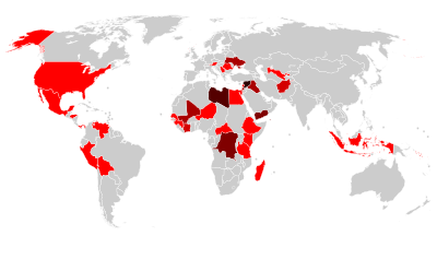
Megacities of the world -
Hyderabad (/ˈhaɪdərəbæd/ ⓘ HY-dər-ə-bad; Telugu: [ˈɦaɪ̯daraːbaːd], Urdu: [ˈɦɛːdəɾaːbaːd]) is the capital and largest city of the Indian state of Telangana. It occupies 650 km2 (250 sq mi) on the Deccan Plateau along the banks of the Musi River, in the northern part of Southern India. With an average altitude of 542 m (1,778 ft), much of Hyderabad is situated on hilly terrain around artificial lakes, including the Hussain Sagar lake, predating the city's founding, in the north of the city centre. According to the 2011 census of India, Hyderabad is the fourth-most populous city in India with a population of 6.9 million residents within the city limits, and has a population of 9.7 million residents in the metropolitan region, making it the sixth-most populous metropolitan area in India. With an output of US$74 billion, Hyderabad has the fifth-largest urban economy in India.
The Qutb Shahi dynasty's Muhammad Quli Qutb Shah established Hyderabad in 1591 to extend the capital beyond the fortified Golconda. In 1687, the city was annexed by the Mughals. In 1724, Asaf Jah I, the Mughal viceroy, declared his sovereignty and founded the Asaf Jahi dynasty, also known as the Nizams. Hyderabad served as the imperial capital of the Asaf Jahis from 1769 to 1948. As capital of the princely state of Hyderabad, the city housed the British Residency and cantonment until Indian independence in 1947. Hyderabad was annexed by the Indian Union in 1948 and continued as a capital of Hyderabad State from 1948 to 1956. After the introduction of the States Reorganisation Act of 1956, Hyderabad was made the capital of the newly formed Andhra Pradesh. In 2014, Andhra Pradesh was split to form the state of Telangana, and Hyderabad became the joint capital of the two states with a transitional arrangement scheduled to end in 2024. Since 1956, the city has housed the Rashtrapati Nilayam, the winter office of the president of India. (Full article...)Did you know -

- ... that "Look at the world" is a 1996 choral harvest anthem with text and music by John Rutter, written for CPRE "on the theme of the environment and our responsibility towards it"?
- ... that Lake Bell made her directorial debut, In a World..., after no one else would direct it?
- ... that British Turk Hüseyin Er won world and European championships with the Turkey national deaf football team?
- ... that according to its founders, Pink Peacock is the only "queer Yiddish anarchist vegan pay-what-you-can cafe" in the world?
- ... that Arti Rana was the president of the self-help group Tharu Hath KargaGharelu Udyog when it received assistance from the World Wide Fund for Nature to make its looms more efficient?
- ... that Dane Hansen started a road-construction business with about 100 mules that he was unable to sell to the US Army after World War I ended?
- ... that since 1977, a world constitution has existed alongside a Provisional World Parliament?
- ... that the visual design of Overwatch character Widowmaker was inspired by World of Warcraft character Sylvanas Windrunner?
Countries of the world -

Senegal, officially the Republic of Senegal, is the westernmost country in West Africa, situated on the Atlantic Ocean coastline. Senegal is bordered by Mauritania to the north, Mali to the east, Guinea to the southeast and Guinea-Bissau to the southwest. Senegal nearly surrounds The Gambia, a country occupying a narrow sliver of land along the banks of the Gambia River, which separates Senegal's southern region of Casamance from the rest of the country. Senegal also shares a maritime border with Cape Verde. Senegal's economic and political capital is Dakar.
Senegal is the westernmost country in the mainland of the Old World, or Afro-Eurasia. It owes its name to the Senegal River, which borders it to the east and north. The climate is typically Sahelian, though there is a rainy season. Senegal covers a land area of almost 197,000 square kilometres (76,000 sq mi) and has a population of around 18 million.0 The state is a unitary presidential republic; since the country's foundation in 1960, it has been recognized as one of the most stable countries on the African continent. On the 2023 V-Dem Democracy Indices, Senegal is ranked 52nd in electoral democracy worldwide and 4th in electoral democracy in Africa. (Full article...)
Related portals
Protected areas of the world -
-
Queensland is the second largest state in Australia. As at 2020, it contained more than 1000 protected areas. In August 2023, it was estimated a total of 14.5 million hectares or 8.38% of Queensland's landmass was protected. (Full article...)
-
The Protected areas of Kyrgyzstan are regulated by the law on specially protected natural areas of 2 May 2011, last modified on 2 June 2018. In total, they cover 14,761.216 km2 (5,699.337 sq mi) and account for 7.38% of the country's total area (as of 2017). The first protected area in Kyrgyzstan (Issyk-Kul) was established in 1948. According to the Government Decree on Priorities of Conservation of Biological Diversity and the relevant Action Plan for 2014-2024 the target area for the protected areas in Kyrgyzstan is 10 percent of the country’s area by 2024.
The protected areas are subdivided into seven categories: (Full article...) -

A view at Kintrishi National Park
The South Caucasian nation of Georgia is home to several protected areas, which receive protection because of their environmental, cultural or similar value. The oldest of these – now known as the Lagodekhi Protected Areas – dates back to 1912, when Georgia was part of the Russian Empire.
The total area of Georgia's protected terrestrial territories is 6,501 km2 (2,510 sq mi), which amounts to approximately 9.29% of the country's territory. In addition 153 km2 (59 sq mi) of marine area protected, or 0.67% of the country's territorial waters. There are a total of 89 protected areas, including 14 Strict Nature Reserves, 12 National Parks, 20 Managed Nature Reserves, 40 Natural Monuments, 2 Ramsar sites and 1 Protected Landscape. Strict nature reserves comprise 140,672 ha, while national parks cover 276,724 ha. The total number of visitors to Georgia's protected areas was just under 1.2 million in 2019. (Full article...) -
The following list of protected areas of British Columbia includes all federally and provincially protected areas within the Canadian province of British Columbia. As of 2015, approximately 15.46% of the province's land area and 3.17% of the province's waters are protected. (Full article...)
-

The protected areas of Bhutan are its national parks, nature preserves, and wildlife sanctuaries. Most of these protected areas were first set aside in the 1960s, originally covering most of the northern and southern regions of Bhutan. Today, protected areas cover more than 42% of the kingdom, mostly in the northern regions. Protected areas also line most of Bhutan's international borders with China and India. (Full article...) -
This is a list of protected areas of Romania.
About 5.18% of the area of Romania has a protected status (12,360 km2), including the Danube Delta, which makes half of these areas (2.43% of Romania's area). (Full article...) -
Protected areas of Turkmenistan include nine nature reserves (zapovednik) and 13 sanctuaries (zakaznik) with a total area of 19,750 km2 or more than 4% of Turkmenistan's territory. (Full article...)
-
This is a list of protected areas of Cambodia.
A total of 8 forms of protected area are recognized under the Cambodian Protected Area Law of 2008. These are: (Full article...) -

Kejimkujik National Park, Little River
This is a list of protected areas of Nova Scotia. (Full article...) -
This is a list of the nationally designated protected areas of China. There are many forms of protected areas in China. Based on their relative importance, each type of protected area can be further graded into two to three levels (national, provincial and prefectural/county level). Nevertheless, the highest rank for "pocket nature preserve" (social and mass-based), "no-hunting area", "no-fishing area", "no-logging area", "wild medicinal material resources conservation area", "crop germplasm resources conservation area", "forest tree germplasm resources conservation area" or "source water protection area" is practically restricted to provincial level. The local government at county level is also responsible for the delimitation and declaration of "basic farmland protection area" and "basic grassland".
Take note that many protected areas in China have multiple official designations, and the statutory boundaries of these multi-designated PAs may be identical or may vary one from the other. For instance, the boundaries of Huangshan NSHA coincide with those of the Huangshan NGP, whereas Fujian province's Wuyi Mountains NNR, NSHA and NFP are adjacent to each other. In Heilongjiang, 27,642.14 hectares out of 115,340.27 hectares of Huzhong NFP are intersected with the experiment zone of Huzhong NNR. (Full article...) -
Protected areas of Libya include any geographical area protected for a specific use.
Most protected areas are intended for the conservation of flora and fauna. Libya's national parks and nature reserves are maintained by the "Technical Committee of Wildlife and National Parks" which was created in 1990, as part of the General Secretariat of Agricultural Reclamation and Land Reform. (Full article...) -

A view of Kaptai National Park
This is a list of protected areas of Bangladesh. Bangladesh is a country in South Asia. It is the eighth-most populous country in the world, with a population exceeding 163 million people in an area of either 148,460 square kilometres (57,320 sq mi) or 147,570 square kilometres (56,980 sq mi), making it one of the most densely populated countries in the world. (Full article...) -

Overview of IUCN Protected area - WAP (W, Arli, Pendjari) area - Niger, Burkina Faso, and Benin
The following is a list of protected areas of Burkina Faso. (Full article...) -
The Protected areas of Kyrgyzstan are regulated by the law on specially protected natural areas of 2 May 2011, last modified on 2 June 2018. In total, they cover 14,761.216 km2 (5,699.337 sq mi) and account for 7.38% of the country's total area (as of 2017). The first protected area in Kyrgyzstan (Issyk-Kul) was established in 1948. According to the Government Decree on Priorities of Conservation of Biological Diversity and the relevant Action Plan for 2014-2024 the target area for the protected areas in Kyrgyzstan is 10 percent of the country’s area by 2024.
The protected areas are subdivided into seven categories: (Full article...) -

Total size of protected area of Bosnia and Herzegovina amounts of 57.83694 hectares (142.9182 acres), which is 1,13% of its entire territory. This is a list of areas protected by corresponding levels of the government of Bosnia and Herzegovina, namely at the entity's levels, and with various categorizations. (Full article...)


Selected world maps
-
 Mollweide projection of the world
 -
 Index map from the International Map of the World (1:1,000,000 scale)
 -
 The world map by Gerardus Mercator (1569), the first map in the well-known Mercator projection
 -
 A plate tectonics map with volcano locations indicated with red circles
 -
 1516 map of the world by Martin Waldseemüller
 -
 Time zones of the world
 -
 The Goode homolosine projection is a pseudocylindrical, equal-area, composite map projection used for world maps.
 -
 United Nations Human Development Index map by country (2016)
 -
 Only a few of the largest large igneous provinces appear (coloured dark purple) on this geological map, which depicts crustal geologic provinces as seen in seismic refraction data


World records
- List of Olympic records in athletics
- List of world records in athletics
- List of junior world records in athletics
- List of world records in masters athletics
- List of world youth bests in athletics
- List of IPC world records in athletics
- List of world records in canoeing
- List of world records in chess
- List of cycling records
- List of world records in track cycling
- List of world records in finswimming
- List of world records in juggling
- List of world records in rowing
- List of world records in speed skating
- List of world records in swimming
- List of IPC world records in swimming
- List of world records in Olympic weightlifting
Topics

Continents of Earth | ||||||||
|---|---|---|---|---|---|---|---|---|
| ||||||||
| ||||||||
| ||||||||


| Cenozoic Era (present–66.0 Ma) |
| ||||||||||||
|---|---|---|---|---|---|---|---|---|---|---|---|---|---|
| Mesozoic Era (66.0–252 Ma) |
| ||||||||||||
| Paleozoic Era (252–539 Ma) |
| ||||||||||||
| Proterozoic Eon (539 Ma–2.5 Ga) |
| ||||||||||||
| Archean Eon (2.5–4 Ga) | |||||||||||||
| Hadean Eon (4–4.6 Ga) | |||||||||||||
ka = kiloannum (thousands years ago); Ma = megaannum (millions years ago); Ga = gigaannum (billions years ago). See also: Geologic time scale • | |||||||||||||
| Locations | ||
|---|---|---|
| Related | ||

| |||||||||||||||||||
| |||||||||||||||||||
| |||||||||||||||||||

Economic classification of countries | |||||
|---|---|---|---|---|---|
| Three-World Model | |||||
| Gross domestic product (GDP) |
| ||||
| Gross national income (GNI) | |||||
| Wages | |||||
| Wealth | |||||
| Other national accounts | |||||
| Human development | |||||
| Digital divide | |||||
| Net international investment position (NIIP) | |||||
| Technological |
| ||||
|---|---|---|---|---|---|
| Sociological | |||||
| Ecological |
| ||||
| Biological |
| ||||
| Astronomical | |||||
| Eschatological |
| ||||
| Others |
| ||||
| Fictional | |||||
| Organizations | |||||
Categories

Wikimedia
The following Wikimedia Foundation sister projects provide more on this subject:
-
 Commons
Free media repository -
 Wikibooks
Free textbooks and manuals -
 Wikidata
Free knowledge base -
 Wikinews
Free-content news -
 Wikiquote
Collection of quotations -
 Wikisource
Free-content library -
 Wikispecies
Directory of species -
 Wikiversity
Free learning tools -
 Wikivoyage
Free travel guide -
 Wiktionary
Dictionary and thesaurus


