
Zovaber, Gegharkunik
Zovaber
Զովաբեր | |
|---|---|
 A view of Zovaber | |
 Zovaber  Zovaber | |
| Coordinates: 40°34′02″N 44°47′22″E / 40.56722°N 44.78944°E | |
| Country | Armenia |
| Province | Gegharkunik |
| Municipality | Sevan |
| Founded | 1830 |
| Area | |
| • Total | 1.20 km2 (0.46 sq mi) |
| Elevation | 1,773 m (5,817 ft) |
| Population | |
| • Total | 1,683 |
| • Density | 1,400/km2 (3,600/sq mi) |
| Time zone | UTC+4 (AMT) |
| Postal code | 1509 |
| Zovaber, Gegharkunik at GEOnet Names Server | |
Zovaber (Armenian: Զովաբեր) is a village in the Sevan Municipality of the Gegharkunik Province of Armenia.
Toponymy[edit]
The village was previously known as Yaydzhi or Yayji.
History[edit]
The village was founded in 1830 by emigrants from Maku. The village has a church of St. Stepanos, built in 1860.[2]
Gallery[edit]
-
 St. Stepanos Church
 -
 Monument in Zovaber
 -
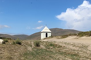 Chapel in Zovaber
 -
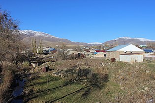 A view of Zovaber, November 2014
 -
 Tukh Manuk in Zovaber


References[edit]
- ^ Statistical Committee of Armenia. "The results of the 2011 Population Census of Armenia" (PDF).
- ^ Kiesling, Brady; Kojian, Raffi (2005). Rediscovering Armenia: Guide (2nd ed.). Yerevan: Matit Graphic Design Studio. p. 75. ISBN 99941-0-121-8.
External links[edit]
Wikimedia Commons has media related to Zovaber.
- Report of the results of the 2001 Armenian Census, Statistical Committee of Armenia
- Kiesling, Brady (June 2000). Rediscovering Armenia: An Archaeological/Touristic Gazetteer and Map Set for the Historical Monuments of Armenia (PDF). Archived (PDF) from the original on 6 November 2021.

This article about a location in Gegharkunik Province, Armenia is a stub. You can help Wikipedia by expanding it. |