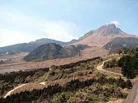
Unzen-Amakusa National Park
| Unzen-Amakusa National Park | |
|---|---|
| 雲仙天草国立公園 | |
 | |
| Location | Kyūshū, Japan |
| Coordinates | 32°45′00″N 130°16′00″E / 32.75000°N 130.26667°E |
| Area | 282.79 km2 (109.19 sq mi) |
| Established | 16 March 1934 |
Unzen-Amakusa National Park (雲仙天草国立公園, Unzen-Amakusa Kokuritsu Kōen) is a national park in Nagasaki, Kumamoto, and Kagoshima Prefectures, Japan. Established in 1934, the park derives its name from Mount Unzen, an active volcano at the middle of the Shimabara Peninsula, and the Amakusa islands in the Yatsushiro Sea. The area is closely connected to the early history of Christianity in Japan, and the park encompasses numerous areas related to Kakure Kirishitan.[1][2][3]
History[edit]
The park was established as the Unzen National Park in 1934 and, after extension, in 1956 renamed the Unzen-Amakusa National Park.[4]
Related municipalities[edit]
- Kagoshima: Nagashima[4]
- Kumamoto: Amakusa, Kami-Amakusa, Reihoku[4]
- Nagasaki: Minamishimabara, Shimabara, Unzen[4]
See also[edit]
- List of national parks of Japan
- Shimabara Rebellion
- Kakure Kirishitan
- Hidden Christian Sites in the Nagasaki Region
References[edit]
- ^ "Introducing places of interest: Unzen-Amakusa National Park". Ministry of the Environment. Archived from the original on 8 February 2012. Retrieved 8 February 2012.
- ^ Sutherland, Mary; Britton, Dorothy (1995). National Parks of Japan. Kodansha. pp. 140–2. ISBN 4-7700-1971-8.
- ^ "Unzen-Amakusa National Park". Encyclopedia of Japan. Tokyo: Shogakukan. 2012. OCLC 56431036. Archived from the original on 25 August 2007. Retrieved 9 August 2012.
- ^ a b c d "Unzen-Amakusa National Park: Basic Information" (in Japanese). Ministry of the Environment. Archived from the original on 29 January 2013. Retrieved 8 February 2012.
External links[edit]
Wikimedia Commons has media related to Unzen-Amakusa National Park.
- (in English) Unzen-Amakusa National Park
- (in Japanese) Unzen-Amakusa National Park
- Map of Unzen-Amakusa National Park


