
Nimy
Nimy
Nîmi (Walloon) | |
|---|---|
 Grand Large | |
 Coat of arms | |
Location of Nimy  | |
 Location of Nimy in Mons | |
 Nimy  Nimy | |
| Coordinates: 50°28′33″N 3°57′17″E / 50.47583°N 3.95472°E | |
| Country | |
| Community | |
| Region | |
| Province | |
| Arrondissement | Mons |
| Municipality | Mons |
| Area | |
| • Total | 4.16 km2 (1.61 sq mi) |
| Population (2020-01-01) | |
| • Total | 4,751 |
| • Density | 1,100/km2 (3,000/sq mi) |
| Postal codes | 7020 |
| Area codes | 065 |
Nimy (French pronunciation: [nimi]; Walloon: Nîmi) is a sub-municipality of the city of Mons located in the province of Hainaut, Wallonia, Belgium. It was a separate municipality until 1972. On 1 January 1972, it was merged into Mons.[1]
History[edit]
In 1914, it was the scene of heavy fighting during the Battle of Mons, the first action of the British Expeditionary Force in World War I. Notable for its earthenware pottery.
Gallery[edit]
-
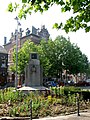 Old Town Hall.
 -
 St. Mary Church.


References[edit]
- ^ Arrêté royal du 18 février 1971 portant fusion des communes de Mons, Cuesmes, Ghlin, Hyon, Nimy et Obourg.
Wikimedia Commons has media related to Nimy.
| National | |
|---|---|
| Geographic | |
This Hainaut Province location article is a stub. You can help Wikipedia by expanding it. |