Kungsängen
Kungsängen | |
|---|---|
 Kungsängen Train Station in September 2010 | |
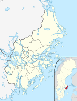
| Coordinates: 59°29′N 17°45′E / 59.483°N 17.750°E | |
| Country | Sweden |
| Province | Uppland |
| County | Stockholm County |
| Municipality | Upplands-Bro Municipality |
| Area | |
| • Total | 3.63 km2 (1.40 sq mi) |
| Population (31 December 2010)[1] | |
| • Total | 9,382 |
| • Density | 2,588/km2 (6,700/sq mi) |
| Time zone | UTC+1 (CET) |
| • Summer (DST) | UTC+2 (CEST) |
Kungsängen (English: King’s Meadow) is a locality and the seat of Upplands-Bro Municipality, Stockholm County, Sweden with 9,382 inhabitants in 2010.[1]
References[edit]
Wikimedia Commons has media related to Kungsängen.
- ^ a b c "Tätorternas landareal, folkmängd och invånare per km2 2005 och 2010" (in Swedish). Statistics Sweden. 14 December 2011. Archived from the original on 27 January 2012. Retrieved 10 January 2012.


