
File:Saint Petersburg metro future map RUS.png
Size of this preview: 473 × 600 pixels. Other resolutions: 189 × 240 pixels | 378 × 480 pixels | 606 × 768 pixels | 807 × 1,024 pixels | 1,615 × 2,048 pixels | 4,780 × 6,061 pixels.
Original file (4,780 × 6,061 pixels, file size: 1.05 MB, MIME type: image/png)
| This is a file from the Wikimedia Commons. Information from its description page there is shown below. Commons is a freely licensed media file repository. You can help. |
| Description |
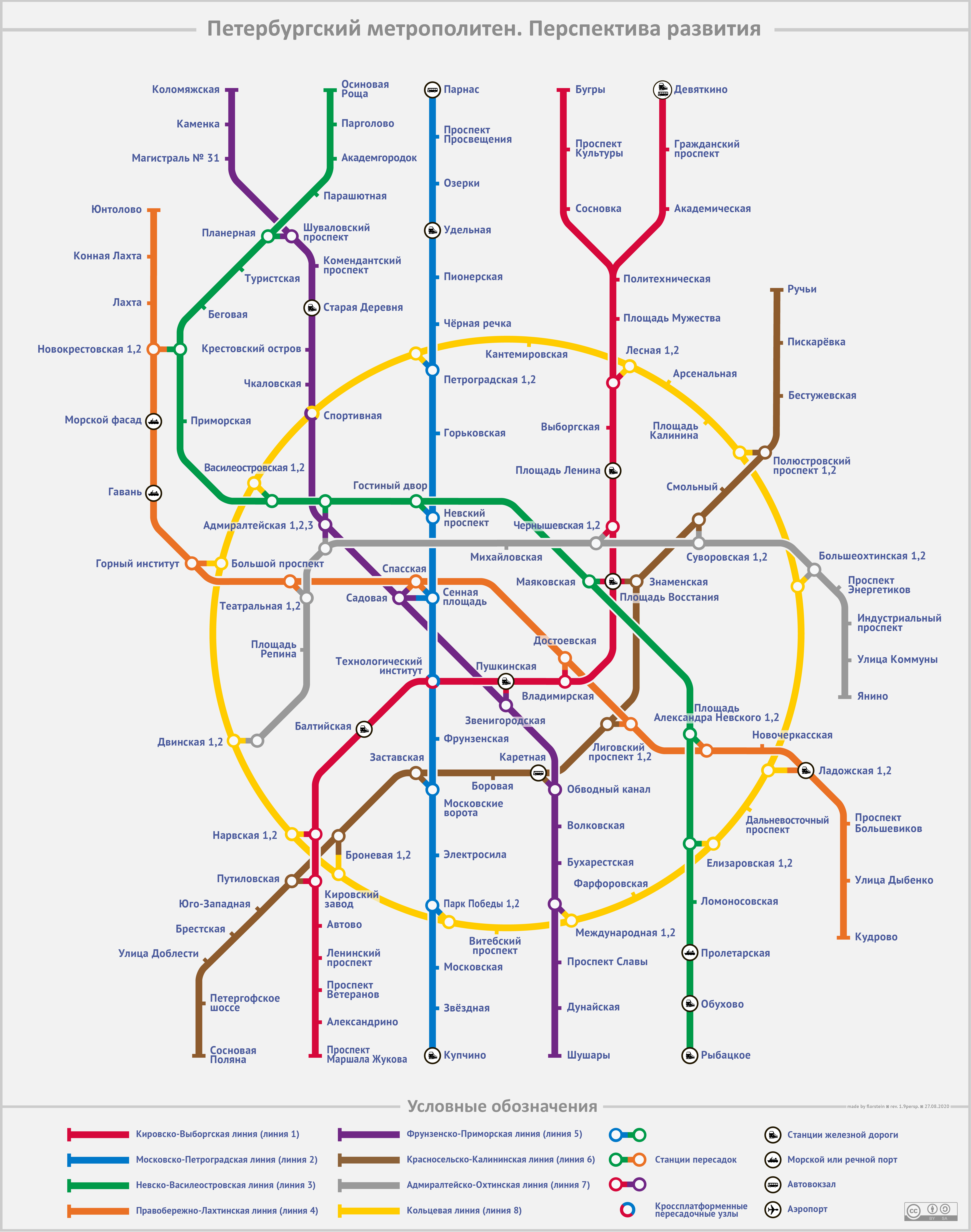
English: Saint Petersburg metro development map. Русский: Перспективная схема линий Петербургского метрополитена. Создана на основе официальной схемы развития Петербургского метрополитена от 22 марта 2018 года[1]. Цвета будущим линиям даны согласно шаблону Легенда линий метро. |
||
| Date | |||
| Source | Own work | ||
| Author | Florstein | ||
| Permission (Reusing this file) |
Alex Florstein, the copyright holder of this work, hereby publishes it under the following licenses:
This file is licensed under the Creative Commons Attribution-Share Alike 3.0 Unported, 2.5 Generic, 2.0 Generic and 1.0 Generic license. Attribution: Alex Florstein
You may select the license of your choice. |
||
| Other versions |
  |

File history
Click on a date/time to view the file as it appeared at that time.
| Date/Time | Thumbnail | Dimensions | User | Comment | |
|---|---|---|---|---|---|
| current | 19:33, 27 August 2020 | | 4,780 × 6,061 (1.05 MB) | Florstein | 1.9 |
| 14:07, 27 August 2020 |  | 4,780 × 6,061 (988 KB) | Florstein | На основе фициальной схемы развития от 22 марта 2018 года | |
| 17:04, 21 November 2012 |  | 1,147 × 1,455 (179 KB) | Florstein | minor | |
| 16:55, 19 November 2012 |  | 2,390 × 3,030 (442 KB) | Florstein | official colour of KKLine | |
| 10:08, 29 September 2012 |  | 2,390 × 3,030 (448 KB) | Florstein | Some minor corrections | |
| 16:33, 13 May 2012 |  | 2,390 × 3,030 (463 KB) | Florstein | Rev. 1.5 | |
| 11:51, 7 May 2012 |  | 2,390 × 3,030 (466 KB) | Florstein | Some minor corrections | |
| 12:34, 6 May 2012 |  | 2,390 × 3,030 (462 KB) | Florstein | {{Information |Description={{en|Saint Petersburg metro development map.}}{{ru|Перспективная схема линий Петербургского метрополитена. Создана основе [http://commons.wikimedia.org/wiki/File:... |
File usage
The following pages on the English Wikipedia use this file (pages on other projects are not listed):
Global file usage
The following other wikis use this file:
- Usage on he.wikipedia.org
- Usage on ja.wikipedia.org
- Usage on nl.wikipedia.org
- Usage on ru.wikipedia.org
- Usage on uk.wikipedia.org