
File:Sacsayhuman-map.jpg
Size of this preview: 745 × 600 pixels. Other resolutions: 298 × 240 pixels | 596 × 480 pixels | 954 × 768 pixels | 1,202 × 968 pixels.
Original file (1,202 × 968 pixels, file size: 139 KB, MIME type: image/jpeg)
| This is a file from the Wikimedia Commons. Information from its description page there is shown below. Commons is a freely licensed media file repository. You can help. |


Summary
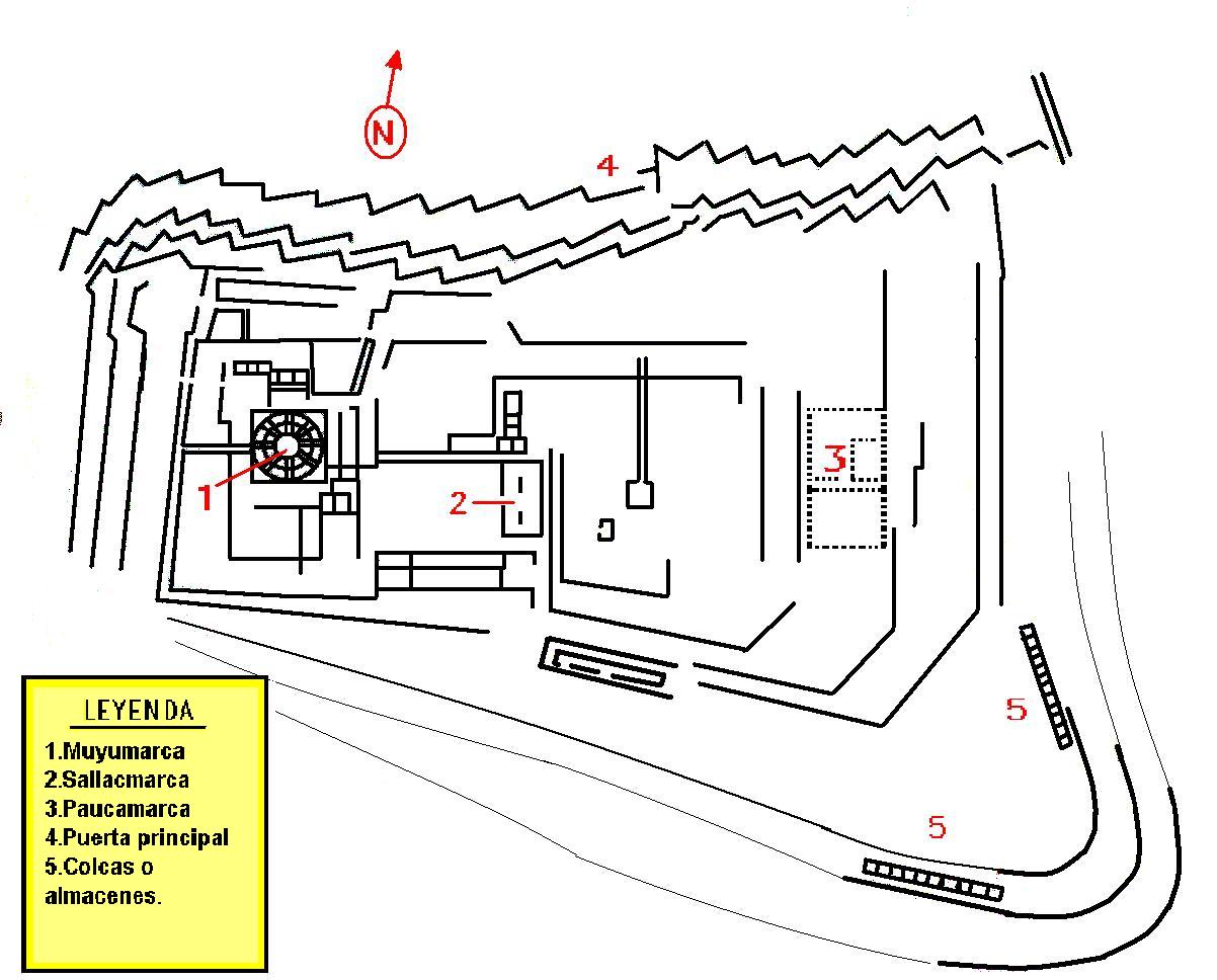
| Description | Mapa de Sacsayhuamán |
| Date | |
| Source | Hecho en base a un mapa satelital de google earth y a fuentes como los libros de Waldemar Espinoza y Víctor Angles. |
| Author | Scarton |
| Permission (Reusing this file) |
Trabajo propio |
Licensing
| I, the copyright holder of this work, release this work into the public domain. This applies worldwide. In some countries this may not be legally possible; if so: I grant anyone the right to use this work for any purpose, without any conditions, unless such conditions are required by law. |
File history
Click on a date/time to view the file as it appeared at that time.
| Date/Time | Thumbnail | Dimensions | User | Comment | |
|---|---|---|---|---|---|
| current | 17:43, 16 January 2008 | | 1,202 × 968 (139 KB) | Scarton | {{Information |Description=Mapa de Sacsayhuamán |Source=Hecho en base a un mapa satelital de google earth y a fuentes como los libros de Waldemar Espinoza y Víctor Angles. |Date=16-ene-2008 |Author=Scartob |Permission=Trabajo propio |other_versions= }} |
File usage
The following pages on the English Wikipedia use this file (pages on other projects are not listed):
Global file usage
The following other wikis use this file:
- Usage on ar.wikipedia.org
- Usage on ast.wikipedia.org
- Usage on ca.wikipedia.org
- Usage on de.wikipedia.org
- Usage on es.wikipedia.org
- Usage on eu.wikipedia.org
- Usage on fa.wikipedia.org
- Usage on fr.wikipedia.org
- Usage on he.wikipedia.org
- Usage on id.wikipedia.org
- Usage on it.wikipedia.org
- Usage on nl.wikipedia.org
- Usage on qu.wikipedia.org
- Usage on ru.wikipedia.org