
File:RoadThroughMeiringspoort.jpg
Size of this preview: 800 × 555 pixels. Other resolutions: 320 × 222 pixels | 640 × 444 pixels | 1,024 × 711 pixels | 1,280 × 888 pixels | 2,560 × 1,777 pixels | 4,980 × 3,456 pixels.
Original file (4,980 × 3,456 pixels, file size: 11.6 MB, MIME type: image/jpeg)
| This is a file from the Wikimedia Commons. Information from its description page there is shown below. Commons is a freely licensed media file repository. You can help. |
Summary
| Description |
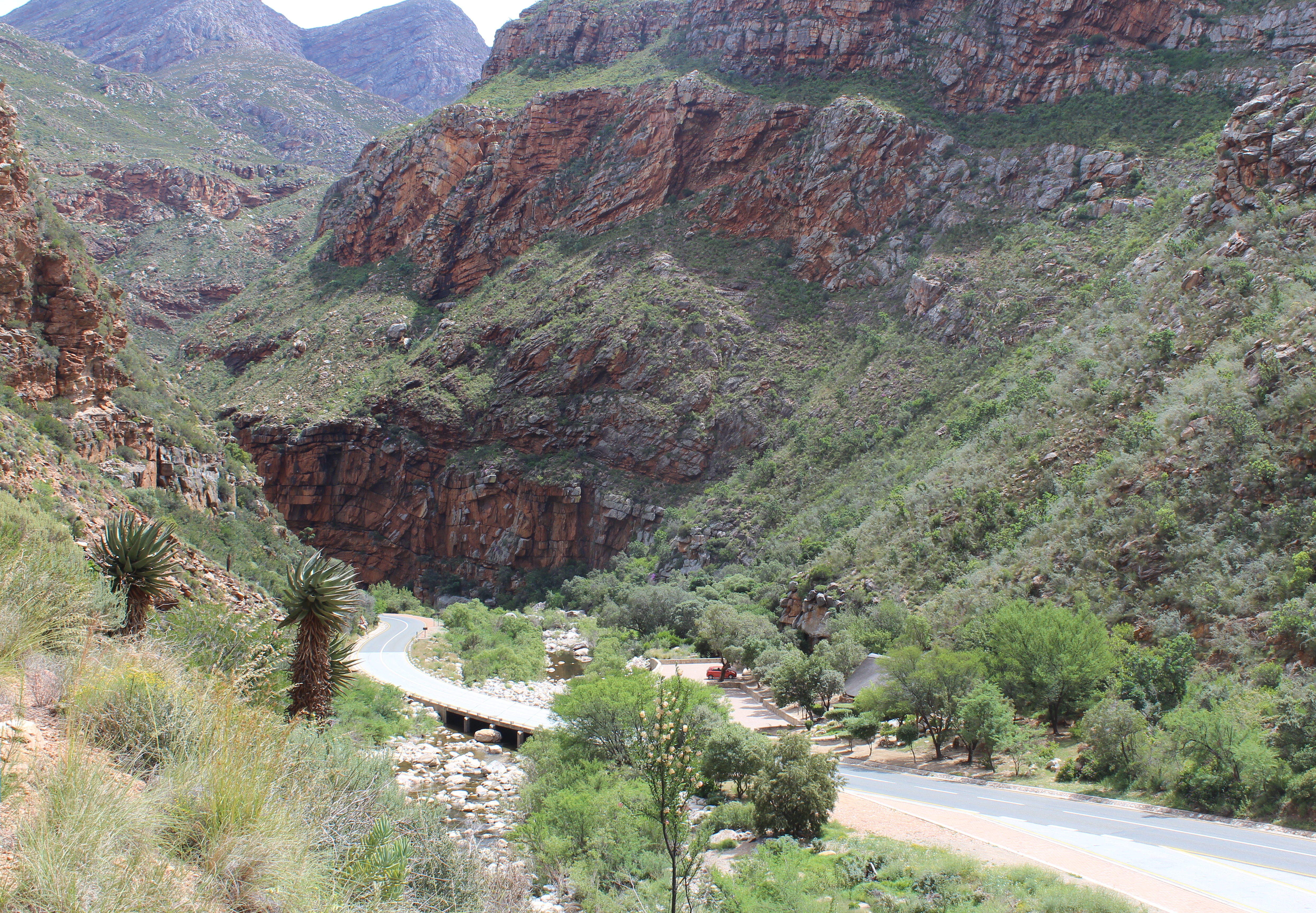
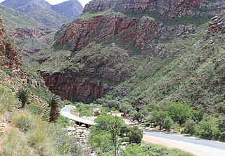
English: View of the South African N12 road as it passes through Meiringspoort, a 20 km (12 mi) gorge with cliffs of up to 700 m (2300&bnbsp;ft) in the Swartberg, a mountain range that separates the Great Karoo from the Little Karoo. The folds in the Swartberg are clearly visible in both the gorge and in this picture. The Groot River (in spite of its name, little more than a stream) passes through the gorge - one of the many crossings of the N12 and the river are visible in the lower part of the picture. The town of Oudtshoorn is about 35 km (22 mi) from the southern portal of the gorge.
Afrikaans: Uitsig op die Suid-Afrikaanse N12-pad in die omgewing Meiringspoort. Meiringspoort is 'n 20 km lank met kranse van 700 m. Hy sny deur die Swartberg tussen die Groot-Karoo en die Klein-Karoo. Die voue in die Swartberg is duidelik sigbaar in die kloof. Een van die kruisings van die N12 oor die Grootrivier wat deur die poort loop is sigbaar in die onderste deel van die prentjie. Die dorp Oudtshoorn is sowat 35 km vanaf die suidelike portaal van die kloof. |
| Date | |
| Source | Own work |
| Author | Martinvl |
| Camera location | | View this and other nearby images on: OpenStreetMap |
|---|
|
This place is a UNESCO World Heritage Site under the reference 1007.
|
-
 Meiringspoort tourist information

Licensing
I, the copyright holder of this work, hereby publish it under the following license:
This file is licensed under the Creative Commons Attribution-Share Alike 4.0 International license.
- You are free:
- to share – to copy, distribute and transmit the work
- to remix – to adapt the work
- Under the following conditions:
- attribution – You must give appropriate credit, provide a link to the license, and indicate if changes were made. You may do so in any reasonable manner, but not in any way that suggests the licensor endorses you or your use.
- share alike – If you remix, transform, or build upon the material, you must distribute your contributions under the same or compatible license as the original.
File history
Click on a date/time to view the file as it appeared at that time.
| Date/Time | Thumbnail | Dimensions | User | Comment | |
|---|---|---|---|---|---|
| current | 14:19, 12 December 2015 | | 4,980 × 3,456 (11.6 MB) | Martinvl | User created page with UploadWizard |
File usage
The following pages on the English Wikipedia use this file (pages on other projects are not listed):
Global file usage
The following other wikis use this file:
- Usage on af.wikipedia.org
- Usage on ca.wikipedia.org
- Usage on ceb.wikipedia.org
- Usage on de.wikipedia.org
- Usage on fy.wikipedia.org
- Usage on nl.wikipedia.org
- Usage on no.wikipedia.org
- Usage on pl.wikipedia.org
- Usage on sw.wikipedia.org
- Usage on www.wikidata.org