
File:Relief Map of Krasnoyarsk Krai.jpg
Size of this preview: 350 × 600 pixels. Other resolutions: 140 × 240 pixels | 280 × 480 pixels | 448 × 768 pixels | 597 × 1,024 pixels | 2,000 × 3,427 pixels.
Original file (2,000 × 3,427 pixels, file size: 603 KB, MIME type: image/jpeg)
| This is a file from the Wikimedia Commons. Information from its description page there is shown below. Commons is a freely licensed media file repository. You can help. |
Summary
| Description |
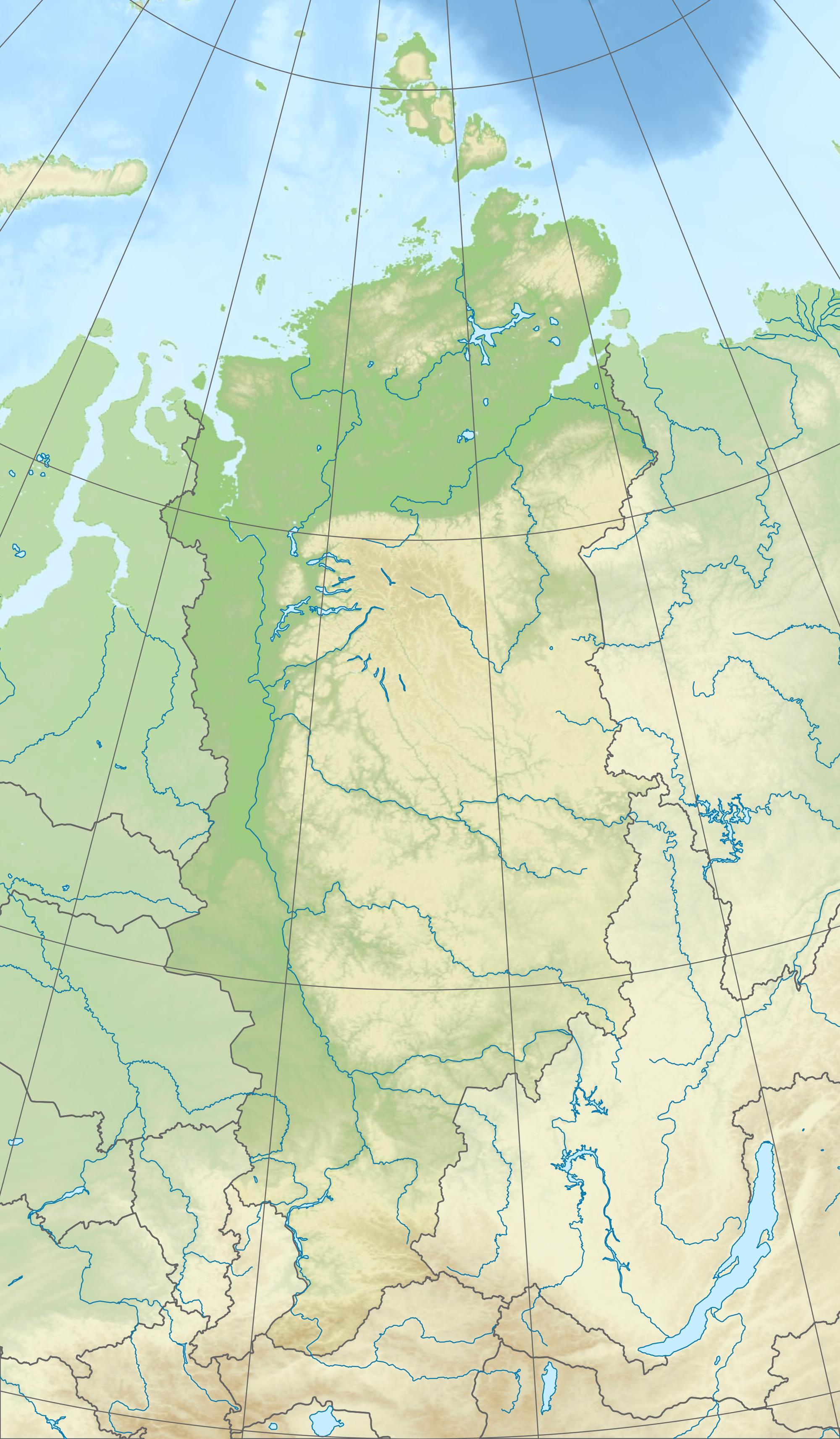
Русский: Физическая карта Красноярского края
|
| Date | |
| Source |
|
| Author | Виктор В |
| Other versions |
[] |


Licensing
This file is licensed under the Creative Commons Attribution-Share Alike 2.0 Generic license.
- You are free:
- to share – to copy, distribute and transmit the work
- to remix – to adapt the work
- Under the following conditions:
- attribution – You must give appropriate credit, provide a link to the license, and indicate if changes were made. You may do so in any reasonable manner, but not in any way that suggests the licensor endorses you or your use.
- share alike – If you remix, transform, or build upon the material, you must distribute your contributions under the same or compatible license as the original.
File history
Click on a date/time to view the file as it appeared at that time.
| Date/Time | Thumbnail | Dimensions | User | Comment | |
|---|---|---|---|---|---|
| current | 12:48, 3 October 2010 | | 2,000 × 3,427 (603 KB) | Виктор В | + градусная сетка |
| 10:25, 3 October 2010 |  | 2,000 × 3,427 (539 KB) | Виктор В | == {{int:filedesc}} == {{Information |Description={{ru|1=Физическая карта Красноярского края *Проекция — коническая равнопромежуточная. **первая стандартная парал� |
File usage
The following pages on the English Wikipedia use this file (pages on other projects are not listed):
- Academy of Sciences Glacier
- Akhmatov Fjord
- Anabar Plateau
- Ary-Mas
- Bakhta (river)
- Bazaikha
- Boguchany Airport
- Bolshaya Kheta
- Bolshoy Pit
- Borchgrevinkium
- Byrranga Mountains
- Cape Baranov
- Cape Berg
- Cape Neupokoyev
- Cape October
- Cape Sterligov
- Cape Unslicht
- Ergaki
- Grandiozny Peak
- Itat Formation
- Kacha (river)
- Karpinsky Glacier
- Kem (Yenisey)
- Khantayka
- Khatanga (river)
- Khatanga Gulf
- Kheta (river)
- Kotuy
- Kotuykan
- Krasnoyarsk Dam
- Krasnoyarsk Reservoir
- Krenkel Bay
- Lake Cheko
- Lake Dynda
- Lake Fiordovoye
- Lake Glubokoye (Putorana)
- Lake Keta
- Lake Khantayskoye
- Lake Labaz
- Lake Lama
- Lake Pyasino
- Lake Taymyr
- Lake Vivi
- Lake Yessey
- Laptev Sea
- Marat Fjord
- Maria Pronchishcheva Bay
- Matusevich Fjord
- Middendorff Bay
- Mikoyan Bay
- Minusinsk Hollow
- Nakson
- North Siberian Lowland
- Okunev culture
- Popigay (river)
- Putorana Nature Reserve
- Putorana Plateau
- Red Army Strait
- Shokalsky Strait
- Simsa Bay
- Solnechny Bay
- Suringda
- Sym (river)
- Syverma Plateau
- Talnikovy Waterfall
- Tanama (river)
- Taymyr Gulf
- Toll Bay
- Tunguska Plateau
- Tuva Depression
- Uyedineniya Island
- Vilkitsky Strait
- Vivi (river)
- Yeloguy
- Yenisey Range
- Yuny Strait
- Zhuravlev Bay
- User:HaussmannSaintLazare/sandbox
- User:Ty654/List of earthquakes from 1960-1964 exceeding magnitude 6+
- User:Ty654/List of earthquakes from 1985-1989 exceeding magnitude 6+
- User:Ty654/List of earthquakes from 1990-1994 exceeding magnitude 6+
- Module:Location map/data/Russia Krasnoyarsk Krai
- Module:Location map/data/Russia Krasnoyarsk Krai/doc
Global file usage
The following other wikis use this file:
- Usage on ar.wikipedia.org
- Usage on az.wikipedia.org
- Dikson adası
- Şimal Torpağı
- Şablon:Yer xəritəsi Rusiya Krasnoyarsk diyarı
- Starokadomski adası
- Pioner adası
- Trudnıy adası
- Sibiryakov adası (Krasnoyarsk diyarı)
- Morennıe
- Plavnikovye
- Arktiçeski İnstitutu adaları
- Obmannıy adası
- Zabor
- Pustoy adası
- Çyornıy adası
- Taş adası
- Zapadnıy adası
- Vostoçnıy adası
- Zabıtıy (ada)
- Sedov arxipelaqı
- İzvestiy Tsik adaları
- Krasnoflotskie adaları
- Faddey körfəzi
- Vesennıy adası
- Vollosoviç adası
- Mayski adaları
- İzvestnyakovıy adaları
- Opasnıe adaları
- Zveroboy adaları
- Kamennıe adaları
- Labirint adaları
- Plavnikovıe adaları
- Minin şxeri
- Morjov adası
- Rastorquev adası
- Vxodnıe adaları
- Şimal adası (Vxodnıe adaları)
- Oleni adaları
- Poputnıy adası
- Samoyloviç adası
- Firnley adaları
- Tillo adaları
- Kolomeysev adaları
- Myaçin adaları
- Skott-Hansen adaları
- Sverdrup adası
- Strijyov adası (Vilkiski adaları)
- Makarov buxtası
- Panfilovçular körfəzi
- Spartak buxtası
View more global usage of this file.