
File:Potomac Dams CoE 2-45.jpg
Size of this preview: 800 × 588 pixels. Other resolutions: 320 × 235 pixels | 640 × 471 pixels | 1,024 × 753 pixels | 1,250 × 919 pixels.
Original file (1,250 × 919 pixels, file size: 131 KB, MIME type: image/jpeg)
| This is a file from the Wikimedia Commons. Information from its description page there is shown below. Commons is a freely licensed media file repository. You can help. |
Summary
| Description |
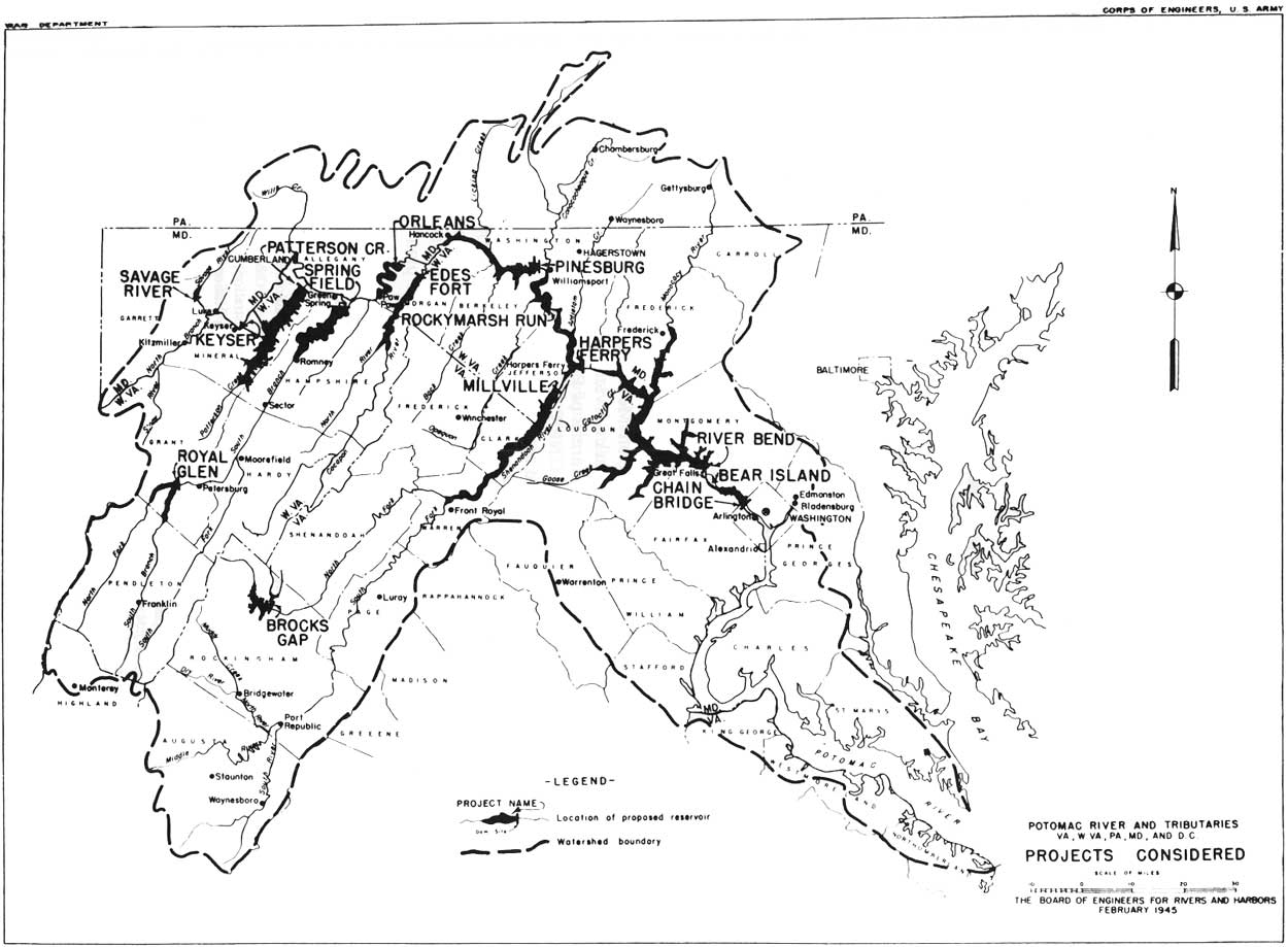
English: Map of proposed dams in the Potomac River watershed as of February, 1945
Français : Carte des barrages proposés dans le bassin versant de la rivière Potomac en février 1945 |
| Date | |
| Source | http://www.nps.gov/parkhistory/online_books/choh/admin_history/images/fig4-1.jpg |
| Author | US Army Corps of Engineers |
Licensing
This image or file is a work of a U.S. Army Corps of Engineers soldier or employee, taken or made as part of that person's official duties. As a work of the U.S. federal government, the image is in the public domain.
|
File history
Click on a date/time to view the file as it appeared at that time.
| Date/Time | Thumbnail | Dimensions | User | Comment | |
|---|---|---|---|---|---|
| current | 18:10, 10 February 2016 | | 1,250 × 919 (131 KB) | Acroterion | {{Information |Description ={{en|1=Map of proposed dams in the Potomac River watershed as of February, 1945}} |Source =http://www.nps.gov/parkhistory/online_books/choh/admin_history/images/fig4-1.jpg |Author =US Army Corps of Enginee... |
File usage
The following pages on the English Wikipedia use this file (pages on other projects are not listed):